
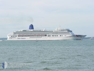
AURORA
Passengers Ship
Current Trip
| Time Travelled | 1 day |
|---|---|
| Remaining Time | 12 h, 34 mins |
| Distance Travelled | 464.18 nm |
| Remaining Distance | 209.30 nm |
| AVG Speed | 19 Knots |
| MAX Speed | 21 Knots |
| AVG Wind | 19.3 knots |
| MAX Wind | 27 knots |
| MIN Temp | 12.3°C / 54.14°F |
| MAX Temp | 18.2°C / 64.76°F |
| Draught | 8.4 m |
| Position Received | 1 m ago |
Current Position
| Longitude | 2.66880° |
|---|---|
| Latitude | 52.18870° |
| Status | Under way using engine |
| Speed | 16.3 Knots |
| Course | 208.4° |
| Area | North Sea |
| Station | T-AIS |
| Position Received | 1 m ago |
Info
Information
The current position of AURORA is in North Sea with coordinates 52.18870° / 2.66880° as reported on 2024-06-02 15:00 by AIS to our vessel tracker app. The vessel's current speed is 16.3 Knots and is heading at the port of SOUTHAMPTON. The estimated time of arrival as calculated by MyShipTracking vessel tracking app is 2024-06-03 04:36 LT
The vessel AURORA (IMO: 9169524, MMSI: 310556000) is a Passengers Ship that was built in 2000 ( 24 years old ). It's sailing under the flag of [BM] Bermuda.
In this page you can find informations about the vessels current position, last detected port calls, and current voyage information. If the vessels is not in coverage by AIS you will find the latest position.
The current position of AURORA is detected by our AIS receivers and we are not responsible for the reliability of the data. The last position was recorded while the vessel was in Coverage by the Ais receivers of our vessel tracking app.
The current draught of AURORA as reported by AIS is 8.4 meters
Weather
| Temperature | 12.4°C / 54.32°F |
|---|---|
| Wind Speed | 14 knots |
| Direction | 351° N |
| Pressure | 1025.7 hPa |
| Humidity | 83.1 % |
| Cloud Coverage | 5 % |
Featured Company
Last Port Calls
| Port | Arrival | Departure | Time In Port |
|---|---|---|---|
| 2024-06-01 07:22 | 2024-06-01 16:55 | 9 h | |
| 2024-05-31 07:11 | 2024-05-31 18:17 | 11 h | |
| 2024-05-30 06:46 | 2024-05-30 18:21 | 11 h | |
| 2024-05-28 05:52 | 2024-05-28 22:07 | 16 h | |
| 2024-05-24 22:24 | 2024-05-25 17:00 | 18 h | |
| 2024-05-23 08:21 | 2024-05-24 19:02 | 1 d | |
| 2024-05-21 06:52 | 2024-05-21 17:28 | 10 h | |
| 2024-05-18 05:41 | 2024-05-18 17:28 | 11 h | |
| 2024-05-16 06:46 | 2024-05-16 19:01 | 12 h | |
| 2024-05-15 05:16 | 2024-05-15 18:01 | 12 h |
Last Trips
| Origin | Departure | Destination | Arrival | Distance | |
|---|---|---|---|---|---|
| 2024-05-31 18:17 | 2024-06-01 07:22 | 158.06 nm | |||
| 2024-05-30 18:21 | 2024-05-31 07:11 | 163.69 nm | |||
| 2024-05-28 22:07 | 2024-05-30 06:46 | 359.42 nm | |||
| 2024-05-25 17:00 | 2024-05-28 05:52 | 489.58 nm | |||
| 2024-05-24 19:02 | 2024-05-24 22:24 | 44.71 nm | |||
| 2024-05-21 17:28 | 2024-05-23 08:21 | 660.08 nm | |||
| 2024-05-18 17:28 | 2024-05-21 06:52 | 936.67 nm | |||
| 2024-05-16 19:01 | 2024-05-18 05:41 | 378.63 nm | |||
| 2024-05-15 18:01 | 2024-05-16 06:46 | 207.87 nm | |||
| 2024-05-12 14:45 | 2024-05-15 05:16 | 1201.36 nm |
Events
| Time | Event | Details | Position / Dest | Info |
|---|---|---|---|---|
| 2024-06-02 12:22 | Detected in Sea | United Kingdom part of the North Sea |
52.83401 / 3.18353
North Sea
DKSKA - GBSOU
|
Speed: 16.1 kn Course: 198.8° |
| 2024-06-02 05:55 | Change Sea Area | Dutch part of the North Sea German part of the North Sea |
54.59630 / 5.01874
North Sea
DKSKA - GBSOU
|
Speed: 20.4 kn Course: 211.6° |
| 2024-06-02 02:50 | Change Sea Area | German part of the North Sea Danish part of the North Sea |
55.44546 / 6.06276
North Sea
DKSKA - GBSOU
|
Speed: 20.2 kn Course: 215.7° |
| 2024-06-01 20:17 | Change Sea Area | Danish part of the North Sea Danish part of the Skaggerak |
57.20588 / 8.43217
North Sea
DKSKA - GBSOU
|
Speed: 20 kn Course: 234° |
| 2024-06-01 15:41 | Change Sea Area | Danish part of the Skaggerak Danish part of the Kattegat |
57.78573 / 10.82320
Skaggerak
DKSKA - GBSOU
|
Speed: 15 kn Course: 19.6° |
| 2024-06-01 14:55 | PORT DEPARTURE |
|
57.71310 / 10.60479
DKSKA - GBSOU
|
Speed: 5.3 kn Course: 89° |
| 2024-06-01 14:51 | START Moving |
57.71315 / 10.59296
[DK] SKAGEN
|
Speed: 3.1 kn Course: 88° |
|
| 2024-06-01 14:44 | Status Changed | Under way using engine Moored |
57.71352 / 10.58852
[DK] SKAGEN
|
Speed: Course: 72° |
| 2024-06-01 12:50 | Destination Changed | DKSKA - GBSOU DKAAR - DKSKA |
57.71353 / 10.58854
[DK] SKAGEN
|
Speed: Course: 72° |
| 2024-06-01 12:49 | ETA Changed | 2024/06/03 02:30 2024/06/01 05:00 |
57.71353 / 10.58854
[DK] SKAGEN
|
Speed: Course: 72° |