
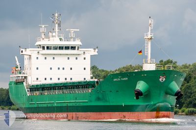
ARKLOW MANOR
General Cargo
Current Trip
| Time Travelled | 2 days |
|---|---|
| Remaining Time | 49 mins |
| Distance Travelled | 690.02 nm |
| Remaining Distance | 185.19 nm |
| AVG Speed | 11.8 Knots |
| MAX Speed | 15 Knots |
| AVG Wind | 18.9 knots |
| MAX Wind | 24.9 knots |
| MIN Temp | 12.8°C / 55.04°F |
| MAX Temp | 16.5°C / 61.7°F |
| Draught | 5.4 m |
| Position Received | 3 m ago |
Current Position
| Longitude | -1.75448° |
|---|---|
| Latitude | 46.13263° |
| Status | Under way using engine |
| Speed | 7.2 Knots |
| Course | 70° |
| Area | North Atlantic Ocean |
| Station | T-AIS |
| Position Received | 3 m ago |
Info
Information
The current position of ARKLOW MANOR is in North Atlantic Ocean with coordinates 46.13263° / -1.75448° as reported on 2024-05-17 03:03 by AIS to our vessel tracker app. The vessel's current speed is 7.2 Knots and is heading at the port of LA PALLICE. The estimated time of arrival as calculated by MyShipTracking vessel tracking app is 2024-05-17 05:55 LT
The vessel ARKLOW MANOR (IMO: 9440241, MMSI: 250001723) is a General Cargo that was built in 2009 ( 15 years old ). It's sailing under the flag of [IE] Ireland.
In this page you can find informations about the vessels current position, last detected port calls, and current voyage information. If the vessels is not in coverage by AIS you will find the latest position.
The current position of ARKLOW MANOR is detected by our AIS receivers and we are not responsible for the reliability of the data. The last position was recorded while the vessel was in Coverage by the Ais receivers of our vessel tracking app.
The current draught of ARKLOW MANOR as reported by AIS is 5.4 meters
Weather
| Temperature | 14.6°C / 58.28°F |
|---|---|
| Wind Speed | 12 knots |
| Direction | 214° SW |
| Pressure | 1006.2 hPa |
| Humidity | 76.4 % |
| Cloud Coverage | 100 % |
Featured Company
Last Port Calls
| Port | Arrival | Departure | Time In Port |
|---|---|---|---|
| 2024-05-13 06:58 | 2024-05-14 18:34 | 1 d | |
| 2024-05-09 09:27 | 2024-05-10 23:38 | 1 d | |
| 2024-04-29 06:54 | 2024-04-30 20:18 | 1 d | |
| 2024-04-29 06:20 | 2024-04-29 06:22 | 2 m | |
| 2024-04-18 17:59 | 2024-04-23 03:28 | 4 d | |
| 2024-04-11 18:55 | 2024-04-15 00:19 | 3 d | |
| 2024-04-08 23:10 | 2024-04-08 23:50 | 40 m | |
| 2024-04-05 10:32 | 2024-04-07 15:21 | 2 d | |
| 2024-03-29 05:23 | 2024-03-29 23:33 | 18 h | |
| 2024-03-23 09:39 | 2024-03-24 11:24 | 1 d |
Last Trips
| Origin | Departure | Destination | Arrival | Distance | |
|---|---|---|---|---|---|
| 2024-05-10 23:38 | 2024-05-13 06:58 | 734.36 nm | |||
| 2024-04-30 20:18 | 2024-05-09 09:27 | 733.15 nm | |||
| 2024-04-29 06:22 | 2024-04-29 06:54 | 1.83 nm | |||
| 2024-04-23 03:28 | 2024-04-29 06:20 | 1399.63 nm | |||
| 2024-04-15 00:19 | 2024-04-18 17:59 | 303.68 nm | |||
| 2024-04-08 23:50 | 2024-04-11 18:55 | 330.58 nm | |||
| 2024-04-07 15:21 | 2024-04-08 23:10 | 356.12 nm | |||
| 2024-03-29 23:33 | 2024-04-05 10:32 | 875.15 nm | |||
| 2024-03-24 11:24 | 2024-03-29 05:23 | 1195.08 nm | |||
| 2024-03-16 00:10 | 2024-03-23 09:39 | 523.02 nm |
Events
| Time | Event | Details | Position / Dest | Info |
|---|---|---|---|---|
| 2024-05-17 03:03 | Change Sea Area | French part of the Bay of Biscay Spanish part of the North Atlantic Ocean |
46.13263 / -1.75448
Bay of Biscay
FRLPE
|
Speed: 7.2 kn Course: 70° |
| 2024-05-17 03:03 | Status Changed | Under way using engine Default |
46.13263 / -1.75448
FRLPE
|
Speed: 8 kn Course: 72° |
| 2024-05-17 02:48 | IN Coverage |
46.13263 / -1.75448
Bay of Biscay
FRLPE
|
Speed: 7.2 kn Course: 70° |
|
| 2024-05-16 06:32 | Status Changed | Default Under way using engine |
44.35500 / -7.81667
FRLPE
|
Speed: 13.8 kn Course: 62° |
| 2024-05-16 06:27 | OUT of Coverage |
44.34494 / -7.84161
North Atlantic Ocean
FRLPE
|
Speed: 13.8 kn Course: 62° |
|
| 2024-05-16 06:27 | ETA Changed | 2024/05/17 04:00 2024/05/17 02:00 |
44.34474 / -7.84216
FRLPE
|
Speed: 13.9 kn Course: 61.1° |
| 2024-05-16 06:26 | Status Changed | Under way using engine Default |
44.34347 / -7.84541
FRLPE
|
Speed: 14 kn Course: 62° |
| 2024-05-16 06:08 | IN Coverage |
44.34494 / -7.84161
North Atlantic Ocean
FRLPE
|
Speed: 13.8 kn Course: 62° |
|
| 2024-05-16 03:56 | Status Changed | Default Under way using engine |
44.07834 / -8.53500
FRLPE
|
Speed: 13.5 kn Course: 56° |
| 2024-05-16 03:50 | OUT of Coverage |
44.06766 / -8.56083
North Atlantic Ocean
FRLPE
|
Speed: 13.5 kn Course: 56° |