
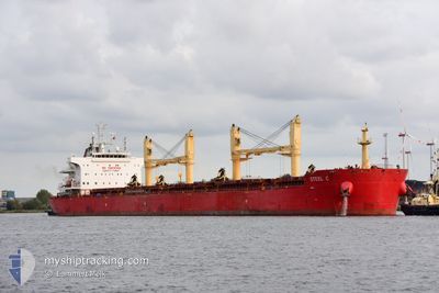
STEEL C
Cargo
Current Trip
| Trip Time | 19 days |
|---|---|
| Trip Distance | 5400.17 nm |
| AVG Speed | 11.4 Knop |
| MAX Speed | 13.7 Knop |
| Djupgående | 10.2 m |
| AVG Wind | 13.4 knots |
| MAX Wind | 31 knots |
| MIN Temp | 7.1°C / 44.78°F |
| MAX Temp | 28.7°C / 83.66°F |
| Position mottagen | 6 d sen |
Current Position
| Longitud | -57.77289° |
|---|---|
| Latitude | -38.44774° |
| Status | Under way using engine |
| Fart | 12.2 Knop |
| Kurs | 241.4° |
| Område | South Atlantic Ocean |
| Station | T-AIS |
| Position mottagen | 6 d sen |
Info
Information
The current position of STEEL C is in South Atlantic Ocean with coordinates -38.44774° / -57.77289° as reported on 2024-06-04 09:33 by AIS to our vessel tracker app. The vessel's current speed is 12.2 Knop and is currently inside the port of PUERTO GALVAN.
The vessel STEEL C (IMO: 9700330, MMSI: 636022811) is a Cargo It's sailing under the flag of [LR] Liberia.
In this page you can find informations about the vessels current position, last detected port calls, and current voyage information. If the vessels is not in coverage by AIS you will find the latest position.
The current position of STEEL C is detected by our AIS receivers and we are not responsible for the reliability of the data. The last position was recorded while the vessel was in Coverage by the Ais receivers of our vessel tracking app.
The current draught of STEEL C as reported by AIS is 10.2 meters
Weather
| Temperature | 13.8°C / 56.84°F |
|---|---|
| Wind Speed | 5 knots |
| Direction | 42° NE |
| Pressure | 1016.5 hPa |
| Humidity | 48.8 % |
| Cloud Coverage | 95 % |
Featured Company
Last Port Calls
| Port | Arrival | Departure | Time In Port |
|---|---|---|---|
| 2024-06-05 08:25 | |||
| 2024-05-04 05:58 | 2024-05-16 13:26 | 12 d | |
| 2024-04-21 00:03 | 2024-04-30 20:27 | 9 d |
Most Visited Ports (Last year)
| Port | Arrivals | |
|---|---|---|
| 2 | ||
| 2 | ||
| 1 | ||
| 1 | ||
| 1 | ||
| 1 |
Last Trips
| Origin | Departure | Destination | Arrival | Distance | |
|---|---|---|---|---|---|
| 2024-05-16 14:26 | 2024-06-05 05:25 | 5400.17 nm | |||
| 2024-04-30 21:27 | 2024-05-04 06:58 | 104.06 nm | |||
| 2024-03-24 17:49 | 2024-04-21 01:03 | 5336.10 nm |
Events
| Tid | Event | Detaljer | Position / Dest | Information |
|---|---|---|---|---|
| 2024-06-05 08:25 | STOPPAR förflyttning |
-38.78562 / -62.29816
[AR] PUERTO GALVAN
|
Fart: 0.2 kn Kurs: 345° |
|
| 2024-06-05 08:25 | ANLÄNDER HAMN |
|
-38.78562 / -62.29816
[AR] PUERTO GALVAN
|
Fart: 0.4 kn Kurs: 346° |
| 2024-06-05 04:49 | STARTAR förflyttning | 13.71 nm, South East of PUERTO ROSALES |
-39.07223 / -61.84188
AR BHI
|
Fart: 4.8 kn Kurs: 275° |
| 2024-06-05 03:41 | STOPPAR förflyttning | 13.7 nm, South East of PUERTO ROSALES |
-39.06987 / -61.83976
AR BHI
|
Fart: 0.2 kn Kurs: 116° |
| 2024-06-04 09:33 | UTANFÖR täckningsområde |
-38.44774 / -57.77289
South Atlantic Ocean
AR BHI
|
Fart: 12.2 kn Kurs: 241.4° |
|
| 2024-06-04 09:15 | Djupgående ändrat | 10.2 9.8 |
-38.41563 / -57.69629
AR BHI
|
Fart: 12.3 kn Kurs: 242.2° |
| 2024-06-04 09:15 | Destination ändrad | AR BHI ESLPA |
-38.41563 / -57.69629
AR BHI
|
Fart: 12.3 kn Kurs: 242.2° |
| 2024-06-04 09:15 | ETA ändrat | 2024/06/04 12:00 2024/05/18 02:00 |
-38.41563 / -57.69629
AR BHI
|
Fart: 12.3 kn Kurs: 242.2° |
| 2024-06-04 09:13 | Status ändrad | Under way using engine Default |
-38.41563 / -57.69629
ESLPA
|
Fart: 12.2 kn Kurs: 241° |
| 2024-06-04 09:13 | Upptäckt i hav | Argentinean part of the South Atlantic Ocean |
-38.41563 / -57.69629
South Atlantic Ocean
|
Fart: 12.3 kn Kurs: 242.2° |