
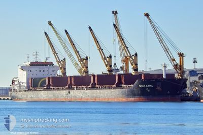
SPAR LYRA
Bulk Carrier
Current Trip
| Time Travelled | 12 days |
|---|---|
| Remaining Time | 5 days |
| Distance Travelled | 2760.73 nm |
| Remaining Distance | 1415.30 nm |
| AVG Speed | 9.4 Knop |
| MAX Speed | 12.2 Knop |
| AVG Wind | 8.7 knots |
| MAX Wind | 21.9 knots |
| MIN Temp | 13.1°C / 55.58°F |
| MAX Temp | 24.9°C / 76.82°F |
| Djupgående | 11 m |
| Position mottagen | 7 d sen |
Current Position
| Longitud | -17.40629° |
|---|---|
| Latitude | 34.25839° |
| Status | Under way using engine |
| Fart | 10.6 Knop |
| Kurs | 260° |
| Område | North Atlantic Ocean |
| Station | T-AIS |
| Position mottagen | 7 d sen |
Info
Information
The current position of SPAR LYRA is in North Atlantic Ocean with coordinates 34.25839° / -17.40629° as reported on 2024-05-28 01:57 by AIS to our vessel tracker app. The vessel's current speed is 10.6 Knop and is heading at the port of CHARLESTON. The estimated time of arrival as calculated by MyShipTracking vessel tracking app is 2024-06-10 13:15 LT
The vessel SPAR LYRA (IMO: 9289013, MMSI: 257316000) is a Bulk Carrier that was built in 2005 ( 19 År gammal ). It's sailing under the flag of [NO] Norway.
In this page you can find informations about the vessels current position, last detected port calls, and current voyage information. If the vessels is not in coverage by AIS you will find the latest position.
The current position of SPAR LYRA is detected by our AIS receivers and we are not responsible for the reliability of the data. The last position was recorded while the vessel was in Coverage by the Ais receivers of our vessel tracking app.
The current draught of SPAR LYRA as reported by AIS is 11 meters
Weather
| Temperature | 21.2°C / 70.16°F |
|---|---|
| Wind Speed | 13 knots |
| Direction | 61° ENE |
| Pressure | 1015.5 hPa |
| Humidity | 81.9 % |
| Cloud Coverage | 100 % |
Featured Company
Last Port Calls
Most Visited Ports (Last year)
| Port | Arrivals | |
|---|---|---|
| 3 | ||
| 3 | ||
| 2 | ||
| 2 | ||
| 1 | ||
| 1 |
Last Trips
| Origin | Departure | Destination | Arrival | Distance | |
|---|---|---|---|---|---|
| 2024-05-15 02:28 | 2024-05-21 21:47 | 411.84 nm | |||
| 2024-04-30 00:52 | 2024-05-07 19:20 | 1808.73 nm | |||
| 2024-04-25 11:15 | 2024-04-25 12:04 | 4.38 nm | |||
| 2024-04-25 10:04 | 2024-04-25 10:45 | 3.11 nm | |||
| 2024-03-22 09:14 | 2024-04-18 05:48 | 4897.95 nm |
Events
| Tid | Event | Detaljer | Position / Dest | Information |
|---|---|---|---|---|
| 2024-05-28 02:02 | Status ändrad | Default Under way using engine |
34.25656 / -17.42136
CHARLESTON
|
Fart: 10.6 kn Kurs: 260° |
| 2024-05-28 01:57 | UTANFÖR täckningsområde |
34.25839 / -17.40629
North Atlantic Ocean
CHARLESTON
|
Fart: 10.6 kn Kurs: 260° |
|
| 2024-05-28 01:55 | Status ändrad | Under way using engine Default |
34.25950 / -17.39803
CHARLESTON
|
Fart: 10.7 kn Kurs: 261° |
| 2024-05-28 01:45 | Status ändrad | Default Under way using engine |
34.26333 / -17.36500
CHARLESTON
|
Fart: 10.8 kn Kurs: 259.6° |
| 2024-05-28 01:40 | Status ändrad | Under way using engine Default |
34.26705 / -17.34758
CHARLESTON
|
Fart: 10 kn Kurs: 259° |
| 2024-05-28 01:12 | Status ändrad | Default Under way using engine |
34.28167 / -17.24667
CHARLESTON
|
Fart: 11 kn Kurs: 257° |
| 2024-05-28 01:08 | Status ändrad | Under way using engine Default |
34.28455 / -17.23081
CHARLESTON
|
Fart: 10.8 kn Kurs: 259° |
| 2024-05-28 00:55 | I täckningsområde |
34.28455 / -17.23081
North Atlantic Ocean
CHARLESTON
|
Fart: 11 kn Kurs: 257° |
|
| 2024-05-28 00:11 | Status ändrad | Default Under way using engine |
34.31684 / -17.03122
CHARLESTON
|
Fart: 10.8 kn Kurs: 258.5° |
| 2024-05-28 00:05 | UTANFÖR täckningsområde |
34.32044 / -17.00866
North Atlantic Ocean
CHARLESTON
|
Fart: 10.8 kn Kurs: 258.5° |