
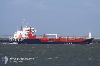
SCOT NUERNBERG
Oil/Chemical Tanker
Current Trip
| Time Travelled | 3 days |
|---|---|
| Remaining Time | --- |
| Distance Travelled | 173.76 nm |
| Remaining Distance | --- |
| AVG Speed | 12.4 Knop |
| MAX Speed | 13.4 Knop |
| AVG Wind | 14.6 knots |
| MAX Wind | 19 knots |
| MIN Temp | 28.1°C / 82.58°F |
| MAX Temp | 29.3°C / 84.74°F |
| Djupgående | 5.2 m |
| Position mottagen | 2 h, 17 m sen |
Current Position
| Longitud | -63.00583° |
|---|---|
| Latitude | 17.47483° |
| Status | At anchor |
| Fart | 0.1 Knop |
| Kurs | 89° |
| Område | Caribbean Sea |
| Station | T-AIS |
| Position mottagen | 2 h, 17 m sen |
Info
Information
The current position of SCOT NUERNBERG is in Caribbean Sea with coordinates 17.47483° / -63.00583° as reported on 2024-06-14 07:32 by AIS to our vessel tracker app. The vessel's current speed is 0.1 Knop
The vessel SCOT NUERNBERG (IMO: 9365257, MMSI: 538009891) is a Oil/Chemical Tanker that was built in 2007 ( 17 År gammal ). It's sailing under the flag of [MH] Marshall Is.
In this page you can find informations about the vessels current position, last detected port calls, and current voyage information. If the vessels is not in coverage by AIS you will find the latest position.
The current position of SCOT NUERNBERG is detected by our AIS receivers and we are not responsible for the reliability of the data. The last position was recorded while the vessel was in Coverage by the Ais receivers of our vessel tracking app.
The current draught of SCOT NUERNBERG as reported by AIS is 5.2 meters
Weather
| Temperature | 28.2°C / 82.76°F |
|---|---|
| Wind Speed | 9 knots |
| Direction | 87° E |
| Pressure | 1013.4 hPa |
| Humidity | 74.5 % |
| Cloud Coverage | 20 % |
Featured Company
Last Port Calls
| Port | Arrival | Departure | Time In Port |
|---|---|---|---|
| 2024-06-09 17:08 | 2024-06-11 01:56 | 1 d | |
| 2024-06-04 17:47 | |||
| 2024-05-26 00:10 | 2024-05-27 10:38 | 1 d | |
| 2024-05-21 18:13 | 2024-05-23 15:21 | 1 d | |
| 2024-05-15 00:30 | 2024-05-16 05:38 | 1 d | |
| 2024-05-05 02:25 | 2024-05-06 07:44 | 1 d | |
| 2024-04-12 18:03 | 2024-04-14 14:51 | 1 d | |
| 2024-04-03 18:43 | 2024-04-05 02:49 | 1 d |
Most Visited Ports (Last year)
| Port | Arrivals | |
|---|---|---|
| 13 | ||
| 12 | ||
| 4 | ||
| 3 | ||
| 2 | ||
| 2 |
Last Trips
| Origin | Departure | Destination | Arrival | Distance | |
|---|---|---|---|---|---|
| 2024-05-27 06:38 | 2024-06-04 13:47 | 791.22 nm | |||
| 2024-05-23 11:21 | 2024-05-25 20:10 | 683.15 nm | |||
| 2024-05-16 01:38 | 2024-05-21 14:13 | 801.78 nm | |||
| 2024-05-06 01:44 | 2024-05-14 20:30 | 1705.33 nm | |||
| 2024-04-14 10:51 | 2024-05-04 20:25 | 1841.04 nm | |||
| 2024-04-04 22:49 | 2024-04-12 14:03 | 606.34 nm | |||
| 2024-03-29 22:14 | 2024-04-03 14:43 | 569.52 nm |
Events
| Tid | Event | Detaljer | Position / Dest | Information |
|---|---|---|---|---|
| 2024-06-14 07:36 | Status ändrad | Default At anchor |
17.47477 / -63.00569
BQEUX
|
Fart: 0.1 kn Kurs: 89° |
| 2024-06-14 07:32 | Status ändrad | At anchor Default |
17.47483 / -63.00583
BQEUX
|
Fart: 0.1 kn Kurs: 67° |
| 2024-06-14 07:32 | I täckningsområde |
17.47483 / -63.00583
Caribbean Sea
|
Fart: 0.1 kn Kurs: 200° |
|
| 2024-06-14 07:32 | UTANFÖR täckningsområde |
17.47483 / -63.00583
Caribbean Sea
|
Fart: 0.1 kn Kurs: 200° |
|
| 2024-06-14 05:45 | Status ändrad | Default At anchor |
17.47433 / -63.00550
BQEUX
|
Fart: 0.1 kn Kurs: 61° |
| 2024-06-14 05:38 | Status ändrad | At anchor Default |
17.47434 / -63.00560
BQEUX
|
Fart: 0.1 kn Kurs: 55° |
| 2024-06-14 05:38 | UTANFÖR täckningsområde |
17.47434 / -63.00560
Caribbean Sea
|
Fart: 0.1 kn Kurs: 59° |
|
| 2024-06-14 05:32 | I täckningsområde |
17.47434 / -63.00560
Caribbean Sea
|
Fart: 0.1 kn Kurs: 59° |
|
| 2024-06-14 04:18 | Status ändrad | Default At anchor |
17.47462 / -63.00569
BQEUX
|
Fart: 0.2 kn Kurs: 90° |
| 2024-06-14 04:12 | UTANFÖR täckningsområde |
17.47483 / -63.00583
Caribbean Sea
|
Fart: 0.2 kn Kurs: 191° |