
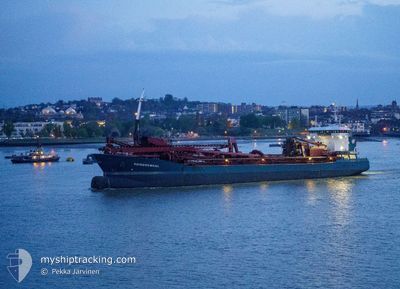
REIMERSWAAL
Trailing Suction Hopper Dredger
Current Trip
| Trip Time | 2 days |
|---|---|
| Trip Distance | 184.93 nm |
| AVG Speed | 6.9 Knop |
| MAX Speed | 13.3 Knop |
| Djupgående | 7.8 m |
| AVG Wind | 12.1 knots |
| MAX Wind | 15 knots |
| MIN Temp | 10.5°C / 50.9°F |
| MAX Temp | 16.5°C / 61.7°F |
| Position mottagen | Nu |
Current Position
| Longitud | 0.32221° |
|---|---|
| Latitude | 51.45997° |
| Status | Under way using engine |
| Fart | 0.2 Knop |
| Kurs | 346° |
| Område | North Sea |
| Station | T-AIS |
| Position mottagen | Nu |
Info
Information
The current position of REIMERSWAAL is in North Sea with coordinates 51.45997° / 0.32221° as reported on 2024-06-10 03:29 by AIS to our vessel tracker app. The vessel's current speed is 0.2 Knop and is currently inside the port of NORTHFLEET.
The vessel REIMERSWAAL (IMO: 9618240, MMSI: 244116000) is a Trailing Suction Hopper Dredger that was built in 2012 ( 12 År gammal ). It's sailing under the flag of [NL] Netherlands.
In this page you can find informations about the vessels current position, last detected port calls, and current voyage information. If the vessels is not in coverage by AIS you will find the latest position.
The current position of REIMERSWAAL is detected by our AIS receivers and we are not responsible for the reliability of the data. The last position was recorded while the vessel was in Coverage by the Ais receivers of our vessel tracking app.
The current draught of REIMERSWAAL as reported by AIS is 7.8 meters
Weather
| Temperature | 11°C / 51.8°F |
|---|---|
| Wind Speed | 10 knots |
| Direction | 242° WSW |
| Pressure | 1006.5 hPa |
| Humidity | 96.1 % |
| Cloud Coverage | 100 % |
Featured Company
Last Port Calls
| Port | Arrival | Departure | Time In Port |
|---|---|---|---|
| 2024-06-10 01:16 | |||
| 2024-06-07 10:42 | 2024-06-07 14:38 | 3 h | |
| 2024-06-03 18:02 | 2024-06-03 22:49 | 4 h | |
| 2024-06-01 04:51 | 2024-06-01 12:30 | 7 h | |
| 2024-05-30 11:29 | 2024-05-30 21:40 | 10 h | |
| 2024-05-29 01:37 | 2024-05-29 07:40 | 6 h | |
| 2024-05-27 11:30 | 2024-05-27 18:50 | 7 h | |
| 2024-05-24 23:35 | 2024-05-25 06:28 | 6 h | |
| 2024-05-21 20:18 | 2024-05-22 03:44 | 7 h | |
| 2024-05-20 07:23 | 2024-05-20 13:24 | 6 h |
Most Visited Ports (Last year)
| Port | Arrivals | |
|---|---|---|
| 49 | ||
| 27 | ||
| 27 | ||
| 23 | ||
| 14 | ||
| 10 |
Last Trips
| Origin | Departure | Destination | Arrival | Distance | |
|---|---|---|---|---|---|
| 2024-06-07 15:38 | 2024-06-10 02:16 | 184.93 nm | |||
| 2024-06-03 23:49 | 2024-06-07 11:42 | 540.68 nm | |||
| 2024-06-01 13:30 | 2024-06-03 19:02 | 233.93 nm | |||
| 2024-05-30 23:40 | 2024-06-01 05:51 | 296.73 nm | |||
| 2024-05-29 08:40 | 2024-05-30 13:29 | 270.86 nm | |||
| 2024-05-27 19:50 | 2024-05-29 02:37 | 243.42 nm | |||
| 2024-05-25 07:28 | 2024-05-27 12:30 | 257.49 nm | |||
| 2024-05-22 04:44 | 2024-05-25 00:35 | 536.93 nm | |||
| 2024-05-20 14:24 | 2024-05-21 21:18 | 252.30 nm | |||
| 2024-05-18 02:42 | 2024-05-20 08:23 | 222.39 nm |
Events
| Tid | Event | Detaljer | Position / Dest | Information |
|---|---|---|---|---|
| 2024-06-10 01:16 | ANLÄNDER HAMN |
|
51.46002 / .32233
[GB] NORTHFLEET
|
Fart: 0.3 kn Kurs: 348° |
| 2024-06-10 01:15 | STOPPAR förflyttning | 0.61 nm, North West of NORTHFLEET |
51.46003 / .32243
NORTHFLEET
|
Fart: 0.3 kn Kurs: 345° |
| 2024-06-09 22:29 | STARTAR förflyttning | 6.43 nm, North East of SHEERNESS |
51.50390 / .87878
NORTHFLEET
|
Fart: 3.1 kn Kurs: 225° |
| 2024-06-09 22:15 | Status ändrad | Under way using engine At anchor |
51.50435 / .87996
NORTHFLEET
|
Fart: 1 kn Kurs: 41° |
| 2024-06-08 18:52 | Status ändrad | At anchor Under way using engine |
51.50476 / .88375
NORTHFLEET
|
Fart: 0.9 kn Kurs: 244° |
| 2024-06-08 18:46 | STOPPAR förflyttning | 6.56 nm, North East of SHEERNESS |
51.50451 / .88244
NORTHFLEET
|
Fart: 0.3 kn Kurs: 254° |
| 2024-06-08 08:21 | Status ändrad | Under way using engine Default |
52.19471 / 1.83387
NORTHFLEET
|
Fart: 6.5 kn Kurs: 194° |
| 2024-06-08 08:17 | Status ändrad | Default Under way using engine |
52.20120 / 1.83659
NORTHFLEET
|
Fart: 6.7 kn Kurs: 194.4° |
| 2024-06-08 08:09 | Status ändrad | Under way using engine Default |
52.21684 / 1.84317
NORTHFLEET
|
Fart: 6.7 kn Kurs: 194° |
| 2024-06-08 08:05 | I täckningsområde |
52.21684 / 1.84317
North Sea
NORTHFLEET
|
Fart: 6.7 kn Kurs: 194.4° |