
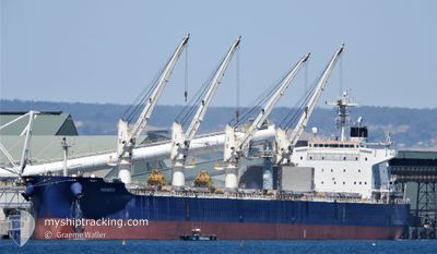
NEMEA
Cargo
Current Trip
| Time Travelled | 10 days |
|---|---|
| Remaining Time | --- |
| Distance Travelled | 2887.90 nm |
| Remaining Distance | --- |
| AVG Speed | 11.6 Knop |
| MAX Speed | 12.9 Knop |
| AVG Wind | 11.3 knots |
| MAX Wind | 19 knots |
| MIN Temp | 13.2°C / 55.76°F |
| MAX Temp | 29.5°C / 85.1°F |
| Djupgående | 12.4 m |
| Position mottagen | 8 d sen |
Current Position
| Longitud | 153.93785° |
|---|---|
| Latitude | -27.49327° |
| Status | Under way using engine |
| Fart | 11.6 Knop |
| Kurs | 1.3° |
| Område | Coral Sea |
| Station | T-AIS |
| Position mottagen | 8 d sen |
Info
Information
The current position of NEMEA is in Coral Sea with coordinates -27.49327° / 153.93785° as reported on 2024-06-08 01:42 by AIS to our vessel tracker app. The vessel's current speed is 11.6 Knop and is heading at the port of TOMAKOMAI. The estimated time of arrival as calculated by MyShipTracking vessel tracking app is 2024-06-23 03:00 LT
The vessel NEMEA (IMO: 9711286, MMSI: 319073100) is a Cargo It's sailing under the flag of [KY] Cayman Is.
In this page you can find informations about the vessels current position, last detected port calls, and current voyage information. If the vessels is not in coverage by AIS you will find the latest position.
The current position of NEMEA is detected by our AIS receivers and we are not responsible for the reliability of the data. The last position was recorded while the vessel was in Coverage by the Ais receivers of our vessel tracking app.
The current draught of NEMEA as reported by AIS is 12.4 meters
Weather
| Temperature | 28.5°C / 83.3°F |
|---|---|
| Wind Speed | 16 knots |
| Direction | 85° E |
| Pressure | 1012.1 hPa |
| Humidity | 77.1 % |
| Cloud Coverage | 14 % |
Featured Company
Most Visited Ports (Last year)
| Port | Arrivals | |
|---|---|---|
| 2 | ||
| 2 | ||
| 2 | ||
| 1 | ||
| 1 | ||
| 1 |
Events
| Tid | Event | Detaljer | Position / Dest | Information |
|---|---|---|---|---|
| 2024-06-08 01:48 | Status ändrad | Default Under way using engine |
-27.47259 / 153.93811
TOMAKOMAI
|
Fart: 11.6 kn Kurs: 1.3° |
| 2024-06-08 01:42 | UTANFÖR täckningsområde |
-27.49327 / 153.93785
Coral Sea
TOMAKOMAI
|
Fart: 11.6 kn Kurs: 1.3° |
|
| 2024-06-08 00:53 | Status ändrad | Under way using engine Default |
-27.65080 / 153.93179
TOMAKOMAI
|
Fart: 11.5 kn Kurs: 3° |
| 2024-06-08 00:36 | Status ändrad | Default Under way using engine |
-27.70344 / 153.92989
TOMAKOMAI
|
Fart: 11.7 kn Kurs: 1° |
| 2024-06-08 00:29 | Status ändrad | Under way using engine Default |
-27.72617 / 153.92937
TOMAKOMAI
|
Fart: 11.7 kn Kurs: 3° |
| 2024-06-08 00:28 | Status ändrad | Default Under way using engine |
-27.72944 / 153.92923
TOMAKOMAI
|
Fart: 11.7 kn Kurs: 2.2° |
| 2024-06-08 00:23 | Status ändrad | Under way using engine Default |
-27.74761 / 153.92792
TOMAKOMAI
|
Fart: 11.8 kn Kurs: 3° |
| 2024-06-08 00:12 | Status ändrad | Default Under way using engine |
-27.78226 / 153.92586
TOMAKOMAI
|
Fart: 12 kn Kurs: 5.3° |
| 2024-06-08 00:12 | Status ändrad | Under way using engine Default |
-27.78343 / 153.92576
TOMAKOMAI
|
Fart: 11.9 kn Kurs: 4° |
| 2024-06-08 00:12 | Upptäckt i hav | Australian part of the Coral Sea |
-27.78343 / 153.92576
Coral Sea
TOMAKOMAI
|
Fart: 12 kn Kurs: 5.3° |