
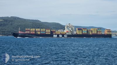
MSC LEANDRA V
Container Ship
Current Trip
| Time Travelled | 19 h, 4 mins |
|---|---|
| Remaining Time | 2 h, 12 mins |
| Distance Travelled | 207.22 nm |
| Remaining Distance | 8.01 nm |
| AVG Speed | 10.2 Knop |
| MAX Speed | 16.6 Knop |
| AVG Wind | 10.2 knots |
| MAX Wind | 15.8 knots |
| MIN Temp | 23°C / 73.4°F |
| MAX Temp | 28.3°C / 82.94°F |
| Djupgående | 12.6 m |
| Position mottagen | Nu |
Current Position
| Longitud | 26.74302° |
|---|---|
| Latitude | 38.80989° |
| Status | Under way using engine |
| Fart | 2.6 Knop |
| Kurs | 313° |
| Område | Aegean Sea |
| Station | T-AIS |
| Position mottagen | Nu |
Info
Information
The current position of MSC LEANDRA V is in Aegean Sea with coordinates 38.80989° / 26.74302° as reported on 2024-06-14 14:01 by AIS to our vessel tracker app. The vessel's current speed is 2.6 Knop and is heading at the port of ALIAGA. The estimated time of arrival as calculated by MyShipTracking vessel tracking app is 2024-06-14 19:14 LT
The vessel MSC LEANDRA V (IMO: 9313943, MMSI: 255803590) is a Container Ship that was built in 2007 ( 17 År gammal ). It's sailing under the flag of [PT] Portugal.
In this page you can find informations about the vessels current position, last detected port calls, and current voyage information. If the vessels is not in coverage by AIS you will find the latest position.
The current position of MSC LEANDRA V is detected by our AIS receivers and we are not responsible for the reliability of the data. The last position was recorded while the vessel was in Coverage by the Ais receivers of our vessel tracking app.
The current draught of MSC LEANDRA V as reported by AIS is 12.6 meters
Weather
| Temperature | 25.8°C / 78.44°F |
|---|---|
| Wind Speed | 11 knots |
| Direction | 288° WNW |
| Pressure | 1007.6 hPa |
| Humidity | 69.4 % |
| Cloud Coverage | 100 % |
Featured Company
Last Port Calls
| Port | Arrival | Departure | Time In Port |
|---|---|---|---|
| 2024-06-13 08:24 | 2024-06-13 21:58 | 13 h | |
| 2024-06-11 17:33 | 2024-06-12 04:39 | 11 h | |
| 2024-06-10 20:51 | 2024-06-11 12:39 | 15 h | |
| 2024-06-08 21:03 | 2024-06-09 21:11 | 1 d | |
| 2024-05-30 20:39 | 2024-05-31 23:09 | 1 d | |
| 2024-05-27 22:31 | 2024-05-29 11:12 | 1 d | |
| 2024-05-25 11:12 | 2024-05-26 19:21 | 1 d | |
| 2024-05-20 10:14 | 2024-05-24 12:03 | 4 d | |
| 2024-05-17 20:16 | 2024-05-18 20:29 | 1 d | |
| 2024-05-13 11:33 | 2024-05-14 06:12 | 18 h |
Last Trips
| Origin | Departure | Destination | Arrival | Distance | |
|---|---|---|---|---|---|
| 2024-06-12 04:39 | 2024-06-13 08:24 | 110.16 nm | |||
| 2024-06-11 12:39 | 2024-06-11 17:33 | 64.81 nm | |||
| 2024-06-09 21:11 | 2024-06-10 20:51 | 293.23 nm | |||
| 2024-05-31 23:09 | 2024-06-08 21:03 | 2916.30 nm | |||
| 2024-05-29 11:12 | 2024-05-30 20:39 | 429.11 nm | |||
| 2024-05-26 19:21 | 2024-05-27 22:31 | 403.72 nm | |||
| 2024-05-24 12:03 | 2024-05-25 11:12 | 206.55 nm | |||
| 2024-05-18 20:29 | 2024-05-20 10:14 | 535.19 nm | |||
| 2024-05-14 06:12 | 2024-05-17 20:16 | 1002.59 nm | |||
| 2024-05-11 20:26 | 2024-05-13 11:33 | 668.55 nm |
Events
| Tid | Event | Detaljer | Position / Dest | Information |
|---|---|---|---|---|
| 2024-06-14 13:58 | STOPPAR förflyttning | 8.3 nm, North of FOCA |
38.80896 / 26.74404
TRALI
|
Fart: 0.3 kn Kurs: 306° |
| 2024-06-14 12:58 | STARTAR förflyttning | 7.72 nm, North of FOCA |
38.79923 / 26.75033
TRALI
|
Fart: 3.1 kn Kurs: 282° |
| 2024-06-14 11:58 | ETA ändrat | 2024/06/14 16:00 2024/06/14 11:00 |
38.80189 / 26.74040
TRALI
|
Fart: 0.5 kn Kurs: 216° |
| 2024-06-14 11:39 | STOPPAR förflyttning | 7.9 nm, North of FOCA |
38.80214 / 26.73696
TRALI
|
Fart: 0.3 kn Kurs: 232° |
| 2024-06-14 09:56 | Byter havsområde | Turkish part of the Aegean Sea Greek part of the Aegean Sea |
38.81744 / 26.62978
Aegean Sea
TRALI
|
Fart: 12.4 kn Kurs: 102.2° |
| 2024-06-14 03:07 | Byter havsområde | Greek part of the Aegean Sea Turkish part of the Aegean Sea |
39.89741 / 25.86837
Aegean Sea
TRALI
|
Fart: 14.8 kn Kurs: 214° |
| 2024-06-14 02:52 | Status ändrad | Under way using engine Default |
39.94716 / 25.91425
TRALI
|
Fart: 14.9 kn Kurs: 226° |
| 2024-06-14 02:16 | Status ändrad | Default Under way using engine |
40.01300 / 26.07669
TRALI
|
Fart: 15 kn Kurs: 262.4° |
| 2024-06-14 01:57 | Byter havsområde | Turkish part of the Aegean Sea Turkish part of the Sea of Marmara |
40.02511 / 26.17837
Aegean Sea
TRALI
|
Fart: 14.6 kn Kurs: 258.7° |
| 2024-06-13 23:48 | Status ändrad | Under way using engine Default |
40.35192 / 26.64653
TRALI
|
Fart: 14.8 kn Kurs: 210° |