
MAX SCHULTE
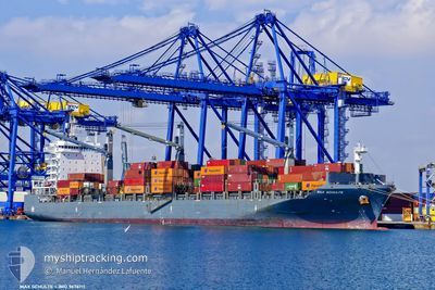
Cargo
Current Trip
| Time Travelled | 4 days |
|---|---|
| Remaining Time | 5 days |
| Distance Travelled | 905.70 nm |
| Remaining Distance | 1083.95 nm |
| AVG Speed | 9 Knop |
| MAX Speed | 14.8 Knop |
| AVG Wind | 8.3 knots |
| MAX Wind | 16.4 knots |
| MIN Temp | 16.4°C / 61.52°F |
| MAX Temp | 22°C / 71.6°F |
| Djupgående | 9.5 m |
| Position mottagen | Nu |
Current Position
| Longitud | 12.96010° |
|---|---|
| Latitude | 36.84073° |
| Status | Under way using engine |
| Fart | 8.6 Knop |
| Kurs | 108.3° |
| Område | Mediterranean Sea - Eastern Basin |
| Station | T-AIS |
| Position mottagen | Nu |
Info
Information
The current position of MAX SCHULTE is in Mediterranean Sea - Eastern Basin with coordinates 36.84073° / 12.96010° as reported on 2024-05-29 04:39 by AIS to our vessel tracker app. The vessel's current speed is 8.6 Knop and is heading at the port of MERSIN. The estimated time of arrival as calculated by MyShipTracking vessel tracking app is 2024-06-03 07:06 LT
The vessel MAX SCHULTE (IMO: 9676711, MMSI: 565380000) is a Cargo It's sailing under the flag of [SG] Singapore.
In this page you can find informations about the vessels current position, last detected port calls, and current voyage information. If the vessels is not in coverage by AIS you will find the latest position.
The current position of MAX SCHULTE is detected by our AIS receivers and we are not responsible for the reliability of the data. The last position was recorded while the vessel was in Coverage by the Ais receivers of our vessel tracking app.
The current draught of MAX SCHULTE as reported by AIS is 9.5 meters
Weather
| Temperature | 20.5°C / 68.9°F |
|---|---|
| Wind Speed | 7 knots |
| Direction | 241° WSW |
| Pressure | 1013.7 hPa |
| Humidity | 75.4 % |
| Cloud Coverage | 66 % |
Featured Company
Last Port Calls
| Port | Arrival | Departure | Time In Port |
|---|---|---|---|
| 2024-05-24 17:23 | 2024-05-24 23:29 | 6 h | |
| 2024-05-14 17:36 | 2024-05-15 11:05 | 17 h | |
| 2024-05-12 16:10 | 2024-05-13 03:15 | 11 h | |
| 2024-05-09 13:36 | 2024-05-11 00:39 | 1 d | |
| 2024-04-28 12:36 | 2024-04-28 17:27 | 4 h | |
| 2024-04-23 04:03 | 2024-04-23 15:28 | 11 h | |
| 2024-04-21 16:25 | 2024-04-22 03:51 | 11 h | |
| 2024-04-20 04:21 | 2024-04-21 10:33 | 1 d | |
| 2024-04-18 14:54 | 2024-04-19 23:42 | 1 d | |
| 2024-04-15 07:14 | 2024-04-15 21:43 | 14 h |
Last Trips
| Origin | Departure | Destination | Arrival | Distance | |
|---|---|---|---|---|---|
| 2024-05-15 07:05 | 2024-05-24 18:23 | 3700.64 nm | |||
| 2024-05-12 23:15 | 2024-05-14 13:36 | 504.92 nm | |||
| 2024-05-10 20:39 | 2024-05-12 12:10 | 319.38 nm | |||
| 2024-04-28 19:27 | 2024-05-09 09:36 | 3228.88 nm | |||
| 2024-04-23 18:28 | 2024-04-28 14:36 | 1655.19 nm | |||
| 2024-04-22 06:51 | 2024-04-23 07:03 | 286.76 nm | |||
| 2024-04-21 13:33 | 2024-04-21 19:25 | 69.43 nm | |||
| 2024-04-20 02:42 | 2024-04-20 07:21 | 55.24 nm | |||
| 2024-04-16 00:43 | 2024-04-18 17:54 | 801.81 nm | |||
| 2024-04-06 22:49 | 2024-04-15 10:14 | 2019.19 nm |
Events
| Tid | Event | Detaljer | Position / Dest | Information |
|---|---|---|---|---|
| 2024-05-28 23:11 | Byter havsområde | Italian part of the Mediterranean Sea - Eastern Basin Tunisian part of the Mediterranean Sea - Eastern Basin |
37.07811 / 11.98168
Mediterranean Sea - Eastern Basin
TRMER
|
Fart: 9.1 kn Kurs: 108.1° |
| 2024-05-28 19:59 | Upptäckt i hav | Tunisian part of the Mediterranean Sea - Eastern Basin |
37.27123 / 11.41161
Mediterranean Sea - Eastern Basin
TRMER
|
Fart: 9.2 kn Kurs: 114.9° |
| 2024-05-28 18:20 | Status ändrad | Under way using engine Default |
37.37478 / 11.12114
TRMER
|
Fart: 9.2 kn Kurs: 110° |
| 2024-05-28 18:13 | Status ändrad | Default Under way using engine |
37.38110 / 11.09950
TRMER
|
Fart: 9.2 kn Kurs: 104.4° |
| 2024-05-28 11:11 | Status ändrad | Under way using engine Default |
37.57441 / 9.73323
TRMER
|
Fart: 8.7 kn Kurs: 94° |
| 2024-05-28 10:48 | Status ändrad | Default Under way using engine |
37.57805 / 9.65869
TRMER
|
Fart: 8.7 kn Kurs: 91.3° |
| 2024-05-28 08:48 | Status ändrad | Under way using engine Default |
37.58873 / 9.28999
TRMER
|
Fart: 7.9 kn Kurs: 95° |
| 2024-05-28 08:02 | Status ändrad | Default Under way using engine |
37.59794 / 9.15539
TRMER
|
Fart: 7.9 kn Kurs: 95.4° |
| 2024-05-28 07:56 | Status ändrad | Under way using engine Default |
37.59909 / 9.14051
TRMER
|
Fart: 7.8 kn Kurs: 96° |
| 2024-05-28 07:52 | Status ändrad | Default Under way using engine |
37.60011 / 9.12843
TRMER
|
Fart: 7.8 kn Kurs: 95.7° |