
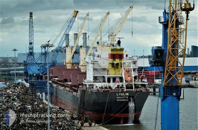
LYULIN
Bulk Carrier
Current Trip
| Time Travelled | 13 days |
|---|---|
| Remaining Time | 6 days |
| Distance Travelled | 3044.82 nm |
| Remaining Distance | 1777.55 nm |
| AVG Speed | 10.7 Knop |
| MAX Speed | 13.8 Knop |
| AVG Wind | 10.7 knots |
| MAX Wind | 19.9 knots |
| MIN Temp | 7.7°C / 45.86°F |
| MAX Temp | 20.3°C / 68.54°F |
| Djupgående | 10.3 m |
| Position mottagen | 6 m sen |
Current Position
| Longitud | -8.98687° |
|---|---|
| Latitude | 34.06533° |
| Status | Under way using engine |
| Fart | 11.1 Knop |
| Kurs | 218.8° |
| Område | North Atlantic Ocean |
| Station | T-AIS |
| Position mottagen | 6 m sen |
Info
Information
The current position of LYULIN is in North Atlantic Ocean with coordinates 34.06533° / -8.98687° as reported on 2024-05-29 02:26 by AIS to our vessel tracker app. The vessel's current speed is 11.1 Knop and is heading at the port of CONAKRY. The estimated time of arrival as calculated by MyShipTracking vessel tracking app is 2024-06-04 22:40 LT
The vessel LYULIN (IMO: 9498248, MMSI: 248938000) is a Bulk Carrier that was built in 2011 ( 13 År gammal ). It's sailing under the flag of [MT] Malta.
In this page you can find informations about the vessels current position, last detected port calls, and current voyage information. If the vessels is not in coverage by AIS you will find the latest position.
The current position of LYULIN is detected by our AIS receivers and we are not responsible for the reliability of the data. The last position was recorded while the vessel was in Coverage by the Ais receivers of our vessel tracking app.
The current draught of LYULIN as reported by AIS is 10.3 meters
Weather
| Temperature | 19.1°C / 66.38°F |
|---|---|
| Wind Speed | 15 knots |
| Direction | 10° N |
| Pressure | 1014.5 hPa |
| Humidity | 91.6 % |
| Cloud Coverage | --- |
Featured Company
Last Port Calls
| Port | Arrival | Departure | Time In Port |
|---|---|---|---|
| 2024-05-09 06:34 | 2024-05-16 02:09 | 6 d | |
| 2024-04-18 11:25 | 2024-04-24 16:18 | 6 d | |
| 2024-04-04 10:47 | 2024-04-11 04:12 | 6 d | |
| 2024-03-08 21:50 | 2024-03-23 02:42 | 14 d |
Most Visited Ports (Last year)
| Port | Arrivals | |
|---|---|---|
| 4 | ||
| 4 | ||
| 2 | ||
| 2 | ||
| 2 | ||
| 1 |
Last Trips
| Origin | Departure | Destination | Arrival | Distance | |
|---|---|---|---|---|---|
| 2024-04-24 16:18 | 2024-05-09 06:34 | 1354.70 nm | |||
| 2024-04-11 04:12 | 2024-04-18 11:25 | 1745.07 nm | |||
| 2024-03-23 02:42 | 2024-04-04 10:47 | 3192.16 nm | |||
| 2024-02-05 07:28 | 2024-03-08 21:50 | 3878.72 nm |
Events
| Tid | Event | Detaljer | Position / Dest | Information |
|---|---|---|---|---|
| 2024-05-29 02:23 | Status ändrad | Under way using engine Default |
34.07220 / -8.98031
GN CKY
|
Fart: 11 kn Kurs: 218° |
| 2024-05-29 02:07 | I täckningsområde |
34.07220 / -8.98031
North Atlantic Ocean
GN CKY
|
Fart: 11.1 kn Kurs: 222.5° |
|
| 2024-05-29 01:30 | Status ändrad | Default Under way using engine |
34.19971 / -8.85920
GN CKY
|
Fart: 10.7 kn Kurs: 217.1° |
| 2024-05-29 01:20 | UTANFÖR täckningsområde |
34.22331 / -8.83634
North Atlantic Ocean
GN CKY
|
Fart: 10.7 kn Kurs: 217.1° |
|
| 2024-05-29 00:34 | Status ändrad | Under way using engine Default |
34.33033 / -8.73066
GN CKY
|
Fart: 10.8 kn Kurs: 220° |
| 2024-05-29 00:27 | Status ändrad | Default Under way using engine |
34.34669 / -8.71431
GN CKY
|
Fart: 10.9 kn Kurs: 218.5° |
| 2024-05-29 00:12 | Status ändrad | Under way using engine Default |
34.38264 / -8.67908
GN CKY
|
Fart: 10.9 kn Kurs: 216° |
| 2024-05-28 23:36 | Status ändrad | Default Under way using engine |
34.46866 / -8.59529
GN CKY
|
Fart: 10.7 kn Kurs: 217.9° |
| 2024-05-28 23:27 | Status ändrad | Under way using engine Default |
34.48916 / -8.57565
GN CKY
|
Fart: 10.6 kn Kurs: 218° |
| 2024-05-28 23:08 | Status ändrad | Default Under way using engine |
34.53491 / -8.53195
GN CKY
|
Fart: 10.9 kn Kurs: 218.5° |