
KARTERIA
Bulk Carrier
Current Trip
| Time Travelled | 25 days |
|---|---|
| Remaining Time | --- |
| Distance Travelled | 3044.62 nm |
| Remaining Distance | 6.80 nm |
| AVG Speed | 9 Knop |
| MAX Speed | 15.7 Knop |
| AVG Wind | 13.7 knots |
| MAX Wind | 26 knots |
| MIN Temp | 6.2°C / 43.16°F |
| MAX Temp | 21.4°C / 70.52°F |
| Djupgående | 12.2 m |
| Position mottagen | 9 m sen |
Current Position
| Longitud | 28.40496° |
|---|---|
| Latitude | 59.80828° |
| Status | At anchor |
| Fart | |
| Kurs | 30° |
| Område | Gulf of Finland |
| Station | T-AIS |
| Position mottagen | 9 m sen |
Info
Information
The current position of KARTERIA is in Gulf of Finland with coordinates 59.80828° / 28.40496° as reported on 2024-06-14 17:59 by AIS to our vessel tracker app. The vessel's current speed is 0 Knop and is heading at the port of UST-LUGA. The estimated time of arrival as calculated by MyShipTracking vessel tracking app is 2024-06-13 13:00 LT
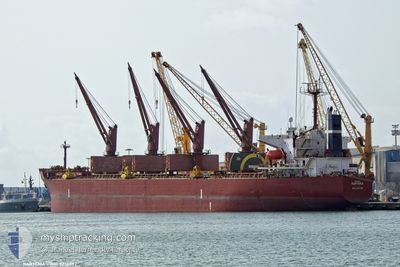
The vessel KARTERIA (IMO: 9236092, MMSI: 249562000) is a Bulk Carrier that was built in 2001 ( 23 År gammal ). It's sailing under the flag of [MT] Malta.
In this page you can find informations about the vessels current position, last detected port calls, and current voyage information. If the vessels is not in coverage by AIS you will find the latest position.
The current position of KARTERIA is detected by our AIS receivers and we are not responsible for the reliability of the data. The last position was recorded while the vessel was in Coverage by the Ais receivers of our vessel tracking app.
The current draught of KARTERIA as reported by AIS is 12.2 meters
Weather
| Temperature | 12.9°C / 55.22°F |
|---|---|
| Wind Speed | 3 knots |
| Direction | 241° WSW |
| Pressure | 1015.9 hPa |
| Humidity | 77.2 % |
| Cloud Coverage | 100 % |
Featured Company
Last Port Calls
| Port | Arrival | Departure | Time In Port |
|---|---|---|---|
| 2024-05-16 17:34 | 2024-05-20 04:38 | 3 d | |
| 2024-04-18 00:47 | 2024-04-24 23:39 | 6 d | |
| 2024-04-01 13:54 |
Most Visited Ports (Last year)
| Port | Arrivals | |
|---|---|---|
| 3 | ||
| 2 | ||
| 2 | ||
| 1 | ||
| 1 | ||
| 1 |
Last Trips
| Origin | Departure | Destination | Arrival | Distance | |
|---|---|---|---|---|---|
| 2024-04-25 01:39 | 2024-05-16 18:34 | 4475.69 nm | |||
| 2024-04-01 16:54 | 2024-04-18 02:47 | 3498.88 nm |
Events
| Tid | Event | Detaljer | Position / Dest | Information |
|---|---|---|---|---|
| 2024-06-14 17:59 | Status ändrad | At anchor Default |
59.80828 / 28.40496
RUULU
|
Fart: Kurs: 29° |
| 2024-06-14 17:53 | Status ändrad | Default At anchor |
59.80822 / 28.40485
RUULU
|
Fart: Kurs: 28° |
| 2024-06-14 17:44 | Status ändrad | At anchor Default |
59.80817 / 28.40497
RUULU
|
Fart: Kurs: 15° |
| 2024-06-14 17:23 | Status ändrad | Default At anchor |
59.80799 / 28.40519
RUULU
|
Fart: Kurs: 7° |
| 2024-06-14 16:59 | Status ändrad | At anchor Default |
59.80793 / 28.40597
RUULU
|
Fart: 0.2 kn Kurs: 355° |
| 2024-06-14 16:53 | Status ändrad | Default At anchor |
59.80797 / 28.40605
RUULU
|
Fart: Kurs: 353° |
| 2024-06-14 15:23 | Status ändrad | At anchor Default |
59.80803 / 28.40740
RUULU
|
Fart: Kurs: 332° |
| 2024-06-14 15:20 | Status ändrad | Default At anchor |
59.80809 / 28.40743
RUULU
|
Fart: Kurs: 331° |
| 2024-06-14 12:56 | Status ändrad | At anchor Default |
59.80852 / 28.40799
RUULU
|
Fart: 0.2 kn Kurs: 328° |
| 2024-06-14 12:50 | Status ändrad | Default At anchor |
59.80832 / 28.40734
RUULU
|
Fart: 0.2 kn Kurs: 350° |