
IRYDA
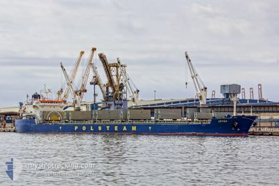
Bulk Carrier
Current Trip
| Time Travelled | 8 days |
|---|---|
| Remaining Time | --- |
| Distance Travelled | 2331.54 nm |
| Remaining Distance | --- |
| AVG Speed | 10.2 Knop |
| MAX Speed | 13.9 Knop |
| AVG Wind | 15.7 knots |
| MAX Wind | 27 knots |
| MIN Temp | 12.1°C / 53.78°F |
| MAX Temp | 21.5°C / 70.7°F |
| Djupgående | 10.1 m |
| Position mottagen | 1 m sen |
Current Position
| Longitud | 7.29752° |
|---|---|
| Latitude | 56.36176° |
| Status | Under way using engine |
| Fart | 10 Knop |
| Kurs | 31.7° |
| Område | North Sea |
| Station | T-AIS |
| Position mottagen | 1 m sen |
Info
Information
The current position of IRYDA is in North Sea with coordinates 56.36176° / 7.29752° as reported on 2024-06-01 19:44 by AIS to our vessel tracker app. The vessel's current speed is 10 Knop and is heading at the port of PORT MORSKI POLICE. The estimated time of arrival as calculated by MyShipTracking vessel tracking app is 2024-06-03 18:00 LT
The vessel IRYDA (IMO: 9180384, MMSI: 212891000) is a Bulk Carrier that was built in 1999 ( 25 År gammal ). It's sailing under the flag of [CY] Cyprus.
In this page you can find informations about the vessels current position, last detected port calls, and current voyage information. If the vessels is not in coverage by AIS you will find the latest position.
The current position of IRYDA is detected by our AIS receivers and we are not responsible for the reliability of the data. The last position was recorded while the vessel was in Coverage by the Ais receivers of our vessel tracking app.
The current draught of IRYDA as reported by AIS is 10.1 meters
Weather
| Temperature | 13.5°C / 56.3°F |
|---|---|
| Wind Speed | 22 knots |
| Direction | 330° NNW |
| Pressure | 1018.2 hPa |
| Humidity | 83.3 % |
| Cloud Coverage | 45 % |
Featured Company
Most Visited Ports (Last year)
| Port | Arrivals | |
|---|---|---|
| 3 | ||
| 3 | ||
| 3 | ||
| 2 | ||
| 2 | ||
| 2 |
Events
| Tid | Event | Detaljer | Position / Dest | Information |
|---|---|---|---|---|
| 2024-06-01 14:34 | Status ändrad | Under way using engine Default |
55.69314 / 6.39122
PLPLC
|
Fart: 9 kn Kurs: 24° |
| 2024-06-01 14:27 | Status ändrad | Default Under way using engine |
55.67333 / 6.37667
PLPLC
|
Fart: 9.6 kn Kurs: 25° |
| 2024-06-01 12:54 | Upptäckt i hav | Danish part of the North Sea |
55.44441 / 6.20013
North Sea
PLPLC
|
Fart: 9.7 kn Kurs: 22.7° |
| 2024-06-01 12:54 | Djupgående ändrat | 10.1 10 |
55.44232 / 6.19854
PLPLC
|
Fart: 9.7 kn Kurs: 23.1° |
| 2024-06-01 12:54 | Status ändrad | Under way using engine Default |
55.44232 / 6.19854
PLPLC
|
Fart: 9.9 kn Kurs: 23° |
| 2024-06-01 12:44 | Status ändrad | Default Under way using engine |
55.41917 / 6.18154
PLPLC
|
Fart: 9.9 kn Kurs: 24.5° |
| 2024-06-01 11:55 | Status ändrad | Under way using engine Default |
55.29536 / 6.08868
PLPLC
|
Fart: 9.6 kn Kurs: 25° |
| 2024-06-01 11:39 | I täckningsområde |
55.29703 / 6.09005
North Sea
PLPLC
|
Fart: 9.8 kn Kurs: 24.8° |
|
| 2024-06-01 10:29 | Status ändrad | Default Under way using engine |
55.09007 / 5.92704
PLPLC
|
Fart: 9.2 kn Kurs: 23.5° |
| 2024-06-01 10:22 | UTANFÖR täckningsområde |
55.07182 / 5.91286
North Sea
PLPLC
|
Fart: 9.2 kn Kurs: 23.5° |