
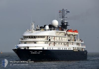
HEBRIDEAN SKY
Passengers Ship
Current Trip
| Time Travelled | 13 h, 30 mins |
|---|---|
| Remaining Time | 19 h, 29 mins |
| Distance Travelled | 57.66 nm |
| Remaining Distance | 205.56 nm |
| AVG Speed | 6.6 Knop |
| MAX Speed | 8.4 Knop |
| AVG Wind | 2.9 knots |
| MAX Wind | 5.5 knots |
| MIN Temp | 4.2°C / 39.56°F |
| MAX Temp | 7.1°C / 44.78°F |
| Djupgående | 4.3 m |
| Position mottagen | 1 d sen |
Current Position
| Longitud | -18.25880° |
|---|---|
| Latitude | 65.94098° |
| Status | Under way using engine |
| Fart | 7 Knop |
| Kurs | 153.5° |
| Område | Greenland Sea |
| Station | T-AIS |
| Position mottagen | 1 d sen |
Info
Information
The current position of HEBRIDEAN SKY is in Greenland Sea with coordinates 65.94098° / -18.25880° as reported on 2024-06-10 03:27 by AIS to our vessel tracker app. The vessel's current speed is 7 Knop and is heading at the port of SEYDISFJORDUR. The estimated time of arrival as calculated by MyShipTracking vessel tracking app is 2024-06-12 07:10 LT
The vessel HEBRIDEAN SKY (IMO: 8802882, MMSI: 311000253) is a Passengers Ship that was built in 1991 ( 33 År gammal ). It's sailing under the flag of [BS] Bahamas.
In this page you can find informations about the vessels current position, last detected port calls, and current voyage information. If the vessels is not in coverage by AIS you will find the latest position.
The current position of HEBRIDEAN SKY is detected by our AIS receivers and we are not responsible for the reliability of the data. The last position was recorded while the vessel was in Coverage by the Ais receivers of our vessel tracking app.
The current draught of HEBRIDEAN SKY as reported by AIS is 4.3 meters
Weather
| Temperature | 5.2°C / 41.36°F |
|---|---|
| Wind Speed | 2 knots |
| Direction | 231° SW |
| Pressure | 1020.6 hPa |
| Humidity | 74.4 % |
| Cloud Coverage | 81 % |
Featured Company
Last Port Calls
| Port | Arrival | Departure | Time In Port |
|---|---|---|---|
| 2024-06-10 05:52 | 2024-06-10 22:11 | 16 h | |
| 2024-06-09 08:40 | 2024-06-09 21:05 | 12 h | |
| 2024-06-06 17:21 | 2024-06-07 13:13 | 19 h | |
| 2024-06-04 06:51 | 2024-06-04 17:42 | 10 h | |
| 2024-06-01 06:48 | 2024-06-01 19:52 | 13 h | |
| 2024-05-31 06:52 | 2024-05-31 19:24 | 12 h | |
| 2024-05-30 07:03 | 2024-05-30 22:14 | 15 h | |
| 2024-05-29 06:26 | 2024-05-29 18:10 | 11 h | |
| 2024-05-28 07:13 | 2024-05-28 18:40 | 11 h | |
| 2024-05-25 07:30 | 2024-05-25 18:17 | 10 h |
Most Visited Ports (Last year)
| Port | Arrivals | |
|---|---|---|
| 5 | ||
| 4 | ||
| 4 | ||
| 4 | ||
| 3 | ||
| 3 |
Last Trips
| Origin | Departure | Destination | Arrival | Distance | |
|---|---|---|---|---|---|
| 2024-06-09 21:05 | 2024-06-10 05:52 | 60.49 nm | |||
| 2024-06-07 13:13 | 2024-06-09 08:40 | 467.25 nm | |||
| 2024-06-04 17:42 | 2024-06-06 17:21 | 427.63 nm | |||
| 2024-06-01 19:52 | 2024-06-04 06:51 | 231.84 nm | |||
| 2024-05-31 19:24 | 2024-06-01 06:48 | 106.34 nm | |||
| 2024-05-30 22:14 | 2024-05-31 06:52 | 56.81 nm | |||
| 2024-05-29 18:10 | 2024-05-30 07:03 | 126.82 nm | |||
| 2024-05-28 18:40 | 2024-05-29 06:26 | 92.59 nm | |||
| 2024-05-25 18:17 | 2024-05-28 07:13 | 398.27 nm | |||
| 2024-05-24 14:12 | 2024-05-25 07:30 | 191.24 nm |
Events
| Tid | Event | Detaljer | Position / Dest | Information |
|---|---|---|---|---|
| 2024-06-11 11:14 | STARTAR förflyttning | 0.52 nm, South West of GRIMSEY |
66.53087 / -18.02698
IS SEY
|
Fart: 4.8 kn Kurs: 231° |
| 2024-06-11 07:32 | STOPPAR förflyttning | 0.32 nm, South West of GRIMSEY |
66.53377 / -18.02309
IS SEY
|
Fart: 0.3 kn Kurs: 165° |
| 2024-06-10 22:11 | STARTAR förflyttning | 0.33 nm, North East of AKUREYRI |
65.69628 / -18.06724
IS SEY
|
Fart: 6.1 kn Kurs: 331° |
| 2024-06-10 22:11 | AVGÅTT HAMN |
|
65.69628 / -18.06724
IS SEY
|
Fart: 2 kn Kurs: 161° |
| 2024-06-10 05:52 | ANLÄNDER HAMN |
|
65.68556 / -18.07388
[IS] AKUREYRI
|
Fart: 5.9 kn Kurs: 174° |
| 2024-06-10 03:54 | Status ändrad | Default Under way using engine |
65.89516 / -18.20164
IS SEY
|
Fart: 7 kn Kurs: 153.5° |
| 2024-06-10 03:27 | UTANFÖR täckningsområde |
65.94098 / -18.25880
Greenland Sea
|
Fart: 7 kn Kurs: 153.5° |
|
| 2024-06-09 21:10 | Byter havsområde | Icelandic part of the Greenland Sea Faeroe Islands part of the North Atlantic Ocean |
66.04471 / -17.38329
Greenland Sea
|
Fart: 7.1 kn Kurs: 303.2° |
| 2024-06-09 21:05 | AVGÅTT HAMN |
|
66.04240 / -17.36280
IS SEY
|
Fart: 6.6 kn Kurs: 250° |
| 2024-06-09 21:04 | Status ändrad | Under way using engine Moored |
66.04281 / -17.35875
[IS] HUSAVIK
|
Fart: 5.7 kn Kurs: 225° |