
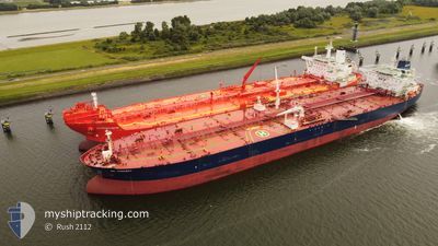
GUANYIN
Crude Oil Tanker
Current Trip
| Time Travelled | 4 days |
|---|---|
| Remaining Time | --- |
| Distance Travelled | 1269.68 nm |
| Remaining Distance | --- |
| AVG Speed | 10.3 Knop |
| MAX Speed | 12 Knop |
| AVG Wind | 10.7 knots |
| MAX Wind | 24.5 knots |
| MIN Temp | 11°C / 51.8°F |
| MAX Temp | 18.9°C / 66.02°F |
| Djupgående | 15 m |
| Position mottagen | 3 h, 22 m sen |
Current Position
| Longitud | 4.99962° |
|---|---|
| Latitude | 54.80056° |
| Status | Under way using engine |
| Fart | 11.3 Knop |
| Kurs | 209.1° |
| Område | North Sea |
| Station | T-AIS |
| Position mottagen | 3 h, 22 m sen |
Info
Information
The current position of GUANYIN is in North Sea with coordinates 54.80056° / 4.99962° as reported on 2024-06-01 22:09 by AIS to our vessel tracker app. The vessel's current speed is 11.3 Knop and is heading at the port of PORT SAID. The estimated time of arrival as calculated by MyShipTracking vessel tracking app is 2024-06-14 11:00 LT
The vessel GUANYIN (IMO: 9299707, MMSI: 636012383) is a Crude Oil Tanker that was built in 2005 ( 19 År gammal ). It's sailing under the flag of [LR] Liberia.
In this page you can find informations about the vessels current position, last detected port calls, and current voyage information. If the vessels is not in coverage by AIS you will find the latest position.
The current position of GUANYIN is detected by our AIS receivers and we are not responsible for the reliability of the data. The last position was recorded while the vessel was in Coverage by the Ais receivers of our vessel tracking app.
The current draught of GUANYIN as reported by AIS is 15 meters
Weather
| Temperature | 13.1°C / 55.58°F |
|---|---|
| Wind Speed | 22 knots |
| Direction | 345° NNW |
| Pressure | 1023.2 hPa |
| Humidity | 81.1 % |
| Cloud Coverage | 3 % |
Featured Company
Last Port Calls
| Port | Arrival | Departure | Time In Port |
|---|---|---|---|
| 2024-05-26 01:20 | 2024-05-28 07:21 | 2 d | |
| 2024-05-03 07:01 | 2024-05-03 16:07 | 9 h | |
| 2024-04-01 06:45 | 2024-04-01 15:42 | 8 h |
Last Trips
| Origin | Departure | Destination | Arrival | Distance | |
|---|---|---|---|---|---|
| 2024-03-14 20:24 | 2024-05-26 01:20 | 11022.44 nm | |||
| 2024-03-14 20:24 | 2024-05-03 07:01 | 6123.58 nm | |||
| 2024-03-14 20:24 | 2024-04-01 06:45 | 4784.29 nm |
Events
| Tid | Event | Detaljer | Position / Dest | Information |
|---|---|---|---|---|
| 2024-06-01 22:13 | Status ändrad | Default Under way using engine |
54.78973 / 4.98787
EGPSD
|
Fart: 11.3 kn Kurs: 209.1° |
| 2024-06-01 22:09 | Upptäckt i hav | Dutch part of the North Sea |
54.80056 / 4.99963
North Sea
EGPSD
|
Fart: 11.3 kn Kurs: 209.1° |
| 2024-06-01 22:09 | Status ändrad | Under way using engine Default |
54.80056 / 4.99963
EGPSD
|
Fart: 11 kn Kurs: 210° |
| 2024-06-01 22:09 | UTANFÖR täckningsområde |
54.80056 / 4.99963
North Sea
EGPSD
|
Fart: 11.3 kn Kurs: 209.1° |
|
| 2024-06-01 22:04 | Status ändrad | Default Under way using engine |
54.81333 / 5.01333
EGPSD
|
Fart: 11.4 kn Kurs: 208.4° |
| 2024-06-01 21:45 | Status ändrad | Under way using engine Default |
54.86404 / 5.06875
EGPSD
|
Fart: 11 kn Kurs: 208° |
| 2024-06-01 21:37 | Status ändrad | Default Under way using engine |
54.88667 / 5.09333
EGPSD
|
Fart: 11.2 kn Kurs: 208.4° |
| 2024-06-01 17:53 | Byter havsområde | German part of the North Sea Danish part of the North Sea |
55.49915 / 5.76019
North Sea
EGPSD
|
Fart: 11.3 kn Kurs: 208.2° |
| 2024-06-01 05:53 | Byter havsområde | Danish part of the North Sea Danish part of the Skaggerak |
57.32508 / 8.23502
North Sea
EGPSD
|
Fart: 11 kn Kurs: 237.1° |
| 2024-05-31 21:07 | Byter havsområde | Danish part of the Skaggerak Danish part of the Kattegat |
57.79947 / 10.93219
Skaggerak
EGPSD
|
Fart: 10.9 kn Kurs: 303.5° |