
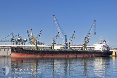
FLORA K
Cargo
Current Trip
| Time Travelled | 17 days |
|---|---|
| Remaining Time | --- |
| Distance Travelled | 3385.03 nm |
| Remaining Distance | --- |
| AVG Speed | 11.1 Knop |
| MAX Speed | 13 Knop |
| AVG Wind | 13.4 knots |
| MAX Wind | 22 knots |
| MIN Temp | 18.2°C / 64.76°F |
| MAX Temp | 28.6°C / 83.48°F |
| Djupgående | 8 m |
| Position mottagen | Nu |
Current Position
| Longitud | -38.50862° |
|---|---|
| Latitude | -13.28711° |
| Status | Under way using engine |
| Fart | 10.6 Knop |
| Kurs | 161.9° |
| Område | South Atlantic Ocean |
| Station | T-AIS |
| Position mottagen | Nu |
Info
Information
The current position of FLORA K is in South Atlantic Ocean with coordinates -13.28711° / -38.50862° as reported on 2024-06-10 18:13 by AIS to our vessel tracker app. The vessel's current speed is 10.6 Knop
The vessel FLORA K (IMO: 9708538, MMSI: 256740000) is a Cargo It's sailing under the flag of [MT] Malta.
In this page you can find informations about the vessels current position, last detected port calls, and current voyage information. If the vessels is not in coverage by AIS you will find the latest position.
The current position of FLORA K is detected by our AIS receivers and we are not responsible for the reliability of the data. The last position was recorded while the vessel was in Coverage by the Ais receivers of our vessel tracking app.
The current draught of FLORA K as reported by AIS is 8 meters
Weather
| Temperature | 26.8°C / 80.24°F |
|---|---|
| Wind Speed | 12 knots |
| Direction | 113° ESE |
| Pressure | 1016.3 hPa |
| Humidity | 67.7 % |
| Cloud Coverage | 67 % |
Featured Company
Last Port Calls
| Port | Arrival | Departure | Time In Port |
|---|---|---|---|
| 2024-05-22 13:21 | 2024-05-24 12:06 | 1 d | |
| 2024-05-18 16:06 | 2024-05-21 11:24 | 2 d | |
| 2024-05-01 13:36 | 2024-05-04 14:13 | 3 d | |
| 2024-04-28 07:43 | 2024-04-29 20:34 | 1 d | |
| 2024-04-21 09:07 | 2024-04-25 17:56 | 4 d | |
| 2024-04-09 12:55 | 2024-04-19 19:26 | 10 d |
Most Visited Ports (Last year)
| Port | Arrivals | |
|---|---|---|
| 2 | ||
| 2 | ||
| 1 | ||
| 1 | ||
| 1 | ||
| 1 |
Last Trips
| Origin | Departure | Destination | Arrival | Distance | |
|---|---|---|---|---|---|
| 2024-05-21 11:24 | 2024-05-22 13:21 | 8.66 nm | |||
| 2024-05-04 14:13 | 2024-05-18 16:06 | 1550.51 nm | |||
| 2024-04-29 20:34 | 2024-05-01 13:36 | 468.03 nm | |||
| 2024-04-25 17:56 | 2024-04-28 07:43 | 336.88 nm | |||
| 2024-04-19 19:26 | 2024-04-21 09:07 | 426.03 nm | |||
| 2024-03-22 09:41 | 2024-04-09 12:55 | 1760.89 nm |
Events
| Tid | Event | Detaljer | Position / Dest | Information |
|---|---|---|---|---|
| 2024-06-10 17:47 | Djupgående ändrat | 8 8.8 |
-13.21377 / -38.53231
PARANAGUA BRAZIL
|
Fart: 10.4 kn Kurs: 161.7° |
| 2024-06-10 17:47 | Destination ändrad | PARANAGUA BRAZIL SALVADOR BRAZIL |
-13.21377 / -38.53231
PARANAGUA BRAZIL
|
Fart: 10.4 kn Kurs: 161.7° |
| 2024-06-10 17:47 | ETA ändrat | 2024/06/14 21:00 2024/06/05 12:00 |
-13.21377 / -38.53231
PARANAGUA BRAZIL
|
Fart: 10.4 kn Kurs: 161.7° |
| 2024-06-10 16:31 | Status ändrad | Under way using engine Default |
-12.98891 / -38.55723
SALVADOR BRAZIL
|
Fart: 11 kn Kurs: 182° |
| 2024-06-10 15:50 | Status ändrad | Default Under way using engine |
-12.87590 / -38.54657
SALVADOR BRAZIL
|
Fart: 11.6 kn Kurs: 219.2° |
| 2024-06-10 15:29 | Status ändrad | Under way using engine Moored |
-12.82872 / -38.50371
SALVADOR BRAZIL
|
Fart: 6.8 kn Kurs: 229.6° |
| 2024-06-10 15:26 | STARTAR förflyttning | 2.86 nm, South West of ARATU |
-12.82540 / -38.50041
SALVADOR BRAZIL
|
Fart: 3.1 kn Kurs: 218° |
| 2024-06-10 13:59 | Status ändrad | Moored Default |
-12.82411 / -38.49886
SALVADOR BRAZIL
|
Fart: Kurs: 181° |
| 2024-06-10 13:50 | I täckningsområde |
-12.82411 / -38.49886
South Atlantic Ocean
|
Fart: Kurs: 182.6° |
|
| 2024-06-10 12:32 | UTANFÖR täckningsområde |
-12.82413 / -38.49886
South Atlantic Ocean
|
Fart: Kurs: 182.6° |