
DAYA
Cargo
Current Trip
| Time Travelled | 2 days |
|---|---|
| Remaining Time | --- |
| Distance Travelled | 70.23 nm |
| Remaining Distance | --- |
| AVG Speed | 8.5 Knop |
| MAX Speed | 11.1 Knop |
| AVG Wind | 4 knots |
| MAX Wind | 5.4 knots |
| MIN Temp | 13°C / 55.4°F |
| MAX Temp | 18.1°C / 64.58°F |
| Djupgående | 1.8 m |
| Position mottagen | 1 d sen |
Current Position
| Longitud | 6.14929° |
|---|---|
| Latitude | 52.06589° |
| Status | Under way using engine |
| Fart | 7.6 Knop |
| Kurs | 29.2° |
| Område | North Sea |
| Station | T-AIS |
| Position mottagen | 1 d sen |
Info
Information
The current position of DAYA is in North Sea with coordinates 52.06589° / 6.14929° as reported on 2024-05-19 08:35 by AIS to our vessel tracker app. The vessel's current speed is 7.6 Knop
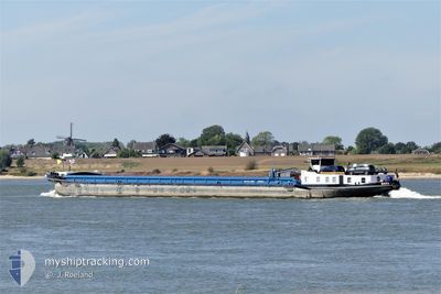
The vessel DAYA (MMSI: 205430290) is a Cargo It's sailing under the flag of [BE] Belgium.
In this page you can find informations about the vessels current position, last detected port calls, and current voyage information. If the vessels is not in coverage by AIS you will find the latest position.
The current position of DAYA is detected by our AIS receivers and we are not responsible for the reliability of the data. The last position was recorded while the vessel was in Coverage by the Ais receivers of our vessel tracking app.
The current draught of DAYA as reported by AIS is 1.8 meters
Weather
| Temperature | 17.1°C / 62.78°F |
|---|---|
| Wind Speed | 4 knots |
| Direction | 11° N |
| Pressure | 1010.6 hPa |
| Humidity | 76.5 % |
| Cloud Coverage | 11 % |
Featured Company
Last Port Calls
| Port | Arrival | Departure | Time In Port |
|---|---|---|---|
| 2024-05-15 10:15 | 2024-05-18 05:33 | 2 d | |
| 2024-05-09 09:43 | 2024-05-11 11:25 | 2 d | |
| 2024-05-06 19:51 | 2024-05-07 11:17 | 15 h | |
| 2024-05-05 18:18 | 2024-05-06 05:57 | 11 h | |
| 2024-05-03 06:58 | 2024-05-03 07:38 | 40 m | |
| 2024-05-02 11:33 | 2024-05-02 12:03 | 29 m | |
| 2024-04-30 12:47 | 2024-04-30 14:18 | 1 h | |
| 2024-04-29 15:20 | 2024-04-29 15:48 | 27 m | |
| 2024-04-25 19:19 | 2024-04-26 05:02 | 9 h | |
| 2024-04-22 08:53 | 2024-04-24 10:48 | 2 d |
Last Trips
| Origin | Departure | Destination | Arrival | Distance | |
|---|---|---|---|---|---|
| 2024-05-11 11:25 | 2024-05-15 10:15 | 3.78 nm | |||
| 2024-05-07 11:17 | 2024-05-09 09:43 | 129.80 nm | |||
| 2024-05-06 05:57 | 2024-05-06 19:51 | 113.18 nm | |||
| 2024-05-03 07:38 | 2024-05-05 18:18 | 222.56 nm | |||
| 2024-05-02 12:03 | 2024-05-03 06:58 | 34.87 nm | |||
| 2024-04-30 14:18 | 2024-05-02 11:33 | 5.19 nm | |||
| 2024-04-29 15:48 | 2024-04-30 12:47 | 35.04 nm | |||
| 2024-04-26 05:02 | 2024-04-29 15:20 | 215.57 nm | |||
| 2024-04-24 10:48 | 2024-04-25 19:19 | 131.45 nm | |||
| 2024-03-14 10:32 | 2024-04-22 08:53 | 547.90 nm |
Events
| Tid | Event | Detaljer | Position / Dest | Information |
|---|---|---|---|---|
| 2024-05-19 08:35 | UTANFÖR täckningsområde |
52.06589 / 6.14929
North Sea
ALMELO
|
Fart: 7.6 kn Kurs: 29.2° |
|
| 2024-05-19 05:43 | Djupgående ändrat | 1.8 2.3 |
51.84434 / 6.15411
ALMELO
|
Fart: 10.3 kn Kurs: 295.2° |
| 2024-05-19 05:43 | Destination ändrad | ALMELO STADTHAFEN HAMM |
51.84434 / 6.15411
ALMELO
|
Fart: 10.3 kn Kurs: 295.2° |
| 2024-05-19 05:43 | ETA ändrat | 2024/05/20 09:30 2024/05/15 04:26 |
51.84434 / 6.15411
ALMELO
|
Fart: 10.3 kn Kurs: 295.2° |
| 2024-05-19 05:26 | I täckningsområde |
51.82912 / 6.21495
North Sea
|
Fart: 10.3 kn Kurs: 270.1° |
|
| 2024-05-18 08:37 | UTANFÖR täckningsområde |
51.71185 / 7.27867
North Sea
|
Fart: 5.7 kn Kurs: 291.8° |
|
| 2024-05-18 08:16 | STARTAR förflyttning | 4.6 nm, South West of OLFEN |
51.68992 / 7.31858
STADTHAFEN HAMM
|
Fart: 3.2 kn Kurs: 306.3° |
| 2024-05-18 07:56 | I täckningsområde |
51.68785 / 7.32272
North Sea
|
Fart: 0.4 kn Kurs: 145.4° |
|
| 2024-05-18 03:38 | UTANFÖR täckningsområde |
51.66871 / 7.72117
North Sea
|
Fart: 5.3 kn Kurs: 238.5° |
|
| 2024-05-18 03:33 | AVGÅTT HAMN |
|
51.67134 / 7.73119
STADTHAFEN HAMM
|
Fart: 3.8 kn Kurs: 254.1° |