
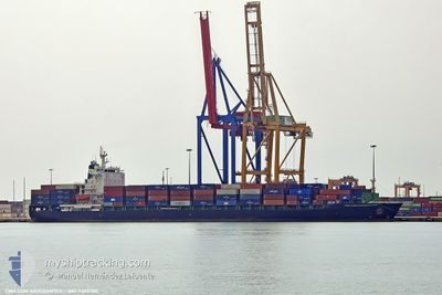
CMA CGM NAVEGANTES
Container Ship
Current Trip
| Time Travelled | 7 days |
|---|---|
| Remaining Time | 4 days |
| Distance Travelled | 2668.11 nm |
| Remaining Distance | 1585.87 nm |
| AVG Speed | 14.3 Knop |
| MAX Speed | 20.1 Knop |
| AVG Wind | 10.9 knots |
| MAX Wind | 27 knots |
| MIN Temp | 16.3°C / 61.34°F |
| MAX Temp | 21.9°C / 71.42°F |
| Djupgående | 10.8 m |
| Position mottagen | 10 h, 42 m sen |
Current Position
| Longitud | -48.53842° |
|---|---|
| Latitude | 34.35324° |
| Status | Under way using engine |
| Fart | 15.6 Knop |
| Kurs | 256.1° |
| Område | North Atlantic Ocean |
| Station | T-AIS |
| Position mottagen | 10 h, 42 m sen |
Info
Information
The current position of CMA CGM NAVEGANTES is in North Atlantic Ocean with coordinates 34.35324° / -48.53842° as reported on 2024-06-01 03:52 by AIS to our vessel tracker app. The vessel's current speed is 15.6 Knop and is heading at the port of MIAMI. The estimated time of arrival as calculated by MyShipTracking vessel tracking app is 2024-06-06 03:18 LT
The vessel CMA CGM NAVEGANTES (IMO: 9303780, MMSI: 256144000) is a Container Ship that was built in 2006 ( 18 År gammal ). It's sailing under the flag of [MT] Malta.
In this page you can find informations about the vessels current position, last detected port calls, and current voyage information. If the vessels is not in coverage by AIS you will find the latest position.
The current position of CMA CGM NAVEGANTES is detected by our AIS receivers and we are not responsible for the reliability of the data. The last position was recorded while the vessel was in Coverage by the Ais receivers of our vessel tracking app.
The current draught of CMA CGM NAVEGANTES as reported by AIS is 10.8 meters
Weather
| Temperature | 21.9°C / 71.42°F |
|---|---|
| Wind Speed | 19 knots |
| Direction | 163° SSE |
| Pressure | 1017.5 hPa |
| Humidity | 91.7 % |
| Cloud Coverage | 100 % |
Featured Company
Last Port Calls
| Port | Arrival | Departure | Time In Port |
|---|---|---|---|
| 2024-05-24 01:08 | 2024-05-25 00:35 | 23 h | |
| 2024-05-21 17:19 | 2024-05-22 10:53 | 17 h | |
| 2024-05-18 17:41 | 2024-05-20 02:17 | 1 d | |
| 2024-05-17 18:04 | 2024-05-18 10:41 | 16 h | |
| 2024-04-28 23:30 | 2024-04-30 02:06 | 1 d | |
| 2024-04-26 07:06 | 2024-04-27 09:11 | 1 d | |
| 2024-04-24 08:04 | 2024-04-25 12:53 | 1 d | |
| 2024-04-20 14:05 | 2024-04-21 07:09 | 17 h | |
| 2024-04-07 13:09 | 2024-04-08 17:16 | 1 d | |
| 2024-04-04 21:29 | 2024-04-05 05:04 | 7 h |
Last Trips
| Origin | Departure | Destination | Arrival | Distance | |
|---|---|---|---|---|---|
| 2024-05-22 10:53 | 2024-05-24 01:08 | 171.49 nm | |||
| 2024-05-20 02:17 | 2024-05-21 17:19 | 377.01 nm | |||
| 2024-05-18 10:41 | 2024-05-18 17:41 | 74.59 nm | |||
| 2024-04-30 02:06 | 2024-05-17 18:04 | 5929.71 nm | |||
| 2024-04-27 09:11 | 2024-04-28 23:30 | 516.66 nm | |||
| 2024-04-25 12:53 | 2024-04-26 07:06 | 239.87 nm | |||
| 2024-04-21 07:09 | 2024-04-24 08:04 | 1084.59 nm | |||
| 2024-04-08 17:16 | 2024-04-20 14:05 | 4371.04 nm | |||
| 2024-04-05 05:04 | 2024-04-07 13:09 | 173.44 nm | |||
| 2024-04-02 22:06 | 2024-04-04 21:29 | 397.09 nm |
Events
| Tid | Event | Detaljer | Position / Dest | Information |
|---|---|---|---|---|
| 2024-06-01 04:04 | Status ändrad | Default Under way using engine |
34.34241 / -48.59587
ESVLC>USMIA
|
Fart: 15.6 kn Kurs: 256.1° |
| 2024-06-01 03:52 | UTANFÖR täckningsområde |
34.35324 / -48.53842
North Atlantic Ocean
ESVLC>USMIA
|
Fart: 15.6 kn Kurs: 256.1° |
|
| 2024-06-01 03:50 | Status ändrad | Under way using engine Default |
34.35552 / -48.52708
ESVLC>USMIA
|
Fart: 15.8 kn Kurs: 257° |
| 2024-06-01 03:22 | Status ändrad | Default Under way using engine |
34.38228 / -48.38280
ESVLC>USMIA
|
Fart: 15.9 kn Kurs: 259° |
| 2024-06-01 03:16 | Status ändrad | Under way using engine Default |
34.38740 / -48.35196
ESVLC>USMIA
|
Fart: 16 kn Kurs: 259° |
| 2024-06-01 03:12 | I täckningsområde |
34.38740 / -48.35196
North Atlantic Ocean
ESVLC>USMIA
|
Fart: 15.9 kn Kurs: 259° |
|
| 2024-05-30 15:17 | Status ändrad | Default Under way using engine |
35.67397 / -37.49812
ESVLC>USMIA
|
Fart: 14.9 kn Kurs: 263.4° |
| 2024-05-30 15:01 | Status ändrad | Under way using engine Default |
35.68251 / -37.41709
ESVLC>USMIA
|
Fart: 14.9 kn Kurs: 263° |
| 2024-05-30 15:01 | UTANFÖR täckningsområde |
35.68251 / -37.41709
North Atlantic Ocean
ESVLC>USMIA
|
Fart: 14.9 kn Kurs: 263.4° |
|
| 2024-05-30 14:56 | Status ändrad | Default Under way using engine |
35.68543 / -37.39024
ESVLC>USMIA
|
Fart: 15.1 kn Kurs: 262.1° |