
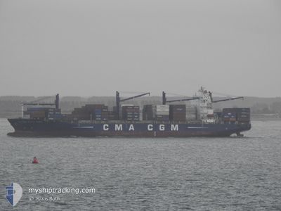
CMA CGM AFRICA THREE
Container Ship
Current Trip
| Trip Time | 1 day |
|---|---|
| Trip Distance | 516.72 nm |
| AVG Speed | 12.7 Knop |
| MAX Speed | 15.6 Knop |
| Djupgående | 10.7 m |
| AVG Wind | 12.8 knots |
| MAX Wind | 19.9 knots |
| MIN Temp | 19.8°C / 67.64°F |
| MAX Temp | 27.9°C / 82.22°F |
| Position mottagen | 14 d sen |
Current Position
| Longitud | 54.78914° |
|---|---|
| Latitude | -21.07206° |
| Status | Under way using engine |
| Fart | 10.7 Knop |
| Kurs | 238.6° |
| Område | Indian Ocean |
| Station | T-AIS |
| Position mottagen | 14 d sen |
Info
Information
The current position of CMA CGM AFRICA THREE is in Indian Ocean with coordinates -21.07206° / 54.78914° as reported on 2024-04-15 19:17 by AIS to our vessel tracker app. The vessel's current speed is 10.7 Knop and is currently inside the port of BEIRA.
The vessel CMA CGM AFRICA THREE (IMO: 9451939, MMSI: 311044200) is a Container Ship that was built in 2010 ( 14 År gammal ). It's sailing under the flag of [BS] Bahamas.
In this page you can find informations about the vessels current position, last detected port calls, and current voyage information. If the vessels is not in coverage by AIS you will find the latest position.
The current position of CMA CGM AFRICA THREE is detected by our AIS receivers and we are not responsible for the reliability of the data. The last position was recorded while the vessel was in Coverage by the Ais receivers of our vessel tracking app.
The current draught of CMA CGM AFRICA THREE as reported by AIS is 10.7 meters
Weather
| Temperature | 21.9°C / 71.42°F |
|---|---|
| Wind Speed | 4 knots |
| Direction | 154° SSE |
| Pressure | 1017.8 hPa |
| Humidity | 86 % |
| Cloud Coverage | --- |
Featured Company
Last Port Calls
| Port | Arrival | Departure | Time In Port |
|---|---|---|---|
| 2024-04-27 05:30 | |||
| 2024-04-23 03:01 | 2024-04-25 11:15 | 2 d | |
| 2024-04-14 01:26 | 2024-04-15 16:16 | 1 d | |
| 2024-04-03 18:09 | 2024-04-04 19:24 | 1 d | |
| 2024-04-01 11:57 | 2024-04-02 22:29 | 1 d | |
| 2024-03-14 04:46 | |||
| 2024-03-11 01:43 | 2024-03-11 16:02 | 14 h | |
| 2024-02-29 17:25 | 2024-03-02 16:11 | 1 d | |
| 2024-02-25 13:57 | 2024-02-28 03:13 | 2 d | |
| 2024-02-19 05:39 | 2024-02-20 16:02 | 1 d |
Most Visited Ports (Last year)
| Port | Arrivals | |
|---|---|---|
| 9 | ||
| 8 | ||
| 7 | ||
| 7 | ||
| 7 | ||
| 6 |
Last Trips
| Origin | Departure | Destination | Arrival | Distance | |
|---|---|---|---|---|---|
| 2024-04-25 13:15 | 2024-04-27 07:30 | 516.72 nm | |||
| 2024-04-15 20:16 | 2024-04-23 05:01 | 1366.72 nm | |||
| 2024-04-05 03:24 | 2024-04-14 05:26 | 3465.26 nm | |||
| 2024-04-03 06:29 | 2024-04-04 02:09 | 34.51 nm | |||
| 2024-03-11 20:02 | 2024-03-14 08:46 | 222.66 nm | |||
| 2024-03-02 18:11 | 2024-03-11 05:43 | 1263.95 nm | |||
| 2024-02-28 05:13 | 2024-02-29 19:25 | 523.21 nm | |||
| 2024-02-20 20:02 | 2024-02-25 15:57 | 1347.19 nm | |||
| 2024-02-10 18:09 | 2024-02-19 09:39 | 3463.81 nm | |||
| 2024-02-08 07:53 | 2024-02-09 14:10 | 52.74 nm |
Events
| Tid | Event | Detaljer | Position / Dest | Information |
|---|---|---|---|---|
| 2024-04-27 05:30 | STOPPAR förflyttning |
-19.81833 / 34.83333
[MZ] BEIRA
|
Fart: Kurs: -1° |
|
| 2024-04-27 05:30 | ANLÄNDER HAMN |
|
-19.81833 / 34.83333
[MZ] BEIRA
|
Fart: 1.4 kn Kurs: 16° |
| 2024-04-25 11:15 | STARTAR förflyttning | 1.1 nm, North West of MAPUTO |
-25.96752 / 32.54900
MZMPM
|
Fart: 4.2 kn Kurs: 127° |
| 2024-04-25 11:15 | AVGÅTT HAMN |
|
-25.96752 / 32.54900
MZMPM
|
Fart: 1.4 kn Kurs: 310° |
| 2024-04-23 03:29 | STOPPAR förflyttning |
-25.96232 / 32.54657
[MZ] MAPUTO
|
Fart: Kurs: 306° |
|
| 2024-04-23 03:01 | ANLÄNDER HAMN |
|
-25.96232 / 32.54657
[MZ] MAPUTO
|
Fart: 6.2 kn Kurs: 319° |
| 2024-04-23 01:07 | STARTAR förflyttning | 10.87 nm, East of MAPUTO |
-25.92971 / 32.76079
MZMPM
|
Fart: 4.5 kn Kurs: 268° |
| 2024-04-23 00:40 | STOPPAR förflyttning | 10.78 nm, East of MAPUTO |
-25.93848 / 32.76153
MZMPM
|
Fart: 0.2 kn Kurs: 79° |
| 2024-04-22 23:24 | STARTAR förflyttning | 13.99 nm, East of MAPUTO |
-25.96186 / 32.82476
MZMPM
|
Fart: 3.8 kn Kurs: 297° |
| 2024-04-20 17:11 | STOPPAR förflyttning | 14.15 nm, East of MAPUTO |
-25.95889 / 32.82754
MZMPM
|
Fart: 0.3 kn Kurs: 208° |