
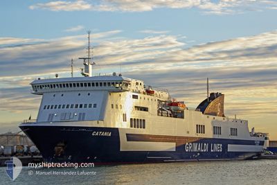
CATANIA
Ro-Ro/Passenger Ship
Current Trip
| Time Travelled | 6 h, 14 mins |
|---|---|
| Remaining Time | 4 h, 7 mins |
| Distance Travelled | 110.14 nm |
| Remaining Distance | 83.44 nm |
| AVG Speed | 18.4 Knop |
| MAX Speed | 19.4 Knop |
| AVG Wind | 6.2 knots |
| MAX Wind | 9 knots |
| MIN Temp | 21.7°C / 71.06°F |
| MAX Temp | 28.1°C / 82.58°F |
| Djupgående | 6.4 m |
| Position mottagen | 16 m sen |
Current Position
| Longitud | 11.46095° |
|---|---|
| Latitude | 37.73072° |
| Status | Under way using engine |
| Fart | 18 Knop |
| Kurs | 229° |
| Område | Mediterranean Sea - Western Basin |
| Station | T-AIS |
| Position mottagen | 16 m sen |
Info
Information
The current position of CATANIA is in Mediterranean Sea - Western Basin with coordinates 37.73072° / 11.46095° as reported on 2024-06-01 16:01 by AIS to our vessel tracker app. The vessel's current speed is 18 Knop and is heading at the port of RADES. The estimated time of arrival as calculated by MyShipTracking vessel tracking app is 2024-06-01 21:24 LT
The vessel CATANIA (IMO: 9261554, MMSI: 247098200) is a Ro-Ro/Passenger Ship that was built in 2003 ( 21 År gammal ). It's sailing under the flag of [IT] Italy.
In this page you can find informations about the vessels current position, last detected port calls, and current voyage information. If the vessels is not in coverage by AIS you will find the latest position.
The current position of CATANIA is detected by our AIS receivers and we are not responsible for the reliability of the data. The last position was recorded while the vessel was in Coverage by the Ais receivers of our vessel tracking app.
The current draught of CATANIA as reported by AIS is 6.4 meters
Weather
| Temperature | 21.9°C / 71.42°F |
|---|---|
| Wind Speed | 3 knots |
| Direction | 297° WNW |
| Pressure | 1014.7 hPa |
| Humidity | 76.2 % |
| Cloud Coverage | 95 % |
Featured Company
Last Port Calls
| Port | Arrival | Departure | Time In Port |
|---|---|---|---|
| 2024-06-01 07:09 | 2024-06-01 12:03 | 4 h | |
| 2024-05-31 15:55 | 2024-05-31 21:54 | 5 h | |
| 2024-05-30 15:09 | 2024-05-30 21:40 | 6 h | |
| 2024-05-29 15:06 | 2024-05-29 22:26 | 7 h | |
| 2024-05-28 13:30 | 2024-05-28 20:32 | 7 h | |
| 2024-05-27 23:34 | 2024-05-28 03:42 | 4 h | |
| 2024-05-27 07:07 | 2024-05-27 14:39 | 7 h | |
| 2024-05-26 18:21 | 2024-05-26 22:03 | 3 h | |
| 2024-05-25 21:19 | 2024-05-26 06:51 | 9 h | |
| 2024-05-25 06:07 | 2024-05-25 11:29 | 5 h |
Most Visited Ports (Last year)
| Port | Arrivals | |
|---|---|---|
| 178 | ||
| 126 | ||
| 68 | ||
| 42 |
Last Trips
| Origin | Departure | Destination | Arrival | Distance | |
|---|---|---|---|---|---|
| 2024-05-31 21:54 | 2024-06-01 07:09 | 165.18 nm | |||
| 2024-05-30 21:40 | 2024-05-31 15:55 | 311.76 nm | |||
| 2024-05-29 22:26 | 2024-05-30 15:09 | 328.24 nm | |||
| 2024-05-28 20:32 | 2024-05-29 15:06 | 327.70 nm | |||
| 2024-05-28 03:42 | 2024-05-28 13:30 | 190.03 nm | |||
| 2024-05-27 14:39 | 2024-05-27 23:34 | 165.46 nm | |||
| 2024-05-26 22:03 | 2024-05-27 07:07 | 166.00 nm | |||
| 2024-05-26 06:51 | 2024-05-26 18:21 | 181.07 nm | |||
| 2024-05-25 11:29 | 2024-05-25 21:19 | 191.28 nm | |||
| 2024-05-24 20:57 | 2024-05-25 06:07 | 164.48 nm |
Events
| Tid | Event | Detaljer | Position / Dest | Information |
|---|---|---|---|---|
| 2024-06-01 16:04 | Status ändrad | Default Under way using engine |
37.71912 / 11.44345
ITPMO>TNLGT
|
Fart: 18 kn Kurs: 229° |
| 2024-06-01 14:50 | Byter havsområde | Italian part of the Mediterranean Sea - Western Basin Italian part of the Tyrrhenian Sea |
37.97075 / 11.79941
Mediterranean Sea - Western Basin
ITPMO>TNLGT
|
Fart: 18 kn Kurs: 226° |
| 2024-06-01 12:14 | Status ändrad | Under way using engine Default |
38.24146 / 12.73685
ITPMO>TNLGT
|
Fart: 19 kn Kurs: 264° |
| 2024-06-01 11:53 | Status ändrad | Default Under way using engine |
38.25252 / 12.87982
ITPMO>TNLGT
|
Fart: 19.4 kn Kurs: 264° |
| 2024-06-01 10:03 | AVGÅTT HAMN |
|
38.11875 / 13.38452
ITPMO>TNLGT
|
Fart: 5.4 kn Kurs: 72° |
| 2024-06-01 09:52 | STARTAR förflyttning |
38.13300 / 13.36595
[IT] PALERMO
|
Fart: 3.1 kn Kurs: 127° |
|
| 2024-06-01 09:47 | Status ändrad | Under way using engine Moored |
38.13459 / 13.36462
[IT] PALERMO
|
Fart: Kurs: 67° |
| 2024-06-01 09:47 | Destination ändrad | ITPMO>TNLGT ITSAL>ITPMO |
38.13459 / 13.36460
[IT] PALERMO
|
Fart: Kurs: 67° |
| 2024-06-01 09:47 | ETA ändrat | 2024/06/01 20:30 2024/06/01 05:00 |
38.13459 / 13.36460
[IT] PALERMO
|
Fart: Kurs: 67° |
| 2024-06-01 06:41 | Status ändrad | Moored Default |
38.13455 / 13.36458
[IT] PALERMO
|
Fart: Kurs: 67° |