
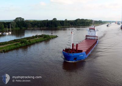
CARLOW
General Cargo
Current Trip
| Time Travelled | 5 days |
|---|---|
| Remaining Time | 4 days |
| Distance Travelled | 1288.14 nm |
| Remaining Distance | 1761.59 nm |
| AVG Speed | 9.7 Knop |
| MAX Speed | 12.8 Knop |
| AVG Wind | 15.6 knots |
| MAX Wind | 29 knots |
| MIN Temp | 15.8°C / 60.44°F |
| MAX Temp | 21.7°C / 71.06°F |
| Djupgående | 6.1 m |
| Position mottagen | Nu |
Current Position
| Longitud | 11.95866° |
|---|---|
| Latitude | 37.60998° |
| Status | Under way using engine |
| Fart | 10.8 Knop |
| Kurs | 93.7° |
| Område | Mediterranean Sea - Western Basin |
| Station | T-AIS |
| Position mottagen | Nu |
Info
Information
The current position of CARLOW is in Mediterranean Sea - Western Basin with coordinates 37.60998° / 11.95866° as reported on 2024-06-03 02:28 by AIS to our vessel tracker app. The vessel's current speed is 10.8 Knop and is heading at the port of HAIFA. The estimated time of arrival as calculated by MyShipTracking vessel tracking app is 2024-06-07 13:36 LT
The vessel CARLOW (IMO: 9127162, MMSI: 371949000) is a General Cargo that was built in 1995 ( 29 År gammal ). It's sailing under the flag of [PA] Panama.
In this page you can find informations about the vessels current position, last detected port calls, and current voyage information. If the vessels is not in coverage by AIS you will find the latest position.
The current position of CARLOW is detected by our AIS receivers and we are not responsible for the reliability of the data. The last position was recorded while the vessel was in Coverage by the Ais receivers of our vessel tracking app.
The current draught of CARLOW as reported by AIS is 6.1 meters
Weather
| Temperature | 20.3°C / 68.54°F |
|---|---|
| Wind Speed | 12 knots |
| Direction | 315° NW |
| Pressure | 1014.7 hPa |
| Humidity | 76.4 % |
| Cloud Coverage | 87 % |
Featured Company
Last Port Calls
| Port | Arrival | Departure | Time In Port |
|---|---|---|---|
| 2024-05-25 07:59 | 2024-05-28 14:10 | 3 d | |
| 2024-05-19 06:06 | 2024-05-22 20:08 | 3 d | |
| 2024-05-06 07:53 | 2024-05-10 10:49 | 4 d | |
| 2024-04-29 15:16 | 2024-05-02 13:32 | 2 d | |
| 2024-04-25 04:44 | 2024-04-26 14:52 | 1 d | |
| 2024-04-13 08:35 | 2024-04-18 04:25 | 4 d | |
| 2024-04-08 05:45 | 2024-04-10 12:17 | 2 d | |
| 2024-04-02 13:05 | 2024-04-06 14:11 | 4 d |
Last Trips
| Origin | Departure | Destination | Arrival | Distance | |
|---|---|---|---|---|---|
| 2024-05-22 21:08 | 2024-05-25 08:59 | 437.42 nm | |||
| 2024-05-10 12:49 | 2024-05-19 07:06 | 1652.67 nm | |||
| 2024-05-02 16:32 | 2024-05-06 09:53 | 352.13 nm | |||
| 2024-04-26 16:52 | 2024-04-29 18:16 | 736.61 nm | |||
| 2024-04-18 07:25 | 2024-04-25 06:44 | 633.69 nm | |||
| 2024-04-10 14:17 | 2024-04-13 11:35 | 744.53 nm | |||
| 2024-04-06 16:11 | 2024-04-08 07:45 | 121.75 nm | |||
| 2024-03-27 17:55 | 2024-04-02 15:05 | 503.97 nm |
Events
| Tid | Event | Detaljer | Position / Dest | Information |
|---|---|---|---|---|
| 2024-06-03 02:23 | Upptäckt i hav | Italian part of the Mediterranean Sea - Western Basin |
37.61092 / 11.93965
Mediterranean Sea - Western Basin
IL HFA
|
Fart: 10.8 kn Kurs: 94.3° |
| 2024-06-03 02:20 | Status ändrad | Under way using engine Default |
37.61148 / 11.92957
IL HFA
|
Fart: 10.6 kn Kurs: 94° |
| 2024-06-03 02:20 | I täckningsområde |
37.61092 / 11.93965
Mediterranean Sea - Western Basin
IL HFA
|
Fart: 10.8 kn Kurs: 94.3° |
|
| 2024-05-31 11:13 | Status ändrad | Default Under way using engine |
36.72333 / .26167
IL HFA
|
Fart: 9.1 kn Kurs: 78.6° |
| 2024-05-31 11:13 | I täckningsområde |
36.72310 / .25579
Mediterranean Sea - Western Basin
IL HFA
|
Fart: 9.1 kn Kurs: 78.6° |
|
| 2024-05-31 11:12 | Status ändrad | Under way using engine Default |
36.72310 / .25579
IL HFA
|
Fart: 9 kn Kurs: 78° |
| 2024-05-31 11:12 | UTANFÖR täckningsområde |
36.72310 / .25579
Mediterranean Sea - Western Basin
IL HFA
|
Fart: 9.1 kn Kurs: 78.6° |
|
| 2024-05-31 08:18 | Status ändrad | Default Under way using engine |
36.63982 / -.28434
IL HFA
|
Fart: 9.5 kn Kurs: 78.9° |
| 2024-05-31 08:16 | UTANFÖR täckningsområde |
36.63901 / -.28929
Mediterranean Sea - Western Basin
IL HFA
|
Fart: 9.5 kn Kurs: 78.9° |
|
| 2024-05-31 07:13 | Status ändrad | Under way using engine Default |
36.61033 / -.50278
IL HFA
|
Fart: 10.2 kn Kurs: 80° |