
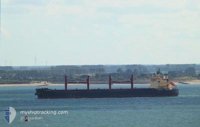
BULK SACHUEST
Bulk Carrier
Current Trip
| Time Travelled | 5 days |
|---|---|
| Remaining Time | --- |
| Distance Travelled | 1611.75 nm |
| Remaining Distance | 9.34 nm |
| AVG Speed | 12.1 Knop |
| MAX Speed | 15 Knop |
| AVG Wind | 13.4 knots |
| MAX Wind | 21 knots |
| MIN Temp | 27.2°C / 80.96°F |
| MAX Temp | 29.5°C / 85.1°F |
| Djupgående | 6.9 m |
| Position mottagen | 5 d sen |
Current Position
| Longitud | -75.10486° |
|---|---|
| Latitude | 11.33185° |
| Status | Under way using engine |
| Fart | 13 Knop |
| Kurs | 320.3° |
| Område | Caribbean Sea |
| Station | T-AIS |
| Position mottagen | 5 d sen |
Info
Information
The current position of BULK SACHUEST is in Caribbean Sea with coordinates 11.33185° / -75.10486° as reported on 2024-05-26 23:40 by AIS to our vessel tracker app. The vessel's current speed is 13 Knop and is heading at the port of CORPUS CHRISTI. The estimated time of arrival as calculated by MyShipTracking vessel tracking app is 2024-06-01 22:00 LT
The vessel BULK SACHUEST (IMO: 9483231, MMSI: 636022222) is a Bulk Carrier that was built in 2010 ( 14 År gammal ). It's sailing under the flag of [LR] Liberia.
In this page you can find informations about the vessels current position, last detected port calls, and current voyage information. If the vessels is not in coverage by AIS you will find the latest position.
The current position of BULK SACHUEST is detected by our AIS receivers and we are not responsible for the reliability of the data. The last position was recorded while the vessel was in Coverage by the Ais receivers of our vessel tracking app.
The current draught of BULK SACHUEST as reported by AIS is 6.9 meters
Weather
| Temperature | 27.9°C / 82.22°F |
|---|---|
| Wind Speed | 11 knots |
| Direction | 111° ESE |
| Pressure | 1011.2 hPa |
| Humidity | 89.2 % |
| Cloud Coverage | 4 % |
Featured Company
Most Visited Ports (Last year)
| Port | Arrivals | |
|---|---|---|
| 2 | ||
| 1 | ||
| 1 | ||
| 1 | ||
| 1 | ||
| 1 |
Last Trips
| Origin | Departure | Destination | Arrival | Distance | |
|---|---|---|---|---|---|
| 2024-05-16 20:50 | 2024-05-18 17:11 | 334.77 nm | |||
| 2024-04-22 23:54 | 2024-05-12 16:21 | 4628.84 nm | |||
| 2024-04-19 23:45 | 2024-04-20 13:19 | 128.03 nm | |||
| 2024-04-09 18:05 | 2024-04-13 08:15 | 584.07 nm | |||
| 2024-03-24 17:08 | 2024-04-06 10:13 | 3092.12 nm |
Events
| Tid | Event | Detaljer | Position / Dest | Information |
|---|---|---|---|---|
| 2024-06-01 05:48 | STOPPAR förflyttning | 9.31 nm, East of PORT ARANSAS |
27.82361 / -96.89324
US CRP
|
Fart: Kurs: 109° |
| 2024-05-29 12:06 | STARTAR förflyttning |
20.47095 / -84.52914
US CRP
|
Fart: 3.4 kn Kurs: 311° |
|
| 2024-05-29 09:46 | STOPPAR förflyttning |
20.43833 / -84.50833
US CRP
|
Fart: Kurs: -1° |
|
| 2024-05-26 23:49 | Status ändrad | Default Under way using engine |
11.35667 / -75.12500
US CRP
|
Fart: 13 kn Kurs: 320.3° |
| 2024-05-26 23:40 | UTANFÖR täckningsområde |
11.33185 / -75.10486
Caribbean Sea
US CRP
|
Fart: 13 kn Kurs: 320.3° |
|
| 2024-05-26 23:30 | Status ändrad | Under way using engine Default |
11.30580 / -75.08195
US CRP
|
Fart: 13 kn Kurs: 316° |
| 2024-05-26 23:25 | Status ändrad | Default Under way using engine |
11.29000 / -75.06667
US CRP
|
Fart: 13.2 kn Kurs: 313.7° |
| 2024-05-26 23:18 | Status ändrad | Under way using engine Default |
11.27314 / -75.04913
US CRP
|
Fart: 13 kn Kurs: 309° |
| 2024-05-26 22:58 | Status ändrad | Default Under way using engine |
11.22325 / -74.99663
US CRP
|
Fart: 13 kn Kurs: 312.4° |
| 2024-05-26 21:30 | AVGÅTT HAMN |
|
11.04076 / -74.81659
US CRP
|
Fart: 10.6 kn Kurs: 302° |