
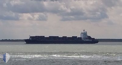
AS CAROLINA
Container Ship
Current Trip
| Time Travelled | 18 h, 55 mins |
|---|---|
| Remaining Time | 1 day |
| Distance Travelled | 220.88 nm |
| Remaining Distance | 557.96 nm |
| AVG Speed | 13.3 Knop |
| MAX Speed | 14.5 Knop |
| AVG Wind | 8.7 knots |
| MAX Wind | 16 knots |
| MIN Temp | 13.5°C / 56.3°F |
| MAX Temp | 15.6°C / 60.08°F |
| Djupgående | 9.6 m |
| Position mottagen | 12 h, 53 m sen |
Current Position
| Longitud | -54.74586° |
|---|---|
| Latitude | -35.07281° |
| Status | Under way using engine |
| Fart | 12.9 Knop |
| Kurs | 88° |
| Område | South Atlantic Ocean |
| Station | T-AIS |
| Position mottagen | 12 h, 53 m sen |
Info
Information
The current position of AS CAROLINA is in South Atlantic Ocean with coordinates -35.07281° / -54.74586° as reported on 2024-06-02 05:21 by AIS to our vessel tracker app. The vessel's current speed is 12.9 Knop and is heading at the port of ITAPOA. The estimated time of arrival as calculated by MyShipTracking vessel tracking app is 2024-06-04 07:25 LT
The vessel AS CAROLINA (IMO: 9314935, MMSI: 255806137) is a Container Ship that was built in 2006 ( 18 År gammal ). It's sailing under the flag of [PT] Portugal.
In this page you can find informations about the vessels current position, last detected port calls, and current voyage information. If the vessels is not in coverage by AIS you will find the latest position.
The current position of AS CAROLINA is detected by our AIS receivers and we are not responsible for the reliability of the data. The last position was recorded while the vessel was in Coverage by the Ais receivers of our vessel tracking app.
The current draught of AS CAROLINA as reported by AIS is 9.6 meters
Weather
| Temperature | 16.7°C / 62.06°F |
|---|---|
| Wind Speed | 17 knots |
| Direction | 326° NW |
| Pressure | 1012.2 hPa |
| Humidity | 86.4 % |
| Cloud Coverage | 84 % |
Featured Company
Last Port Calls
| Port | Arrival | Departure | Time In Port |
|---|---|---|---|
| 2024-06-01 16:19 | 2024-06-01 23:19 | 7 h | |
| 2024-05-31 10:19 | 2024-06-01 03:48 | 17 h | |
| 2024-05-28 09:39 | 2024-05-28 20:39 | 11 h | |
| 2024-05-24 18:17 | 2024-05-25 19:37 | 1 d | |
| 2024-05-13 20:45 | 2024-05-14 04:09 | 7 h | |
| 2024-05-10 23:50 | 2024-05-11 18:22 | 18 h | |
| 2024-05-06 07:58 | 2024-05-07 03:57 | 19 h | |
| 2024-05-03 16:43 | 2024-05-04 03:41 | 10 h | |
| 2024-05-01 14:11 | 2024-05-02 02:41 | 12 h | |
| 2024-04-27 18:41 | 2024-04-28 08:42 | 14 h |
Most Visited Ports (Last year)
| Port | Arrivals | |
|---|---|---|
| 5 | ||
| 4 | ||
| 3 | ||
| 3 | ||
| 3 | ||
| 3 |
Last Trips
| Origin | Departure | Destination | Arrival | Distance | |
|---|---|---|---|---|---|
| 2024-06-01 00:48 | 2024-06-01 13:19 | 145.37 nm | |||
| 2024-05-28 17:39 | 2024-05-31 07:19 | 1003.10 nm | |||
| 2024-05-25 16:37 | 2024-05-28 06:39 | 473.33 nm | |||
| 2024-05-13 23:09 | 2024-05-24 15:17 | 3777.77 nm | |||
| 2024-05-11 13:22 | 2024-05-13 15:45 | 522.60 nm | |||
| 2024-05-06 22:57 | 2024-05-10 18:50 | 1288.52 nm | |||
| 2024-05-03 22:41 | 2024-05-06 02:58 | 503.32 nm | |||
| 2024-05-01 21:41 | 2024-05-03 11:43 | 243.67 nm | |||
| 2024-04-28 03:42 | 2024-05-01 09:11 | 1216.57 nm | |||
| 2024-04-26 13:22 | 2024-04-27 13:41 | 477.80 nm |
Events
| Tid | Event | Detaljer | Position / Dest | Information |
|---|---|---|---|---|
| 2024-06-02 05:24 | Status ändrad | Default Under way using engine |
-35.07221 / -54.73286
ITAPOA
|
Fart: 12.9 kn Kurs: 88° |
| 2024-06-02 05:21 | UTANFÖR täckningsområde |
-35.07281 / -54.74586
South Atlantic Ocean
ITAPOA
|
Fart: 12.9 kn Kurs: 88° |
|
| 2024-06-02 04:02 | Byter havsområde | Uruguayan part of the South Atlantic Ocean Uruguayan part of the Rio de La Plata |
-35.06287 / -55.09566
South Atlantic Ocean
ITAPOA
|
Fart: 13.6 kn Kurs: 97.6° |
| 2024-06-02 03:34 | Status ändrad | Under way using engine Default |
-35.05855 / -55.22711
ITAPOA
|
Fart: 13.8 kn Kurs: 91° |
| 2024-06-02 03:22 | Status ändrad | Default Under way using engine |
-35.05847 / -55.28125
ITAPOA
|
Fart: 13.8 kn Kurs: 90° |
| 2024-06-02 02:54 | Djupgående ändrat | 9.6 8.6 |
-35.06119 / -55.41130
ITAPOA
|
Fart: 13.9 kn Kurs: 87.1° |
| 2024-06-02 02:54 | Destination ändrad | ITAPOA UYMVD |
-35.06119 / -55.41130
ITAPOA
|
Fart: 13.9 kn Kurs: 87.1° |
| 2024-06-02 02:54 | ETA ändrat | 2024/06/04 02:00 2024/06/01 11:00 |
-35.06119 / -55.41130
ITAPOA
|
Fart: 13.9 kn Kurs: 87.1° |
| 2024-06-02 02:48 | Byter havsområde | Uruguayan part of the Rio de La Plata Argentinean part of the Rio de La Plata |
-35.06226 / -55.44099
Rio de La Plata
|
Fart: 13.9 kn Kurs: 87° |
| 2024-06-02 02:48 | Status ändrad | Under way using engine Default |
-35.06226 / -55.44099
UYMVD
|
Fart: 14 kn Kurs: 88° |