
AMIF
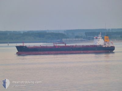
Oil/Chemical Tanker
Current Trip
| Time Travelled | 9 days |
|---|---|
| Remaining Time | --- |
| Distance Travelled | 1255.63 nm |
| Remaining Distance | --- |
| AVG Speed | 10.4 Knop |
| MAX Speed | 12.9 Knop |
| AVG Wind | 11.9 knots |
| MAX Wind | 17.9 knots |
| MIN Temp | 24.4°C / 75.92°F |
| MAX Temp | 28.9°C / 84.02°F |
| Djupgående | 10.4 m |
| Position mottagen | 2024-04-29 02:04 |
Current Position
| Longitud | -16.77448° |
|---|---|
| Latitude | 9.73385° |
| Status | Under way using engine |
| Fart | 11.4 Knop |
| Kurs | 134.6° |
| Område | North Atlantic Ocean |
| Station | T-AIS |
| Position mottagen | 2024-04-29 02:04 |
Info
Information
The current position of AMIF is in North Atlantic Ocean with coordinates 9.73385° / -16.77448° as reported on 2024-04-29 02:04 by AIS to our vessel tracker app. The vessel's current speed is 11.4 Knop
The vessel AMIF (IMO: 9396373, MMSI: 636019644) is a Oil/Chemical Tanker that was built in 2008 ( 16 År gammal ). It's sailing under the flag of [LR] Liberia.
In this page you can find informations about the vessels current position, last detected port calls, and current voyage information. If the vessels is not in coverage by AIS you will find the latest position.
The current position of AMIF is detected by our AIS receivers and we are not responsible for the reliability of the data. The last position was recorded while the vessel was in Coverage by the Ais receivers of our vessel tracking app.
The current draught of AMIF as reported by AIS is 10.4 meters
Weather
| Temperature | 28.2°C / 82.76°F |
|---|---|
| Wind Speed | 12 knots |
| Direction | 220° SW |
| Pressure | 1012.7 hPa |
| Humidity | 80.7 % |
| Cloud Coverage | 82 % |
Featured Company
Last Trips
Events
| Tid | Event | Detaljer | Position / Dest | Information |
|---|---|---|---|---|
| 2024-05-27 17:56 | STOPPAR förflyttning | 2.94 nm, South of LOME |
6.09003 / 1.30015
TG LFW
|
Fart: 0.2 kn Kurs: 216° |
| 2024-05-23 08:13 | AVGÅTT HAMN |
|
9.48175 / -13.72586
TG LFW
|
Fart: 4.8 kn Kurs: 206° |
| 2024-05-23 08:11 | STARTAR förflyttning |
9.51118 / -13.72398
[GN] CONAKRY
|
Fart: 4.8 kn Kurs: 206° |