
AIR
Yacht
Current Trip
BSFPO
| Time Travelled | 30 days |
|---|---|
| Remaining Time | --- |
| Distance Travelled | 4030.45 nm |
| Remaining Distance | --- |
| AVG Speed | 10.8 Knop |
| MAX Speed | 12.8 Knop |
| AVG Wind | 9.6 knots |
| MAX Wind | 26.4 knots |
| MIN Temp | 19.2°C / 66.56°F |
| MAX Temp | 29.6°C / 85.28°F |
| Djupgående | 3.5 m |
| Position mottagen | 5 h, 31 m sen |
Current Position
| Longitud | --- |
|---|---|
| Latitude | --- |
| Status | Moored |
| Fart | |
| Kurs | 92° |
| Område | North Atlantic Ocean |
| Station | T-AIS |
| Position mottagen | 5 h, 31 m sen |
Info
Information
The current position of AIR is in North Atlantic Ocean with coordinates 26.75048° / -80.05057° as reported on 2024-10-31 18:59 by AIS to our vessel tracker app. The vessel's current speed is 0 Knop
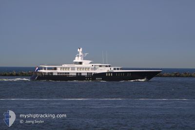
The vessel AIR (IMO: 1011472, MMSI: 248879000) is a Yacht that was built in 2011 ( 13 År gammal ). It's sailing under the flag of [MT] Malta.
In this page you can find informations about the vessels current position, last detected port calls, and current voyage information. If the vessels is not in coverage by AIS you will find the latest position.
The current position of AIR is detected by our AIS receivers and we are not responsible for the reliability of the data. The last position was recorded while the vessel was in Coverage by the Ais receivers of our vessel tracking app.
The current draught of AIR as reported by AIS is 3.5 meters
Weather
| Temperature | 26.2°C / 79.16°F |
|---|---|
| Wind Speed | 15 knots |
| Direction | 81° E |
| Pressure | 1019.4 hPa |
| Humidity | 58.7 % |
| Cloud Coverage | 100 % |
Featured Company
Events
| Tid | Event | Detaljer | Position / Dest | Information |
|---|---|---|---|---|
| 2024-10-31 18:59 | UTANFÖR täckningsområde |
26.75048 / -80.05057
North Atlantic Ocean
|
Fart: Kurs: 281.2° |
|
| 2024-10-31 13:23 | I täckningsområde |
26.75049 / -80.05057
North Atlantic Ocean
|
Fart: Kurs: 281.2° |
|
| 2024-10-27 19:23 | UTANFÖR täckningsområde |
26.75046 / -80.05058
North Atlantic Ocean
|
Fart: Kurs: 281.2° |
|
| 2024-10-27 17:14 | I täckningsområde |
26.75050 / -80.05057
North Atlantic Ocean
|
Fart: Kurs: 281.2° |
|
| 2024-10-23 14:46 | UTANFÖR täckningsområde |
26.75049 / -80.05057
North Atlantic Ocean
|
Fart: Kurs: 281.2° |
|
| 2024-10-23 14:16 | I täckningsområde |
26.75049 / -80.05058
North Atlantic Ocean
|
Fart: Kurs: 281.2° |
|
| 2024-10-23 12:16 | UTANFÖR täckningsområde |
26.75048 / -80.05058
North Atlantic Ocean
|
Fart: Kurs: 281.2° |
|
| 2024-10-23 12:16 | I täckningsområde |
26.75048 / -80.05058
North Atlantic Ocean
|
Fart: Kurs: 281.2° |
|
| 2024-10-23 10:40 | UTANFÖR täckningsområde |
26.75048 / -80.05057
North Atlantic Ocean
|
Fart: Kurs: 281.2° |
|
| 2024-10-23 10:40 | I täckningsområde |
26.75048 / -80.05057
North Atlantic Ocean
|
Fart: Kurs: 281.2° |