
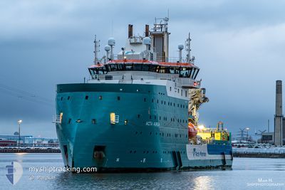
ACTA AURIGA
Other Type
Current Trip
MORAY EAST OWF
| Time Travelled | 6 days |
|---|---|
| Remaining Time | --- |
| Distance Travelled | 113.25 nm |
| Remaining Distance | --- |
| AVG Speed | 8.7 Knop |
| MAX Speed | 10.7 Knop |
| AVG Wind | 9.8 knots |
| MAX Wind | 16 knots |
| MIN Temp | 10.4°C / 50.72°F |
| MAX Temp | 13°C / 55.4°F |
| Djupgående | 5.6 m |
| Position mottagen | 1 h, 46 m sen |
Current Position
| Longitud | -2.63048° |
|---|---|
| Latitude | 58.16709° |
| Status | Restricted manoeuverability |
| Fart | 1 Knop |
| Kurs | 15° |
| Område | North Sea |
| Station | T-AIS |
| Position mottagen | 1 h, 46 m sen |
Info
Information
The current position of ACTA AURIGA is in North Sea with coordinates 58.16709° / -2.63048° as reported on 2024-06-02 14:45 by AIS to our vessel tracker app. The vessel's current speed is 1 Knop
The vessel ACTA AURIGA (IMO: 9822815, MMSI: 244090781) is a Other Type It's sailing under the flag of [NL] Netherlands.
In this page you can find informations about the vessels current position, last detected port calls, and current voyage information. If the vessels is not in coverage by AIS you will find the latest position.
The current position of ACTA AURIGA is detected by our AIS receivers and we are not responsible for the reliability of the data. The last position was recorded while the vessel was in Coverage by the Ais receivers of our vessel tracking app.
The current draught of ACTA AURIGA as reported by AIS is 5.6 meters
Weather
| Temperature | 12.8°C / 55.04°F |
|---|---|
| Wind Speed | 15 knots |
| Direction | 242° WSW |
| Pressure | 1021.8 hPa |
| Humidity | 85.8 % |
| Cloud Coverage | 100 % |
Featured Company
Last Port Calls
| Port | Arrival | Departure | Time In Port |
|---|---|---|---|
| 2024-05-25 23:14 | 2024-05-26 23:53 | 1 d | |
| 2024-05-02 07:45 | 2024-05-23 21:33 | 21 d | |
| 2024-04-28 21:56 | 2024-05-01 13:15 | 2 d | |
| 2024-04-24 01:17 | 2024-04-24 09:58 | 8 h | |
| 2024-04-16 21:36 | 2024-04-18 00:30 | 1 d | |
| 2024-04-09 05:59 | 2024-04-09 18:26 | 12 h | |
| 2024-04-03 09:15 | 2024-04-03 19:22 | 10 h |
Last Trips
| Origin | Departure | Destination | Arrival | Distance | |
|---|---|---|---|---|---|
| 2024-05-23 21:33 | 2024-05-25 23:14 | 414.74 nm | |||
| 2024-05-01 13:15 | 2024-05-02 07:45 | 206.32 nm | |||
| 2024-04-24 09:58 | 2024-04-28 21:56 | 160.14 nm | |||
| 2024-04-18 00:30 | 2024-04-24 01:17 | 181.21 nm | |||
| 2024-04-09 18:26 | 2024-04-16 21:36 | 211.99 nm | |||
| 2024-04-03 19:22 | 2024-04-09 05:59 | 172.24 nm | |||
| 2024-03-29 01:30 | 2024-04-03 09:15 | 180.25 nm |
Events
| Tid | Event | Detaljer | Position / Dest | Information |
|---|---|---|---|---|
| 2024-06-02 14:45 | UTANFÖR täckningsområde |
58.16709 / -2.63048
North Sea
|
Fart: 1 kn Kurs: 191.2° |
|
| 2024-06-02 14:35 | I täckningsområde |
58.16927 / -2.62985
North Sea
|
Fart: Kurs: 276.5° |
|
| 2024-06-02 11:20 | UTANFÖR täckningsområde |
58.15986 / -2.60083
North Sea
|
Fart: Kurs: 12.1° |
|
| 2024-06-02 11:20 | I täckningsområde |
58.15986 / -2.60083
North Sea
|
Fart: Kurs: 12.1° |
|
| 2024-06-02 09:40 | UTANFÖR täckningsområde |
58.15491 / -2.60522
North Sea
|
Fart: Kurs: 56.3° |
|
| 2024-06-02 04:53 | I täckningsområde |
58.17090 / -2.60330
North Sea
|
Fart: Kurs: 57° |
|
| 2024-06-02 03:10 | UTANFÖR täckningsområde |
58.17088 / -2.60328
North Sea
|
Fart: 0.1 kn Kurs: 308.9° |
|
| 2024-06-02 02:12 | I täckningsområde |
58.17091 / -2.60330
North Sea
|
Fart: Kurs: 17.8° |
|
| 2024-06-01 23:50 | UTANFÖR täckningsområde |
58.17086 / -2.60330
North Sea
|
Fart: 0.1 kn Kurs: 1.7° |
|
| 2024-06-01 17:59 | ETA ändrat | 2025/05/27 08:00 2024/05/27 08:00 |
58.17016 / -2.60541
MORAY EAST OWF
|
Fart: Kurs: 159° |