
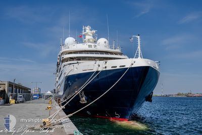
LE BELLOT
Passenger
Current Trip
| Time Travelled | 4 days |
|---|---|
| Remaining Time | --- |
| Distance Travelled | 820.94 морская миля |
| Remaining Distance | --- |
| AVG Speed | 9.9 Узлы |
| MAX Speed | 15.5 Узлы |
| AVG Wind | 13.5 knots |
| MAX Wind | 28.7 knots |
| MIN Temp | 5.2°C / 41.36°F |
| MAX Temp | 12°C / 53.6°F |
| Осадка | 4.7 м |
| Позиция Получена | 1 d тому назад |
Current Position
| Долгота | -6.08568° |
|---|---|
| Широта | 59.54117° |
| Статус | Under way using engine |
| Скорость | 8.3 Узлы |
| Курс | 348.2° |
| Район | North Atlantic Ocean |
| Станция | T-AIS |
| Позиция Получена | 1 d тому назад |
Info
Information
The current position of LE BELLOT is in North Atlantic Ocean with coordinates 59.54117° / -6.08568° as reported on 2024-06-03 13:31 by AIS to our vessel tracker app. The vessel's current speed is 8.3 Узлы and is heading at the port of TORSHAVN. The estimated time of arrival as calculated by MyShipTracking vessel tracking app is 2024-06-04 06:00 LT
The vessel LE BELLOT (IMO: 9852418, MMSI: 578001500) is a Passenger It's sailing under the flag of [WF] Wallis Futuna Is.
In this page you can find informations about the vessels current position, last detected port calls, and current voyage information. If the vessels is not in coverage by AIS you will find the latest position.
The current position of LE BELLOT is detected by our AIS receivers and we are not responsible for the reliability of the data. The last position was recorded while the vessel was in Coverage by the Ais receivers of our vessel tracking app.
The current draught of LE BELLOT as reported by AIS is 4.7 meters
Weather
| Temperature | 7.3°C / 45.14°F |
|---|---|
| Wind Speed | 10 knots |
| Direction | 305° NW |
| Pressure | 1003.5 hPa |
| Humidity | 52.4 % |
| Cloud Coverage | 51 % |
Featured Company
Last Port Calls
| Port | Arrival | Departure | Time In Port |
|---|---|---|---|
| 2024-05-31 06:50 | 2024-05-31 20:54 | 14 h | |
| 2024-05-28 05:23 | 2024-05-28 17:11 | 11 h | |
| 2024-05-27 05:53 | 2024-05-27 17:39 | 11 h | |
| 2024-05-24 06:09 | 2024-05-24 18:15 | 12 h | |
| 2024-05-21 06:15 | 2024-05-21 20:38 | 14 h | |
| 2024-05-20 05:42 | 2024-05-20 17:54 | 12 h | |
| 2024-05-17 06:50 | 2024-05-17 17:38 | 10 h | |
| 2024-05-14 06:30 | 2024-05-14 17:26 | 10 h | |
| 2024-05-13 05:35 | 2024-05-13 17:57 | 12 h | |
| 2024-05-10 06:26 | 2024-05-10 20:01 | 13 h |
Most Visited Ports (Last year)
| Port | Arrivals | |
|---|---|---|
| 12 | ||
| 10 | ||
| 9 | ||
| 9 | ||
| 8 | ||
| 8 |
Last Trips
| Origin | Departure | Destination | Arrival | Distance | |
|---|---|---|---|---|---|
| 2024-05-28 18:11 | 2024-05-31 07:50 | 326.34 морская миля | |||
| 2024-05-27 18:39 | 2024-05-28 06:23 | 149.55 морская миля | |||
| 2024-05-24 19:15 | 2024-05-27 06:53 | 385.12 морская миля | |||
| 2024-05-21 21:38 | 2024-05-24 07:09 | 380.56 морская миля | |||
| 2024-05-20 18:54 | 2024-05-21 07:15 | 146.85 морская миля | |||
| 2024-05-17 18:38 | 2024-05-20 06:42 | 320.77 морская миля | |||
| 2024-05-14 18:26 | 2024-05-17 07:50 | 375.94 морская миля | |||
| 2024-05-13 18:57 | 2024-05-14 07:30 | 150.62 морская миля | |||
| 2024-05-10 21:01 | 2024-05-13 06:35 | 384.75 морская миля | |||
| 2024-05-08 18:44 | 2024-05-10 07:26 | 227.30 морская миля |
Events
| Время | Событие | Детали | Позиция / Направление | Информация |
|---|---|---|---|---|
| 2024-06-03 13:47 | Статус изменился | Default Under way using engine |
59.57834 / -6.09500
FO THO
|
Скорость: 8.3 kn Курс: 348.2° |
| 2024-06-03 13:31 | Статус изменился | Under way using engine Default |
59.54117 / -6.08568
FO THO
|
Скорость: 7 kn Курс: 348° |
| 2024-06-03 13:31 | Вне покрытия |
59.54117 / -6.08568
North Atlantic Ocean
FO THO
|
Скорость: 8.3 kn Курс: 348.2° |
|
| 2024-06-03 13:11 | Статус изменился | Default Under way using engine |
59.49833 / -6.07333
FO THO
|
Скорость: 8.2 kn Курс: 354.3° |
| 2024-06-03 09:10 | Изменение морского района | United Kingdom part of the North Atlantic Ocean United Kingdom part of the Inner Seas off the West Coast of Scotland |
58.95489 / -5.97165
North Atlantic Ocean
FO THO
|
Скорость: 8.3 kn Курс: 354.1° |
| 2024-06-03 09:10 | Статус изменился | Under way using engine Default |
58.95489 / -5.97165
FO THO
|
Скорость: 9 kn Курс: 350° |
| 2024-06-03 08:58 | В покрытии |
58.95489 / -5.97165
North Atlantic Ocean
FO THO
|
Скорость: 8.3 kn Курс: 354.1° |
|
| 2024-06-02 21:40 | Статус изменился | Default Under way using engine |
57.33840 / -6.74184
FO THO
|
Скорость: 9.9 kn Курс: 312.9° |
| 2024-06-02 21:34 | Вне покрытия |
57.32625 / -6.71795
Inner Seas off the West Coast of Scotland
FO THO
|
Скорость: 9.9 kn Курс: 312.9° |
|
| 2024-06-02 21:33 | Статус изменился | Under way using engine Default |
57.32432 / -6.71417
FO THO
|
Скорость: 9.8 kn Курс: 313° |