
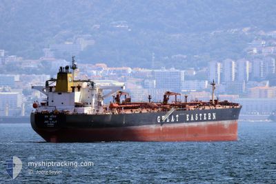
JAG LALIT
Crude Oil Tanker
Current Trip
BASRAH
| Time Travelled | 54 days |
|---|---|
| Remaining Time | --- |
| Distance Travelled | 6829.80 морская миля |
| Remaining Distance | --- |
| AVG Speed | 12.2 Узлы |
| MAX Speed | 16.7 Узлы |
| AVG Wind | 9.6 knots |
| MAX Wind | 27.2 knots |
| MIN Temp | 23°C / 73.4°F |
| MAX Temp | 37.1°C / 98.78°F |
| Осадка | 9 м |
| Позиция Получена | 19 m тому назад |
Current Position
| Долгота | 48.87917° |
|---|---|
| Широта | 29.63248° |
| Статус | Under way using engine |
| Скорость | 3.3 Узлы |
| Курс | 67° |
| Район | Persian Gulf |
| Станция | T-AIS |
| Позиция Получена | 19 m тому назад |
Info
Information
The current position of JAG LALIT is in Persian Gulf with coordinates 29.63248° / 48.87917° as reported on 2024-06-09 22:20 by AIS to our vessel tracker app. The vessel's current speed is 3.3 Узлы
The vessel JAG LALIT (IMO: 9297905, MMSI: 419555000) is a Crude Oil Tanker that was built in 2005 ( 19 лет ). It's sailing under the flag of [IN] India.
In this page you can find informations about the vessels current position, last detected port calls, and current voyage information. If the vessels is not in coverage by AIS you will find the latest position.
The current position of JAG LALIT is detected by our AIS receivers and we are not responsible for the reliability of the data. The last position was recorded while the vessel was in Coverage by the Ais receivers of our vessel tracking app.
The current draught of JAG LALIT as reported by AIS is 9 meters
Weather
| Temperature | 29.6°C / 85.28°F |
|---|---|
| Wind Speed | 12 knots |
| Direction | 148° SSE |
| Pressure | 1001.8 hPa |
| Humidity | 81.8 % |
| Cloud Coverage | --- |
Featured Company
Last Port Calls
| Port | Arrival | Departure | Time In Port |
|---|---|---|---|
| 2024-04-14 14:28 | 2024-04-16 15:25 | 2 d | |
| 2024-04-02 04:28 | 2024-04-03 09:39 | 1 d |
Most Visited Ports (Last year)
| Port | Arrivals | |
|---|---|---|
| 2 | ||
| 1 | ||
| 1 | ||
| 1 | ||
| 1 | ||
| 1 |
Last Trips
| Origin | Departure | Destination | Arrival | Distance | |
|---|---|---|---|---|---|
| 2024-04-03 09:39 | 2024-04-14 14:28 | 2976.17 морская миля |
Events
| Время | Событие | Детали | Позиция / Направление | Информация |
|---|---|---|---|---|
| 2024-06-09 22:25 | Статус изменился | Default Under way using engine |
29.64075 / 48.89305
BASRAH
|
Скорость: 3.3 kn Курс: 67° |
| 2024-06-09 22:20 | Статус изменился | Under way using engine Default |
29.63248 / 48.87917
BASRAH
|
Скорость: 3.6 kn Курс: 67° |
| 2024-06-09 22:14 | Статус изменился | Default Under way using engine |
29.63592 / 48.88524
BASRAH
|
Скорость: 3.2 kn Курс: 60° |
| 2024-06-09 22:04 | Статус изменился | Under way using engine Default |
29.63037 / 48.87710
BASRAH
|
Скорость: 5.4 kn Курс: 359° |
| 2024-06-09 21:58 | Статус изменился | Default Under way using engine |
29.62263 / 48.87650
BASRAH
|
Скорость: 7.1 kn Курс: 1° |
| 2024-06-09 21:50 | Статус изменился | Under way using engine Default |
29.60928 / 48.87642
BASRAH
|
Скорость: 7.3 kn Курс: 353° |
| 2024-06-09 21:39 | Статус изменился | Default Under way using engine |
29.58613 / 48.88087
BASRAH
|
Скорость: 7.6 kn Курс: 322° |
| 2024-06-09 21:35 | Статус изменился | Under way using engine Default |
29.57980 / 48.88620
BASRAH
|
Скорость: 7.6 kn Курс: 324° |
| 2024-06-09 21:29 | Статус изменился | Default Under way using engine |
29.56897 / 48.89677
BASRAH
|
Скорость: 9.7 kn Курс: 354° |
| 2024-06-09 21:21 | Изменение морского района | Iranian part of the Persian Gulf Kuwaiti part of the Persian Gulf |
29.55153 / 48.90080
Persian Gulf
BASRAH
|
Скорость: 9.7 kn Курс: 354° |