
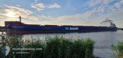
GREEN K-MAX 2
Cargo
Current Trip
| Time Travelled | 23 h, 49 mins |
|---|---|
| Remaining Time | 1 day |
| Distance Travelled | 233.83 морская миля |
| Remaining Distance | 368.42 морская миля |
| AVG Speed | 9.6 Узлы |
| MAX Speed | 11.7 Узлы |
| AVG Wind | 18.6 knots |
| MAX Wind | 21 knots |
| MIN Temp | 12.7°C / 54.86°F |
| MAX Temp | 13.8°C / 56.84°F |
| Осадка | 8.2 м |
| Позиция Получена | 1 m тому назад |
Current Position
| Долгота | 6.47339° |
|---|---|
| Широта | 55.76994° |
| Статус | Under way using engine |
| Скорость | 10.9 Узлы |
| Курс | 22.6° |
| Район | North Sea |
| Станция | T-AIS |
| Позиция Получена | 1 m тому назад |
Info
Information
The current position of GREEN K-MAX 2 is in North Sea with coordinates 55.76994° / 6.47339° as reported on 2024-06-03 00:38 by AIS to our vessel tracker app. The vessel's current speed is 10.9 Узлы and is heading at the port of FREDERICIA. The estimated time of arrival as calculated by MyShipTracking vessel tracking app is 2024-06-04 12:05 LT
The vessel GREEN K-MAX 2 (IMO: 9838060, MMSI: 636019563) is a Cargo It's sailing under the flag of [LR] Liberia.
In this page you can find informations about the vessels current position, last detected port calls, and current voyage information. If the vessels is not in coverage by AIS you will find the latest position.
The current position of GREEN K-MAX 2 is detected by our AIS receivers and we are not responsible for the reliability of the data. The last position was recorded while the vessel was in Coverage by the Ais receivers of our vessel tracking app.
The current draught of GREEN K-MAX 2 as reported by AIS is 8.2 meters
Weather
| Temperature | 12.8°C / 55.04°F |
|---|---|
| Wind Speed | 20 knots |
| Direction | 305° NW |
| Pressure | 1017.9 hPa |
| Humidity | 79.4 % |
| Cloud Coverage | 41 % |
Featured Company
Most Visited Ports (Last year)
| Port | Arrivals | |
|---|---|---|
| 2 | ||
| 2 | ||
| 1 | ||
| 1 | ||
| 1 | ||
| 1 |
Last Trips
| Origin | Departure | Destination | Arrival | Distance | |
|---|---|---|---|---|---|
| 2024-05-04 19:18 | 2024-05-26 11:01 | 5514.57 морская миля | |||
| 2024-03-31 19:11 | 2024-05-01 20:40 | 8281.89 морская миля |
Events
| Время | Событие | Детали | Позиция / Направление | Информация |
|---|---|---|---|---|
| 2024-06-02 22:34 | Изменение морского района | Danish part of the North Sea German part of the North Sea |
55.43026 / 6.19726
North Sea
DK FRC
|
Скорость: 10.6 kn Курс: 26.2° |
| 2024-06-02 21:56 | ETA изменился | 2024/06/04 10:00 2024/06/02 03:45 |
55.32717 / 6.11172
DK FRC
|
Скорость: 10.9 kn Курс: 25.2° |
| 2024-06-02 16:27 | Обнаружено в море | German part of the North Sea |
54.44228 / 5.41768
North Sea
|
Скорость: 10.8 kn Курс: 24.4° |
| 2024-06-02 14:44 | Статус изменился | Under way using engine Default |
54.16254 / 5.19434
DK FRC
|
Скорость: 10.5 kn Курс: 22° |
| 2024-06-02 14:30 | Статус изменился | Default Under way using engine |
54.12519 / 5.16855
DK FRC
|
Скорость: 10.7 kn Курс: 20.1° |
| 2024-06-02 14:26 | Статус изменился | Under way using engine Default |
54.11251 / 5.16022
DK FRC
|
Скорость: 10.6 kn Курс: 21° |
| 2024-06-02 14:07 | Статус изменился | Default Under way using engine |
54.06141 / 5.12782
DK FRC
|
Скорость: 11.1 kn Курс: 19.7° |
| 2024-06-02 13:54 | Статус изменился | Under way using engine Default |
54.02462 / 5.10516
DK FRC
|
Скорость: 10.7 kn Курс: 20° |
| 2024-06-02 13:48 | Статус изменился | Default Under way using engine |
54.00839 / 5.09436
DK FRC
|
Скорость: 10.8 kn Курс: 21.5° |
| 2024-06-02 13:33 | Статус изменился | Under way using engine Default |
53.96636 / 5.06625
DK FRC
|
Скорость: 11 kn Курс: 21° |