
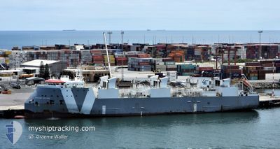
GANADO EXPRESS
Livestock Carrier
Current Trip
| Time Travelled | 2 days |
|---|---|
| Remaining Time | 21 h, 22 mins |
| Distance Travelled | 945.04 морская миля |
| Remaining Distance | 348.44 морская миля |
| AVG Speed | 16 Узлы |
| MAX Speed | 17.3 Узлы |
| AVG Wind | 7.4 knots |
| MAX Wind | 17 knots |
| MIN Temp | 11.1°C / 51.98°F |
| MAX Temp | 15.6°C / 60.08°F |
| Осадка | 6.6 м |
| Позиция Получена | 1 m тому назад |
Current Position
| Долгота | -10.24803° |
|---|---|
| Широта | 38.83754° |
| Статус | Under way using engine |
| Скорость | 16.1 Узлы |
| Курс | 184.5° |
| Район | North Atlantic Ocean |
| Станция | T-AIS |
| Позиция Получена | 1 m тому назад |
Info
Information
The current position of GANADO EXPRESS is in North Atlantic Ocean with coordinates 38.83754° / -10.24803° as reported on 2024-05-20 07:38 by AIS to our vessel tracker app. The vessel's current speed is 16.1 Узлы and is heading at the port of CASABLANCA. The estimated time of arrival as calculated by MyShipTracking vessel tracking app is 2024-05-21 06:01 LT
The vessel GANADO EXPRESS (IMO: 9621209, MMSI: 255915562) is a Livestock Carrier that was built in 2013 ( 11 лет ). It's sailing under the flag of [PT] Portugal.
In this page you can find informations about the vessels current position, last detected port calls, and current voyage information. If the vessels is not in coverage by AIS you will find the latest position.
The current position of GANADO EXPRESS is detected by our AIS receivers and we are not responsible for the reliability of the data. The last position was recorded while the vessel was in Coverage by the Ais receivers of our vessel tracking app.
The current draught of GANADO EXPRESS as reported by AIS is 6.6 meters
Weather
| Temperature | 15.4°C / 59.72°F |
|---|---|
| Wind Speed | 12 knots |
| Direction | 320° NW |
| Pressure | 1016.7 hPa |
| Humidity | 76.3 % |
| Cloud Coverage | --- |
Featured Company
Last Trips
| Origin | Departure | Destination | Arrival | Distance | |
|---|---|---|---|---|---|
| 2024-04-27 02:24 | 2024-05-16 06:32 | 5693.11 морская миля | |||
| 2024-04-18 05:46 | 2024-04-24 12:25 | 2042.02 морская миля | |||
| 2024-03-28 08:31 | 2024-04-17 07:18 | 6641.52 морская миля | |||
| 2024-02-27 07:46 | 2024-03-05 01:39 | 2353.64 морская миля |
Events
| Время | Событие | Детали | Позиция / Направление | Информация |
|---|---|---|---|---|
| 2024-05-20 07:34 | Статус изменился | Under way using engine Default |
38.85411 / -10.24611
MA-CAS
|
Скорость: 15.9 kn Курс: 193° |
| 2024-05-20 07:30 | Статус изменился | Default Under way using engine |
38.87225 / -10.24212
MA-CAS
|
Скорость: 15.8 kn Курс: 196.9° |
| 2024-05-20 07:22 | Статус изменился | Under way using engine Default |
38.90682 / -10.22785
MA-CAS
|
Скорость: 15.8 kn Курс: 197° |
| 2024-05-20 07:06 | Статус изменился | Default Under way using engine |
38.97327 / -10.19931
MA-CAS
|
Скорость: 16.3 kn Курс: 178.5° |
| 2024-05-20 05:21 | Статус изменился | Under way using engine Default |
39.44708 / -10.17800
MA-CAS
|
Скорость: 16 kn Курс: 182° |
| 2024-05-20 05:17 | Статус изменился | Default Under way using engine |
39.46333 / -10.17666
MA-CAS
|
Скорость: 16.2 kn Курс: 183.4° |
| 2024-05-20 05:09 | Статус изменился | Under way using engine Default |
39.49799 / -10.17651
MA-CAS
|
Скорость: 16 kn Курс: 182° |
| 2024-05-20 04:59 | Статус изменился | Default Under way using engine |
39.54656 / -10.17332
MA-CAS
|
Скорость: 16.3 kn Курс: 181.2° |
| 2024-05-20 04:52 | Обнаружено в море | Portuguese part of the North Atlantic Ocean |
39.57738 / -10.17120
North Atlantic Ocean
MA-CAS
|
Скорость: 16.3 kn Курс: 181.2° |
| 2024-05-20 04:52 | Статус изменился | Under way using engine Default |
39.57738 / -10.17120
MA-CAS
|
Скорость: 16.4 kn Курс: 182° |