
WIELAND
Cargo
Current Trip
| Time Travelled | 5 days |
|---|---|
| Remaining Time | 12 mins |
| Distance Travelled | 1267.94 nm |
| Remaining Distance | 4.03 nm |
| AVG Speed | 13.2 Knopen |
| MAX Speed | 16.4 Knopen |
| AVG Wind | 12.5 knots |
| MAX Wind | 22 knots |
| MIN Temp | 12.3°C / 54.14°F |
| MAX Temp | 18.9°C / 66.02°F |
| Diepgang | 10 M |
| Positie ontvangen | 3 m geleden |
Current Position
| Lengtegraad | -5.58300° |
|---|---|
| Breedtegraat | 35.88167° |
| Status | Under way using engine |
| Snelheid | 0.4 Knopen |
| Koers | 257° |
| Gebied | Strait of Gibraltar |
| Station | T-AIS |
| Positie ontvangen | 3 m geleden |
Info
Information
The current position of WIELAND is in Strait of Gibraltar with coordinates 35.88167° / -5.58300° as reported on 2024-05-18 12:41 by AIS to our vessel tracker app. The vessel's current speed is 0.4 Knopen and is heading at the port of TANGER MED. The estimated time of arrival as calculated by MyShipTracking vessel tracking app is 2024-05-18 13:56 LT
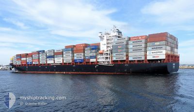
The vessel WIELAND (IMO: 9654464, MMSI: 255805563) is a Cargo It's sailing under the flag of [PT] Portugal.
In this page you can find informations about the vessels current position, last detected port calls, and current voyage information. If the vessels is not in coverage by AIS you will find the latest position.
The current position of WIELAND is detected by our AIS receivers and we are not responsible for the reliability of the data. The last position was recorded while the vessel was in Coverage by the Ais receivers of our vessel tracking app.
The current draught of WIELAND as reported by AIS is 10 meters
Weather
| Temperature | 18.9°C / 66.02°F |
|---|---|
| Wind Speed | 11 knots |
| Direction | 266° W |
| Pressure | 1013.3 hPa |
| Humidity | 63.3 % |
| Cloud Coverage | 91 % |
Featured Company
Last Port Calls
| Port | Arrival | Departure | Time In Port |
|---|---|---|---|
| 2024-05-12 13:13 | 2024-05-13 03:34 | 14 h | |
| 2024-05-10 04:21 | 2024-05-11 17:54 | 1 d | |
| 2024-05-08 19:12 | 2024-05-09 14:13 | 19 h | |
| 2024-05-07 13:54 | 2024-05-08 10:06 | 20 h | |
| 2024-04-29 21:30 | 2024-04-30 17:10 | 19 h | |
| 2024-04-22 22:14 | 2024-04-25 15:34 | 2 d | |
| 2024-04-17 13:06 | 2024-04-18 19:34 | 1 d | |
| 2024-04-09 12:40 | 2024-04-10 22:27 | 1 d | |
| 2024-04-08 21:52 | 2024-04-09 07:59 | 10 h | |
| 2024-04-01 21:08 | 2024-04-02 17:40 | 20 h |
Last Trips
| Origin | Departure | Destination | Arrival | Distance | |
|---|---|---|---|---|---|
| 2024-05-11 17:54 | 2024-05-12 13:13 | 305.91 nm | |||
| 2024-05-09 14:13 | 2024-05-10 04:21 | 132.06 nm | |||
| 2024-05-08 10:06 | 2024-05-08 19:12 | 108.83 nm | |||
| 2024-04-30 17:10 | 2024-05-07 13:54 | 2644.91 nm | |||
| 2024-04-25 15:34 | 2024-04-29 21:30 | 1254.78 nm | |||
| 2024-04-18 19:34 | 2024-04-22 22:14 | 1226.12 nm | |||
| 2024-04-10 22:27 | 2024-04-17 13:06 | 1572.25 nm | |||
| 2024-04-09 07:59 | 2024-04-09 12:40 | 51.82 nm | |||
| 2024-04-02 17:40 | 2024-04-08 21:52 | 1347.97 nm | |||
| 2024-03-30 13:05 | 2024-04-01 21:08 | 310.99 nm |
Events
| Tijd | Evenement | Details | Positie / Bestemming | Info |
|---|---|---|---|---|
| 2024-05-18 10:30 | ETA Changed | 2024/05/18 14:00 2024/05/18 10:00 |
35.89433 / -5.71417
MAPTM
|
Snelheid: 7.6 kn Koers: 99° |
| 2024-05-18 10:07 | Status Changed | Under way using engine Default |
35.89600 / -5.77300
MAPTM
|
Snelheid: 8.3 kn Koers: 95° |
| 2024-05-18 09:55 | Status Changed | Default Under way using engine |
35.89784 / -5.80817
MAPTM
|
Snelheid: 8.4 kn Koers: 92° |
| 2024-05-18 09:43 | Wijzig zee gebeid | Moroccan part of the Strait of Gibraltar Moroccan part of the North Atlantic Ocean |
35.89833 / -5.84050
Strait of Gibraltar
MAPTM
|
Snelheid: 8.2 kn Koers: 90° |
| 2024-05-18 09:43 | Status Changed | Under way using engine Default |
35.89833 / -5.84050
MAPTM
|
Snelheid: 8.2 kn Koers: 91° |
| 2024-05-18 09:07 | Status Changed | Default Under way using engine |
35.90033 / -5.97433
MAPTM
|
Snelheid: 11.4 kn Koers: 86° |
| 2024-05-18 09:00 | Status Changed | Under way using engine Default |
35.89888 / -6.00141
MAPTM
|
Snelheid: 11.1 kn Koers: 86° |
| 2024-05-18 08:50 | Status Changed | Default Under way using engine |
35.89700 / -6.03800
MAPTM
|
Snelheid: 11.3 kn Koers: 86° |
| 2024-05-18 08:45 | Wijzig zee gebeid | Moroccan part of the North Atlantic Ocean Portuguese part of the North Atlantic Ocean |
35.89617 / -6.05800
North Atlantic Ocean
MAPTM
|
Snelheid: 11.3 kn Koers: 86° |
| 2024-05-18 08:44 | Status Changed | Under way using engine Default |
35.89600 / -6.06300
MAPTM
|
Snelheid: 11.3 kn Koers: 86° |