
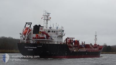
STOLT GREENSHANK
Oil/Chemical Tanker
Current Trip
| Time Travelled | 12 h, 51 mins |
|---|---|
| Remaining Time | 22 h, 5 mins |
| Distance Travelled | 138.51 nm |
| Remaining Distance | 272.54 nm |
| AVG Speed | 10.6 Knopen |
| MAX Speed | 11.5 Knopen |
| AVG Wind | 11.7 knots |
| MAX Wind | 14.1 knots |
| MIN Temp | 9.6°C / 49.28°F |
| MAX Temp | 11.6°C / 52.88°F |
| Diepgang | 5.4 M |
| Positie ontvangen | 2 h, 32 m geleden |
Current Position
| Lengtegraad | 1.25181° |
|---|---|
| Breedtegraat | 55.91670° |
| Status | Under way using engine |
| Snelheid | 11.2 Knopen |
| Koers | 64.7° |
| Gebied | North Sea |
| Station | T-AIS |
| Positie ontvangen | 2 h, 32 m geleden |
Info
Information
The current position of STOLT GREENSHANK is in North Sea with coordinates 55.91670° / 1.25181° as reported on 2024-05-19 10:29 by AIS to our vessel tracker app. The vessel's current speed is 11.2 Knopen and is heading at the port of KRISTIANSAND. The estimated time of arrival as calculated by MyShipTracking vessel tracking app is 2024-05-20 13:06 LT
The vessel STOLT GREENSHANK (IMO: 9518799, MMSI: 235096859) is a Oil/Chemical Tanker that was built in 2011 ( 13 Jaar oud ). It's sailing under the flag of [GB] United Kingdom.
In this page you can find informations about the vessels current position, last detected port calls, and current voyage information. If the vessels is not in coverage by AIS you will find the latest position.
The current position of STOLT GREENSHANK is detected by our AIS receivers and we are not responsible for the reliability of the data. The last position was recorded while the vessel was in Coverage by the Ais receivers of our vessel tracking app.
The current draught of STOLT GREENSHANK as reported by AIS is 5.4 meters
Weather
| Temperature | 11.4°C / 52.52°F |
|---|---|
| Wind Speed | 12 knots |
| Direction | 12° NNE |
| Pressure | 1017.3 hPa |
| Humidity | 93.2 % |
| Cloud Coverage | 11 % |
Featured Company
Last Port Calls
| Port | Arrival | Departure | Time In Port |
|---|---|---|---|
| 2024-05-18 04:31 | 2024-05-19 01:10 | 20 h | |
| 2024-05-16 07:46 | 2024-05-17 06:03 | 22 h | |
| 2024-05-15 09:46 | 2024-05-15 10:55 | 1 h | |
| 2024-05-14 08:35 | 2024-05-15 09:02 | 1 d | |
| 2024-05-12 06:53 | 2024-05-13 06:12 | 23 h | |
| 2024-05-10 05:48 | 2024-05-11 04:51 | 23 h | |
| 2024-05-05 12:02 | 2024-05-06 09:46 | 21 h | |
| 2024-05-03 21:06 | 2024-05-04 11:22 | 14 h | |
| 2024-05-01 02:57 | 2024-05-02 08:07 | 1 d | |
| 2024-04-26 07:45 | 2024-04-29 08:19 | 3 d |
Last Trips
| Origin | Departure | Destination | Arrival | Distance | |
|---|---|---|---|---|---|
| 2024-05-17 06:03 | 2024-05-18 04:31 | 130.24 nm | |||
| 2024-05-15 10:55 | 2024-05-16 07:46 | 216.41 nm | |||
| 2024-05-15 09:02 | 2024-05-15 09:46 | 2.37 nm | |||
| 2024-05-13 06:12 | 2024-05-14 08:35 | 230.84 nm | |||
| 2024-05-11 04:51 | 2024-05-12 06:53 | 202.22 nm | |||
| 2024-05-06 09:46 | 2024-05-10 05:48 | 588.82 nm | |||
| 2024-05-04 11:22 | 2024-05-05 12:02 | 257.71 nm | |||
| 2024-05-02 08:07 | 2024-05-03 21:06 | 205.19 nm | |||
| 2024-04-29 08:19 | 2024-05-01 02:57 | 111.53 nm | |||
| 2024-04-24 21:03 | 2024-04-26 07:45 | 288.92 nm |
Events
| Tijd | Evenement | Details | Positie / Bestemming | Info |
|---|---|---|---|---|
| 2024-05-19 10:34 | Status Changed | Default Under way using engine |
55.92166 / 1.27333
NO KRS
|
Snelheid: 11.2 kn Koers: 64.7° |
| 2024-05-19 10:29 | Status Changed | Under way using engine Default |
55.91670 / 1.25181
NO KRS
|
Snelheid: 11 kn Koers: 64° |
| 2024-05-19 10:29 | Binnenbereik |
55.91670 / 1.25181
North Sea
NO KRS
|
Snelheid: 11.2 kn Koers: 64.7° |
|
| 2024-05-19 10:29 | Buitenbereik |
55.91670 / 1.25181
North Sea
NO KRS
|
Snelheid: 11.2 kn Koers: 64.7° |
|
| 2024-05-19 05:46 | Status Changed | Default Under way using engine |
55.41667 / .02333
NO KRS
|
Snelheid: 11.2 kn Koers: 37.5° |
| 2024-05-19 05:42 | Status Changed | Under way using engine Default |
55.40876 / .01367
NO KRS
|
Snelheid: 11.3 kn Koers: 37° |
| 2024-05-19 05:42 | Buitenbereik |
55.40876 / .01367
North Sea
NO KRS
|
Snelheid: 11.2 kn Koers: 37.5° |
|
| 2024-05-19 05:32 | Status Changed | Default Under way using engine |
55.38419 / -.01965
NO KRS
|
Snelheid: 11.3 kn Koers: 37.8° |
| 2024-05-19 05:22 | Status Changed | Under way using engine Default |
55.35845 / -.05469
NO KRS
|
Snelheid: 11.3 kn Koers: 38° |
| 2024-05-19 05:15 | Binnenbereik |
55.35845 / -.05469
North Sea
NO KRS
|
Snelheid: 11.3 kn Koers: 37.8° |