
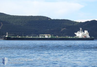
SAKARYA
Crude Oil Tanker
Current Trip
| Time Travelled | --- |
|---|---|
| Remaining Time | --- |
| Distance Travelled | --- |
| Remaining Distance | --- |
| AVG Speed | --- |
| MAX Speed | --- |
| AVG Wind | --- |
| MAX Wind | --- |
| MIN Temp | --- |
| MAX Temp | --- |
| Diepgang | 16.9 M |
| Positie ontvangen | 2 h, 40 m geleden |
Current Position
| Lengtegraad | 17.27558° |
|---|---|
| Breedtegraat | 35.61642° |
| Status | Under way using engine |
| Snelheid | 12.7 Knopen |
| Koers | 107.3° |
| Gebied | Mediterranean Sea - Eastern Basin |
| Station | T-AIS |
| Positie ontvangen | 2 h, 40 m geleden |
Info
Information
The current position of SAKARYA is in Mediterranean Sea - Eastern Basin with coordinates 35.61642° / 17.27558° as reported on 2024-06-02 19:06 by AIS to our vessel tracker app. The vessel's current speed is 12.7 Knopen and is heading at the port of KYAUKPYU. The estimated time of arrival as calculated by MyShipTracking vessel tracking app is 2024-06-22 09:00 LT
The vessel SAKARYA (IMO: 9524463, MMSI: 352002168) is a Crude Oil Tanker that was built in 2011 ( 13 Jaar oud ). It's sailing under the flag of [PA] Panama.
In this page you can find informations about the vessels current position, last detected port calls, and current voyage information. If the vessels is not in coverage by AIS you will find the latest position.
The current position of SAKARYA is detected by our AIS receivers and we are not responsible for the reliability of the data. The last position was recorded while the vessel was in Coverage by the Ais receivers of our vessel tracking app.
The current draught of SAKARYA as reported by AIS is 16.9 meters
Weather
| Temperature | 22.6°C / 72.68°F |
|---|---|
| Wind Speed | 8 knots |
| Direction | 127° SE |
| Pressure | 1013 hPa |
| Humidity | 84 % |
| Cloud Coverage | 100 % |
Featured Company
Last Port Calls
| Port | Arrival | Departure | Time In Port |
|---|---|---|---|
| 2024-04-30 04:18 | 2024-04-30 13:24 | 9 h |
Most Visited Ports (Last year)
| Port | Arrivals | |
|---|---|---|
| 9 | ||
| 1 |
Last Trips
| Origin | Departure | Destination | Arrival | Distance |
|---|
Events
| Tijd | Evenement | Details | Positie / Bestemming | Info |
|---|---|---|---|---|
| 2024-06-02 19:09 | Status Changed | Default Under way using engine |
35.61283 / 17.29011
MMKYP
|
Snelheid: 12.7 kn Koers: 107.3° |
| 2024-06-02 19:06 | Status Changed | Under way using engine Default |
35.61642 / 17.27558
MMKYP
|
Snelheid: 12.7 kn Koers: 107° |
| 2024-06-02 19:06 | Buitenbereik |
35.61642 / 17.27558
Mediterranean Sea - Eastern Basin
MMKYP
|
Snelheid: 12.7 kn Koers: 107.3° |
|
| 2024-06-02 18:54 | Binnenbereik |
35.61642 / 17.27558
Mediterranean Sea - Eastern Basin
MMKYP
|
Snelheid: 12.7 kn Koers: 107.3° |
|
| 2024-06-02 14:10 | Status Changed | Default Under way using engine |
35.89370 / 16.10148
MMKYP
|
Snelheid: 7.3 kn Koers: 103.3° |
| 2024-06-02 14:05 | Buitenbereik |
35.89657 / 16.08730
Mediterranean Sea - Eastern Basin
MMKYP
|
Snelheid: 7.3 kn Koers: 103.3° |
|
| 2024-06-02 14:03 | Status Changed | Under way using engine Default |
35.89719 / 16.08401
MMKYP
|
Snelheid: 5.3 kn Koers: 99° |
| 2024-06-02 13:54 | Status Changed | Default Under way using engine |
35.90058 / 16.06675
MMKYP
|
Snelheid: 2.2 kn Koers: 105° |
| 2024-06-02 13:54 | Start beweging |
35.90058 / 16.06675
MMKYP
|
Snelheid: 4.4 kn Koers: 114° |
|
| 2024-06-02 13:07 | Wijzig zee gebeid | Italian part of the Mediterranean Sea - Eastern Basin Maltese part of the Mediterranean Sea - Eastern Basin |
35.90158 / 16.07152
Mediterranean Sea - Eastern Basin
MMKYP
|
Snelheid: 1 kn Koers: 277.1° |