
RUTH BORCHARD
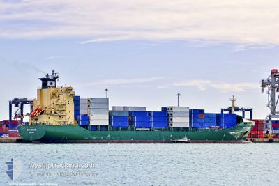
Container Ship
Current Trip
| Time Travelled | 1 day |
|---|---|
| Remaining Time | 5 h, 56 mins |
| Distance Travelled | 397.48 nm |
| Remaining Distance | 89.42 nm |
| AVG Speed | 14.6 Knopen |
| MAX Speed | 15.1 Knopen |
| AVG Wind | 8.1 knots |
| MAX Wind | 12 knots |
| MIN Temp | 19.6°C / 67.28°F |
| MAX Temp | 21.1°C / 69.98°F |
| Diepgang | 8.6 M |
| Positie ontvangen | Nu |
Current Position
| Lengtegraad | 7.56446° |
|---|---|
| Breedtegraat | 43.42966° |
| Status | Under way using engine |
| Snelheid | 13.8 Knopen |
| Koers | 50.9° |
| Gebied | Mediterranean Sea - Western Basin |
| Station | T-AIS |
| Positie ontvangen | Nu |
Info
Information
The current position of RUTH BORCHARD is in Mediterranean Sea - Western Basin with coordinates 43.42966° / 7.56446° as reported on 2024-06-17 08:20 by AIS to our vessel tracker app. The vessel's current speed is 13.8 Knopen and is heading at the port of GENOVA. The estimated time of arrival as calculated by MyShipTracking vessel tracking app is 2024-06-17 14:17 LT
The vessel RUTH BORCHARD (IMO: 9212034, MMSI: 538005024) is a Container Ship that was built in 2000 ( 24 Jaar oud ). It's sailing under the flag of [MH] Marshall Is.
In this page you can find informations about the vessels current position, last detected port calls, and current voyage information. If the vessels is not in coverage by AIS you will find the latest position.
The current position of RUTH BORCHARD is detected by our AIS receivers and we are not responsible for the reliability of the data. The last position was recorded while the vessel was in Coverage by the Ais receivers of our vessel tracking app.
The current draught of RUTH BORCHARD as reported by AIS is 8.6 meters
Weather
| Temperature | 20.5°C / 68.9°F |
|---|---|
| Wind Speed | 8 knots |
| Direction | 71° ENE |
| Pressure | 1016.2 hPa |
| Humidity | 79.3 % |
| Cloud Coverage | --- |
Featured Company
Last Port Calls
| Port | Arrival | Departure | Time In Port |
|---|---|---|---|
| 2024-06-15 16:09 | 2024-06-16 05:05 | 12 h | |
| 2024-06-14 17:51 | 2024-06-15 07:30 | 13 h | |
| 2024-06-13 11:24 | 2024-06-14 01:29 | 14 h | |
| 2024-06-11 18:04 | 2024-06-12 03:07 | 9 h | |
| 2024-06-09 02:21 | 2024-06-09 17:34 | 15 h | |
| 2024-06-07 14:43 | |||
| 2024-06-02 19:35 | 2024-06-03 16:14 | 20 h | |
| 2024-06-01 11:53 | 2024-06-01 23:46 | 11 h | |
| 2024-05-28 03:08 | 2024-05-28 17:56 | 14 h | |
| 2024-05-26 04:27 | 2024-05-26 14:09 | 9 h |
Last Trips
| Origin | Departure | Destination | Arrival | Distance | |
|---|---|---|---|---|---|
| 2024-06-15 09:30 | 2024-06-15 18:09 | 130.14 nm | |||
| 2024-06-14 03:29 | 2024-06-14 19:51 | 192.76 nm | |||
| 2024-06-12 05:07 | 2024-06-13 13:24 | 497.78 nm | |||
| 2024-06-09 20:34 | 2024-06-11 20:04 | 795.84 nm | |||
| 2024-06-07 16:43 | 2024-06-09 05:21 | 522.98 nm | |||
| 2024-06-02 01:46 | 2024-06-02 22:35 | 281.53 nm | |||
| 2024-05-28 19:56 | 2024-06-01 13:53 | 1332.78 nm | |||
| 2024-05-26 16:09 | 2024-05-28 05:08 | 485.56 nm | |||
| 2024-05-25 19:31 | 2024-05-26 06:27 | 131.22 nm | |||
| 2024-05-24 10:30 | 2024-05-25 06:01 | 193.78 nm |
Events
| Tijd | Evenement | Details | Positie / Bestemming | Info |
|---|---|---|---|---|
| 2024-06-17 08:16 | Wijzig zee gebeid | Mon�gasque part of the Mediterranean Sea - Western Basin French part of the Mediterranean Sea - Western Basin |
43.41999 / 7.54810
Mediterranean Sea - Western Basin
ITGOA
|
Snelheid: 13.8 kn Koers: 50.8° |
| 2024-06-17 06:22 | Binnenbereik |
43.12678 / 7.09062
Mediterranean Sea - Western Basin
ITGOA
|
Snelheid: 13.9 kn Koers: 47.6° |
|
| 2024-06-17 03:33 | Status Changed | Default Under way using engine |
42.70695 / 6.36369
ITGOA
|
Snelheid: 14.5 kn Koers: 61.2° |
| 2024-06-17 03:29 | Buitenbereik |
42.69830 / 6.34276
Mediterranean Sea - Western Basin
ITGOA
|
Snelheid: 14.5 kn Koers: 61.2° |
|
| 2024-06-17 03:13 | Draught Changed | 8.6 8.2 |
42.66614 / 6.26465
ITGOA
|
Snelheid: 14.6 kn Koers: 60.3° |
| 2024-06-17 03:13 | Destination Changed | ITGOA ESCAS |
42.66614 / 6.26465
ITGOA
|
Snelheid: 14.6 kn Koers: 60.3° |
| 2024-06-17 03:13 | ETA Changed | 2024/06/17 14:30 2024/06/15 16:00 |
42.66614 / 6.26465
ITGOA
|
Snelheid: 14.6 kn Koers: 60.3° |
| 2024-06-17 02:25 | Status Changed | Under way using engine Default |
42.57148 / 6.03388
ESCAS
|
Snelheid: 14.9 kn Koers: 60° |
| 2024-06-17 02:13 | Status Changed | Default Under way using engine |
42.54655 / 5.97398
ESCAS
|
Snelheid: 14.8 kn Koers: 60.1° |
| 2024-06-17 02:03 | Status Changed | Under way using engine Default |
42.52723 / 5.92939
ESCAS
|
Snelheid: 14.8 kn Koers: 60° |