
RONG XIANG
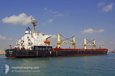
Bulk Carrier
Current Trip
IN PRT
| Time Travelled | 1 day |
|---|---|
| Remaining Time | --- |
| Distance Travelled | 19.63 nm |
| Remaining Distance | --- |
| AVG Speed | 12.8 Knopen |
| MAX Speed | 13.8 Knopen |
| AVG Wind | 17 knots |
| MAX Wind | 17.6 knots |
| MIN Temp | 29.7°C / 85.46°F |
| MAX Temp | 30°C / 86°F |
| Diepgang | 12.2 M |
| Positie ontvangen | 10 d geleden |
Current Position
| Lengtegraad | 77.46456° |
|---|---|
| Breedtegraat | 7.72183° |
| Status | Under way using engine |
| Snelheid | 13.4 Knopen |
| Koers | 119.2° |
| Gebied | Laccadive Sea |
| Station | T-AIS |
| Positie ontvangen | 10 d geleden |
Info
Information
The current position of RONG XIANG is in Laccadive Sea with coordinates 7.72183° / 77.46456° as reported on 2024-05-08 19:04 by AIS to our vessel tracker app. The vessel's current speed is 13.4 Knopen
The vessel RONG XIANG (IMO: 9294197, MMSI: 538007653) is a Bulk Carrier that was built in 2004 ( 20 Jaar oud ). It's sailing under the flag of [MH] Marshall Is.
In this page you can find informations about the vessels current position, last detected port calls, and current voyage information. If the vessels is not in coverage by AIS you will find the latest position.
The current position of RONG XIANG is detected by our AIS receivers and we are not responsible for the reliability of the data. The last position was recorded while the vessel was in Coverage by the Ais receivers of our vessel tracking app.
The current draught of RONG XIANG as reported by AIS is 12.2 meters
Weather
| Temperature | 30.2°C / 86.36°F |
|---|---|
| Wind Speed | 6 knots |
| Direction | 223° SW |
| Pressure | 1006.4 hPa |
| Humidity | 74.2 % |
| Cloud Coverage | 83 % |
Featured Company
Most Visited Ports (Last year)
| Port | Arrivals | |
|---|---|---|
| 4 | ||
| 4 | ||
| 3 | ||
| 1 | ||
| 1 | ||
| 1 |
Events
| Tijd | Evenement | Details | Positie / Bestemming | Info |
|---|---|---|---|---|
| 2024-05-18 15:53 | Vertrekhaven |
|
20.25078 / 86.70040
IN PRT
|
Snelheid: 4.9 kn Koers: 131° |
| 2024-05-18 15:47 | Start beweging |
20.26591 / 86.67155
[IN] PARADIP
|
Snelheid: 3.5 kn Koers: 103° |
|
| 2024-05-15 23:17 | Stop beweging |
20.26454 / 86.66836
[IN] PARADIP
|
Snelheid: Koers: 28° |
|
| 2024-05-15 23:04 | Aankomsthaven |
|
20.26676 / 86.67143
[IN] PARADIP
|
Snelheid: 6.7 kn Koers: 299° |
| 2024-05-15 21:16 | Start beweging | 7.99 nm, East of PARADIP |
20.22269 / 86.80750
IN PRT
|
Snelheid: 7.6 kn Koers: 255° |
| 2024-05-13 06:04 | Stop beweging | 8.73 nm, East of PARADIP |
20.22571 / 86.82233
IN PRT
|
Snelheid: 0.1 kn Koers: 256° |
| 2024-05-10 02:44 | Start beweging |
6.08020 / 81.46036
IN PRT
|
Snelheid: 4 kn Koers: 99° |
|
| 2024-05-10 00:24 | Stop beweging |
6.05448 / 81.45699
IN PRT
|
Snelheid: 0.3 kn Koers: 132° |
|
| 2024-05-09 22:58 | Start beweging | 18.58 nm, East of HAMBANTOTA |
6.04445 / 81.40081
IN PRT
|
Snelheid: 10.1 kn Koers: 69° |
| 2024-05-09 18:11 | Stop beweging | 19.67 nm, East of HAMBANTOTA |
6.01680 / 81.41142
IN PRT
|
Snelheid: 0.2 kn Koers: 71° |