
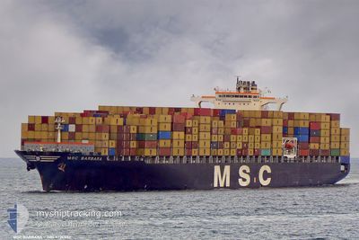
MSC BARBARA
Container Ship
Current Trip
| Time Travelled | 30 days |
|---|---|
| Remaining Time | --- |
| Distance Travelled | 13001.04 nm |
| Remaining Distance | --- |
| AVG Speed | 18.1 Knopen |
| MAX Speed | 21.5 Knopen |
| AVG Wind | 14.5 knots |
| MAX Wind | 27.3 knots |
| MIN Temp | 6.2°C / 43.16°F |
| MAX Temp | 30.7°C / 87.26°F |
| Diepgang | 10.2 M |
| Positie ontvangen | 1 d geleden |
Current Position
| Lengtegraad | 104.23968° |
|---|---|
| Breedtegraat | 1.26445° |
| Status | Under way using engine |
| Snelheid | 18 Knopen |
| Koers | 85.8° |
| Gebied | Singapore Strait |
| Station | T-AIS |
| Positie ontvangen | 1 d geleden |
Info
Information
The current position of MSC BARBARA is in Singapore Strait with coordinates 1.26445° / 104.23968° as reported on 2024-05-24 17:28 by AIS to our vessel tracker app. The vessel's current speed is 18 Knopen and is heading at the port of NEW YORK. The estimated time of arrival as calculated by MyShipTracking vessel tracking app is 2024-05-29 00:00 LT
The vessel MSC BARBARA (IMO: 9226932, MMSI: 353775000) is a Container Ship that was built in 2002 ( 22 Jaar oud ). It's sailing under the flag of [PA] Panama.
In this page you can find informations about the vessels current position, last detected port calls, and current voyage information. If the vessels is not in coverage by AIS you will find the latest position.
The current position of MSC BARBARA is detected by our AIS receivers and we are not responsible for the reliability of the data. The last position was recorded while the vessel was in Coverage by the Ais receivers of our vessel tracking app.
The current draught of MSC BARBARA as reported by AIS is 10.2 meters
Weather
| Temperature | 30.5°C / 86.9°F |
|---|---|
| Wind Speed | 6 knots |
| Direction | 257° WSW |
| Pressure | 1007.4 hPa |
| Humidity | 71.7 % |
| Cloud Coverage | 100 % |
Featured Company
Last Port Calls
| Port | Arrival | Departure | Time In Port |
|---|---|---|---|
| 2024-04-24 09:11 | 2024-04-26 01:28 | 1 d | |
| 2024-04-20 18:26 | 2024-04-21 18:20 | 23 h | |
| 2024-04-15 11:46 | 2024-04-16 20:23 | 1 d | |
| 2024-04-08 13:22 | 2024-04-11 04:05 | 2 d | |
| 2024-03-16 00:48 | 2024-03-17 06:37 | 1 d | |
| 2024-03-12 20:48 | 2024-03-13 08:53 | 12 h | |
| 2024-03-09 09:40 | 2024-03-09 23:46 | 14 h |
Most Visited Ports (Last year)
| Port | Arrivals | |
|---|---|---|
| 4 | ||
| 4 | ||
| 4 | ||
| 4 | ||
| 4 | ||
| 4 |
Last Trips
| Origin | Departure | Destination | Arrival | Distance | |
|---|---|---|---|---|---|
| 2024-04-21 18:20 | 2024-04-24 09:11 | 641.84 nm | |||
| 2024-04-16 20:23 | 2024-04-20 18:26 | 480.08 nm | |||
| 2024-04-11 04:05 | 2024-04-15 11:46 | 1634.93 nm | |||
| 2024-03-17 06:37 | 2024-04-08 13:22 | 9136.89 nm | |||
| 2024-03-13 08:53 | 2024-03-16 00:48 | 487.37 nm | |||
| 2024-03-09 23:46 | 2024-03-12 20:48 | 813.10 nm | |||
| 2024-02-10 21:54 | 2024-03-09 09:40 | 4212.12 nm |
Events
| Tijd | Evenement | Details | Positie / Bestemming | Info |
|---|---|---|---|---|
| 2024-05-24 17:33 | Status Changed | Default Under way using engine |
1.26675 / 104.26318
USNYC-CNXMN
|
Snelheid: 18 kn Koers: 85.8° |
| 2024-05-24 17:28 | Buitenbereik |
1.26445 / 104.23968
Singapore Strait
USNYC-CNXMN
|
Snelheid: 18 kn Koers: 85.8° |
|
| 2024-05-24 17:09 | Wijzig zee gebeid | Malaysian part of the Singapore Strait Indonesian part of the Singapore Strait |
1.26158 / 104.14685
Singapore Strait
USNYC-CNXMN
|
Snelheid: 17.4 kn Koers: 83.6° |
| 2024-05-24 15:26 | Draught Changed | 10.2 10.5 |
1.10461 / 103.73789
USNYC-CNXMN
|
Snelheid: 13.5 kn Koers: 33.9° |
| 2024-05-24 15:26 | Destination Changed | USNYC-CNXMN USNYC-SGSIN |
1.10461 / 103.73789
USNYC-CNXMN
|
Snelheid: 13.5 kn Koers: 33.9° |
| 2024-05-24 15:26 | ETA Changed | 2024/05/29 04:00 2024/05/23 20:00 |
1.10461 / 103.73789
USNYC-CNXMN
|
Snelheid: 13.5 kn Koers: 33.9° |
| 2024-05-24 14:07 | Wijzig zee gebeid | Indonesian part of the Singapore Strait South African part of the South Atlantic Ocean |
1.14971 / 103.45256
Singapore Strait
|
Snelheid: 18.4 kn Koers: 111.9° |
| 2024-05-24 14:05 | Binnenbereik |
1.14971 / 103.45256
Singapore Strait
|
Snelheid: 18.4 kn Koers: 111.9° |
|
| 2024-05-24 14:03 | Status Changed | Under way using engine Default |
1.16026 / 103.43263
USNYC-SGSIN
|
Snelheid: 17.5 kn Koers: 116° |