
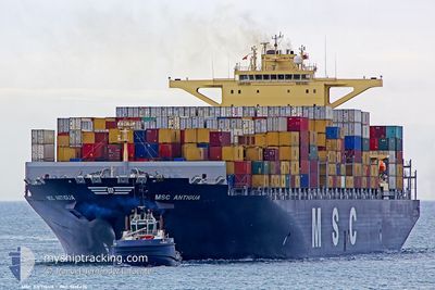
MSC ANTIGUA
Container Ship
Current Trip
| Time Travelled | 6 days |
|---|---|
| Remaining Time | 11 days |
| Distance Travelled | 2473.19 nm |
| Remaining Distance | 4507.93 nm |
| AVG Speed | 16.4 Knopen |
| MAX Speed | 17.6 Knopen |
| AVG Wind | 13.9 knots |
| MAX Wind | 24 knots |
| MIN Temp | 22.2°C / 71.96°F |
| MAX Temp | 30°C / 86°F |
| Diepgang | 14.4 M |
| Positie ontvangen | 14 h, 41 m geleden |
Current Position
| Lengtegraad | 54.52505° |
|---|---|
| Breedtegraat | -20.67656° |
| Status | Under way using engine |
| Snelheid | 16.4 Knopen |
| Koers | 233.1° |
| Gebied | Indian Ocean |
| Station | T-AIS |
| Positie ontvangen | 14 h, 41 m geleden |
Info
Information
The current position of MSC ANTIGUA is in Indian Ocean with coordinates -20.67656° / 54.52505° as reported on 2024-05-20 03:00 by AIS to our vessel tracker app. The vessel's current speed is 16.4 Knopen and is heading at the port of LOME. The estimated time of arrival as calculated by MyShipTracking vessel tracking app is 2024-06-01 05:48 LT
The vessel MSC ANTIGUA (IMO: 9619476, MMSI: 477305900) is a Container Ship that was built in 2013 ( 11 Jaar oud ). It's sailing under the flag of [HK] Hong Kong.
In this page you can find informations about the vessels current position, last detected port calls, and current voyage information. If the vessels is not in coverage by AIS you will find the latest position.
The current position of MSC ANTIGUA is detected by our AIS receivers and we are not responsible for the reliability of the data. The last position was recorded while the vessel was in Coverage by the Ais receivers of our vessel tracking app.
The current draught of MSC ANTIGUA as reported by AIS is 14.4 meters
Weather
| Temperature | 22.8°C / 73.04°F |
|---|---|
| Wind Speed | 24 knots |
| Direction | 128° SE |
| Pressure | 1023.9 hPa |
| Humidity | 64 % |
| Cloud Coverage | 100 % |
Featured Company
Last Port Calls
| Port | Arrival | Departure | Time In Port |
|---|---|---|---|
| 2024-05-13 04:22 | 2024-05-14 16:30 | 1 d | |
| 2024-05-05 04:01 | 2024-05-06 12:39 | 1 d | |
| 2024-05-02 14:08 | 2024-05-03 12:42 | 22 h | |
| 2024-04-29 13:07 | 2024-04-30 09:56 | 20 h | |
| 2024-04-24 20:43 | 2024-04-26 06:32 | 1 d | |
| 2024-03-22 03:46 | 2024-03-25 09:11 | 3 d | |
| 2024-03-14 13:38 | 2024-03-16 13:08 | 1 d | |
| 2024-03-07 19:05 | 2024-03-10 05:30 | 2 d | |
| 2024-03-03 12:32 | 2024-03-04 09:55 | 21 h | |
| 2024-03-02 16:55 |
Most Visited Ports (Last year)
| Port | Arrivals | |
|---|---|---|
| 3 | ||
| 3 | ||
| 3 | ||
| 3 | ||
| 3 | ||
| 2 |
Last Trips
| Origin | Departure | Destination | Arrival | Distance | |
|---|---|---|---|---|---|
| 2024-05-06 12:39 | 2024-05-13 04:22 | 1342.68 nm | |||
| 2024-05-03 12:42 | 2024-05-05 04:01 | 422.74 nm | |||
| 2024-04-30 09:56 | 2024-05-02 14:08 | 557.64 nm | |||
| 2024-04-26 06:32 | 2024-04-29 13:07 | 895.49 nm | |||
| 2024-03-25 09:11 | 2024-04-24 20:43 | 11595.74 nm | |||
| 2024-03-16 13:08 | 2024-03-22 03:46 | 1079.10 nm | |||
| 2024-03-10 05:30 | 2024-03-14 13:38 | 1016.58 nm | |||
| 2024-03-04 09:55 | 2024-03-07 19:05 | 433.18 nm | |||
| 2024-03-02 16:55 | 2024-03-03 12:32 | 114.00 nm |
Events
| Tijd | Evenement | Details | Positie / Bestemming | Info |
|---|---|---|---|---|
| 2024-05-20 03:21 | Status Changed | Default Under way using engine |
-20.73278 / 54.44451
LKCMB>TGLFW
|
Snelheid: 16.4 kn Koers: 233.1° |
| 2024-05-20 03:00 | Buitenbereik |
-20.67656 / 54.52505
Indian Ocean
LKCMB>TGLFW
|
Snelheid: 16.4 kn Koers: 233.1° |
|
| 2024-05-20 01:38 | Draught Changed | 14.4 13.4 |
-20.45630 / 54.84672
LKCMB>TGLFW
|
Snelheid: 16.2 kn Koers: 234.1° |
| 2024-05-20 01:38 | Destination Changed | LKCMB>TGLFW INMUN > LKCMB |
-20.45630 / 54.84672
LKCMB>TGLFW
|
Snelheid: 16.2 kn Koers: 234.1° |
| 2024-05-20 01:38 | ETA Changed | 2024/06/01 06:00 2024/05/11 06:30 |
-20.45630 / 54.84672
LKCMB>TGLFW
|
Snelheid: 16.2 kn Koers: 234.1° |
| 2024-05-19 23:45 | Wijzig zee gebeid | R�union part of the Indian Ocean Indian part of the Laccadive Sea |
-20.15786 / 55.28419
Indian Ocean
|
Snelheid: 16.5 kn Koers: 235.1° |
| 2024-05-19 23:45 | Status Changed | Under way using engine Default |
-20.15786 / 55.28419
INMUN > LKCMB
|
Snelheid: 16.3 kn Koers: 235° |
| 2024-05-19 23:30 | Binnenbereik |
-20.15786 / 55.28419
Indian Ocean
|
Snelheid: 16.5 kn Koers: 235.1° |
|
| 2024-05-14 11:00 | Vertrekhaven |
|
6.97265 / 79.83337
INMUN > LKCMB
|
Snelheid: 7.7 kn Koers: 358° |
| 2024-05-14 10:48 | Start beweging |
6.95161 / 79.83503
[LK] COLOMBO
|
Snelheid: 3.5 kn Koers: 356° |