
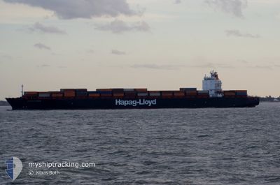
MONTREAL EXPRESS
Container Ship
Current Trip
| Time Travelled | 1 day |
|---|---|
| Remaining Time | --- |
| Distance Travelled | 449.77 nm |
| Remaining Distance | --- |
| AVG Speed | 14.1 Knopen |
| MAX Speed | 16.8 Knopen |
| AVG Wind | 11 knots |
| MAX Wind | 21 knots |
| MIN Temp | 10.1°C / 50.18°F |
| MAX Temp | 14.1°C / 57.38°F |
| Diepgang | 10.1 M |
| Positie ontvangen | Nu |
Current Position
| Lengtegraad | -0.94868° |
|---|---|
| Breedtegraat | 57.54314° |
| Status | Under way using engine |
| Snelheid | 13.5 Knopen |
| Koers | 327.2° |
| Gebied | North Sea |
| Station | T-AIS |
| Positie ontvangen | Nu |
Info
Information
The current position of MONTREAL EXPRESS is in North Sea with coordinates 57.54314° / -0.94868° as reported on 2024-06-15 07:45 by AIS to our vessel tracker app. The vessel's current speed is 13.5 Knopen and is heading at the port of MONTREAL. The estimated time of arrival as calculated by MyShipTracking vessel tracking app is 2024-06-24 00:00 LT
The vessel MONTREAL EXPRESS (IMO: 9253741, MMSI: 310750000) is a Container Ship that was built in 2003 ( 21 Jaar oud ). It's sailing under the flag of [BM] Bermuda.
In this page you can find informations about the vessels current position, last detected port calls, and current voyage information. If the vessels is not in coverage by AIS you will find the latest position.
The current position of MONTREAL EXPRESS is detected by our AIS receivers and we are not responsible for the reliability of the data. The last position was recorded while the vessel was in Coverage by the Ais receivers of our vessel tracking app.
The current draught of MONTREAL EXPRESS as reported by AIS is 10.1 meters
Weather
| Temperature | 11.4°C / 52.52°F |
|---|---|
| Wind Speed | 2 knots |
| Direction | 104° ESE |
| Pressure | 995.9 hPa |
| Humidity | 86.6 % |
| Cloud Coverage | 100 % |
Featured Company
Last Port Calls
| Port | Arrival | Departure | Time In Port |
|---|---|---|---|
| 2024-06-12 13:30 | 2024-06-13 23:51 | 1 d | |
| 2024-06-07 04:31 | 2024-06-07 21:37 | 17 h | |
| 2024-06-05 04:51 | 2024-06-05 20:02 | 15 h | |
| 2024-05-21 03:38 | 2024-05-24 09:10 | 3 d | |
| 2024-05-09 13:18 | 2024-05-11 00:52 | 1 d | |
| 2024-05-04 14:00 | 2024-05-05 16:12 | 1 d | |
| 2024-05-01 19:35 | 2024-05-02 09:33 | 13 h | |
| 2024-04-15 21:02 | 2024-04-19 07:53 | 3 d | |
| 2024-04-01 22:44 |
Most Visited Ports (Last year)
| Port | Arrivals | |
|---|---|---|
| 11 | ||
| 11 | ||
| 11 | ||
| 10 |
Last Trips
| Origin | Departure | Destination | Arrival | Distance | |
|---|---|---|---|---|---|
| 2024-06-07 21:37 | 2024-06-12 13:30 | 644.87 nm | |||
| 2024-06-05 20:02 | 2024-06-07 04:31 | 276.85 nm | |||
| 2024-05-24 09:10 | 2024-06-05 04:51 | 3102.43 nm | |||
| 2024-05-11 00:52 | 2024-05-21 03:38 | 3464.81 nm | |||
| 2024-05-05 16:12 | 2024-05-09 13:18 | 519.68 nm | |||
| 2024-05-02 09:33 | 2024-05-04 14:00 | 329.51 nm | |||
| 2024-04-19 07:53 | 2024-05-01 19:35 | 3107.12 nm | |||
| 2024-04-01 22:44 | 2024-04-15 21:02 | 4184.70 nm |
Events
| Tijd | Evenement | Details | Positie / Bestemming | Info |
|---|---|---|---|---|
| 2024-06-15 07:09 | Gevonden in zee | United Kingdom part of the North Sea |
57.44420 / -.77681
North Sea
DEHAM>>>CAMTR
|
Snelheid: 13.7 kn Koers: 318.2° |
| 2024-06-15 07:09 | Status Changed | Under way using engine Default |
57.44338 / -.77541
DEHAM>>>CAMTR
|
Snelheid: 13.3 kn Koers: 318° |
| 2024-06-15 06:59 | Binnenbereik |
57.44420 / -.77681
North Sea
DEHAM>>>CAMTR
|
Snelheid: 13.7 kn Koers: 318.2° |
|
| 2024-06-14 16:22 | Status Changed | Default Under way using engine |
55.50219 / 3.92076
DEHAM>>>CAMTR
|
Snelheid: 13.7 kn Koers: 299.5° |
| 2024-06-14 16:02 | Buitenbereik |
55.46431 / 4.03771
North Sea
DEHAM>>>CAMTR
|
Snelheid: 13.7 kn Koers: 299.5° |
|
| 2024-06-14 16:01 | Wijzig zee gebeid | Dutch part of the North Sea German part of the North Sea |
55.46307 / 4.04156
North Sea
DEHAM>>>CAMTR
|
Snelheid: 13.7 kn Koers: 298.7° |
| 2024-06-14 14:44 | Status Changed | Under way using engine Default |
55.30578 / 4.46152
DEHAM>>>CAMTR
|
Snelheid: 13.3 kn Koers: 303° |
| 2024-06-14 14:06 | Status Changed | Default Under way using engine |
55.22780 / 4.66567
DEHAM>>>CAMTR
|
Snelheid: 13.6 kn Koers: 304.6° |
| 2024-06-14 13:21 | Status Changed | Under way using engine Default |
55.13429 / 4.90662
DEHAM>>>CAMTR
|
Snelheid: 13.6 kn Koers: 302° |
| 2024-06-14 13:21 | Binnenbereik |
55.13879 / 4.89495
North Sea
DEHAM>>>CAMTR
|
Snelheid: 13.5 kn Koers: 304.4° |