
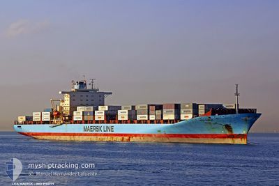
LICA MAERSK
Container Ship
Current Trip
USEWR > PAMIT
| Time Travelled | 1 day |
|---|---|
| Remaining Time | --- |
| Distance Travelled | 154.81 nm |
| Remaining Distance | --- |
| AVG Speed | 12.9 Knopen |
| MAX Speed | 21.7 Knopen |
| AVG Wind | 5.3 knots |
| MAX Wind | 17 knots |
| MIN Temp | 25.5°C / 77.9°F |
| MAX Temp | 30.4°C / 86.72°F |
| Diepgang | 12.8 M |
| Positie ontvangen | 4 h, 8 m geleden |
Current Position
| Lengtegraad | -79.51579° |
|---|---|
| Breedtegraat | 8.88080° |
| Status | Under way using engine |
| Snelheid | 11.3 Knopen |
| Koers | 144.7° |
| Gebied | North Pacific Ocean |
| Station | T-AIS |
| Positie ontvangen | 4 h, 8 m geleden |
Info
Information
The current position of LICA MAERSK is in North Pacific Ocean with coordinates 8.88080° / -79.51579° as reported on 2024-06-02 01:04 by AIS to our vessel tracker app. The vessel's current speed is 11.3 Knopen
The vessel LICA MAERSK (IMO: 9190779, MMSI: 477714300) is a Container Ship that was built in 2001 ( 23 Jaar oud ). It's sailing under the flag of [HK] Hong Kong.
In this page you can find informations about the vessels current position, last detected port calls, and current voyage information. If the vessels is not in coverage by AIS you will find the latest position.
The current position of LICA MAERSK is detected by our AIS receivers and we are not responsible for the reliability of the data. The last position was recorded while the vessel was in Coverage by the Ais receivers of our vessel tracking app.
The current draught of LICA MAERSK as reported by AIS is 12.8 meters
Weather
| Temperature | 28.9°C / 84.02°F |
|---|---|
| Wind Speed | 11 knots |
| Direction | 353° N |
| Pressure | 1008.4 hPa |
| Humidity | 82.7 % |
| Cloud Coverage | 100 % |
Featured Company
Last Port Calls
| Port | Arrival | Departure | Time In Port |
|---|---|---|---|
| 2024-05-30 17:44 | 2024-05-31 18:35 | 1 d | |
| 2024-05-24 03:55 | 2024-05-25 04:26 | 1 d | |
| 2024-05-13 12:33 | 2024-05-14 02:32 | 13 h | |
| 2024-05-06 16:46 | 2024-05-07 21:37 | 1 d | |
| 2024-05-04 18:04 | 2024-05-06 08:36 | 1 d | |
| 2024-05-01 07:31 | 2024-05-03 20:13 | 2 d | |
| 2024-04-29 15:39 | 2024-04-30 15:59 | 1 d | |
| 2024-04-25 12:57 | 2024-04-26 09:14 | 20 h | |
| 2024-04-24 14:44 | 2024-04-25 07:09 | 16 h | |
| 2024-04-11 20:17 | 2024-04-13 16:34 | 1 d |
Most Visited Ports (Last year)
| Port | Arrivals | |
|---|---|---|
| 16 | ||
| 11 | ||
| 9 | ||
| 9 | ||
| 6 | ||
| 6 |
Last Trips
| Origin | Departure | Destination | Arrival | Distance | |
|---|---|---|---|---|---|
| 2024-05-25 04:26 | 2024-05-30 17:44 | 2038.39 nm | |||
| 2024-05-14 02:32 | 2024-05-24 03:55 | 3272.88 nm | |||
| 2024-05-07 21:37 | 2024-05-13 12:33 | 1946.16 nm | |||
| 2024-05-06 08:36 | 2024-05-06 16:46 | 62.55 nm | |||
| 2024-05-03 20:13 | 2024-05-04 18:04 | 326.81 nm | |||
| 2024-04-30 15:59 | 2024-05-01 07:31 | 277.83 nm | |||
| 2024-04-26 09:14 | 2024-04-29 15:39 | 1520.38 nm | |||
| 2024-04-25 07:09 | 2024-04-25 12:57 | 38.31 nm | |||
| 2024-04-13 16:34 | 2024-04-24 14:44 | 4341.62 nm | |||
| 2024-04-08 21:03 | 2024-04-11 20:17 | 826.43 nm |
Events
| Tijd | Evenement | Details | Positie / Bestemming | Info |
|---|---|---|---|---|
| 2024-06-02 01:12 | Status Changed | Default Under way using engine |
8.85539 / -79.49764
USEWR > PAMIT
|
Snelheid: 11.3 kn Koers: 144.7° |
| 2024-06-02 01:04 | Gevonden in zee | Panamanian part of the North Pacific Ocean |
8.88080 / -79.51579
North Pacific Ocean
|
Snelheid: 11.3 kn Koers: 144.7° |
| 2024-06-02 01:04 | Status Changed | Under way using engine Default |
8.88080 / -79.51579
USEWR > PAMIT
|
Snelheid: 8 kn Koers: 141° |
| 2024-06-02 01:04 | Buitenbereik |
8.88080 / -79.51579
North Pacific Ocean
|
Snelheid: 11.3 kn Koers: 144.7° |
|
| 2024-06-02 00:52 | Binnenbereik |
8.88080 / -79.51579
North Pacific Ocean
|
Snelheid: 11.3 kn Koers: 144.7° |
|
| 2024-06-02 00:08 | Start beweging | 1.08 nm, North West of RODMAN |
8.97194 / -79.58141
USEWR > PAMIT
|
Snelheid: 4.5 kn Koers: 142° |
| 2024-06-01 22:56 | Status Changed | Default Under way using engine |
8.98206 / -79.58950
USEWR > PAMIT
|
Snelheid: 1.2 kn Koers: 143° |
| 2024-06-01 22:51 | Status Changed | Under way using engine Default |
8.98348 / -79.59060
USEWR > PAMIT
|
Snelheid: 1.1 kn Koers: 141° |
| 2024-06-01 22:51 | Buitenbereik |
8.98348 / -79.59060
North Atlantic Ocean
|
Snelheid: 1.2 kn Koers: 141.9° |
|
| 2024-06-01 22:44 | Stop beweging | 2.03 nm, North West of RODMAN |
8.98453 / -79.59147
USEWR > PAMIT
|
Snelheid: 0.1 kn Koers: 142° |