
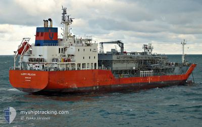
HAPPY PELICAN
Tanker D
Current Trip
| Trip Time | 42 mins |
|---|---|
| Trip Distance | 2.83 nm |
| AVG Speed | 5.3 Knopen |
| MAX Speed | 5.7 Knopen |
| Diepgang | 6.3 M |
| AVG Wind | 11.3 knots |
| MAX Wind | 11.8 knots |
| MIN Temp | 16.4°C / 61.52°F |
| MAX Temp | 16.5°C / 61.7°F |
| Positie ontvangen | 1 d geleden |
Current Position
| Lengtegraad | 4.93323° |
|---|---|
| Breedtegraat | 43.41121° |
| Status | At anchor |
| Snelheid | |
| Koers | 328° |
| Gebied | Mediterranean Sea - Western Basin |
| Station | T-AIS |
| Positie ontvangen | 1 d geleden |
Info
Information
The current position of HAPPY PELICAN is in Mediterranean Sea - Western Basin with coordinates 43.41121° / 4.93323° as reported on 2024-06-02 09:11 by AIS to our vessel tracker app. The vessel's current speed is 0 Knopen and is currently inside the port of LAVERA.
The vessel HAPPY PELICAN (IMO: 9618850, MMSI: 235094449) is a Tanker D It's sailing under the flag of [GB] United Kingdom.
In this page you can find informations about the vessels current position, last detected port calls, and current voyage information. If the vessels is not in coverage by AIS you will find the latest position.
The current position of HAPPY PELICAN is detected by our AIS receivers and we are not responsible for the reliability of the data. The last position was recorded while the vessel was in Coverage by the Ais receivers of our vessel tracking app.
The current draught of HAPPY PELICAN as reported by AIS is 6.3 meters
Weather
| Temperature | 17.8°C / 64.04°F |
|---|---|
| Wind Speed | 13 knots |
| Direction | 339° NNW |
| Pressure | 1013.8 hPa |
| Humidity | 70.6 % |
| Cloud Coverage | 1 % |
Featured Company
Last Port Calls
Most Visited Ports (Last year)
| Port | Arrivals | |
|---|---|---|
| 14 | ||
| 9 | ||
| 5 | ||
| 3 | ||
| 3 | ||
| 2 |
Last Trips
| Origin | Departure | Destination | Arrival | Distance | |
|---|---|---|---|---|---|
| 2024-06-03 03:10 | 2024-06-03 03:52 | 2.83 nm | |||
| 2024-05-13 09:41 | 2024-06-02 16:32 | 2822.55 nm | |||
| 2024-05-04 10:20 | 2024-05-12 03:16 | 430.45 nm | |||
| 2024-04-29 21:18 | 2024-05-02 18:37 | 372.61 nm | |||
| 2024-04-15 09:28 | 2024-04-28 07:33 | 3134.66 nm | |||
| 2024-03-23 15:40 | 2024-04-14 11:17 | 3767.42 nm |
Events
| Tijd | Evenement | Details | Positie / Bestemming | Info |
|---|---|---|---|---|
| 2024-06-03 01:52 | Stop beweging |
43.39635 / 4.99172
[FR] LAVERA
|
Snelheid: Koers: 318° |
|
| 2024-06-03 01:52 | Aankomsthaven |
|
43.39635 / 4.99172
[FR] LAVERA
|
Snelheid: 0.8 kn Koers: 2° |
| 2024-06-03 01:10 | Start beweging | 1.89 nm, West of PORT DE BOUC |
43.40501 / 4.94204
IT VDA > > FR LAV
|
Snelheid: 10.5 kn Koers: 140° |
| 2024-06-03 01:10 | Vertrekhaven |
|
43.40501 / 4.94204
IT VDA > > FR LAV
|
Snelheid: 4.9 kn Koers: 139° |
| 2024-06-02 14:32 | Aankomsthaven |
|
43.41101 / 4.93208
[FR] FOS
|
Snelheid: 0.1 kn Koers: 5° |
| 2024-06-02 09:14 | Status Changed | Default At anchor |
43.41123 / 4.93313
IT VDA > > FR LAV
|
Snelheid: Koers: 328° |
| 2024-06-02 09:11 | Status Changed | At anchor Default |
43.41121 / 4.93323
IT VDA > > FR LAV
|
Snelheid: 0.1 kn Koers: 329° |
| 2024-06-02 09:11 | Buitenbereik |
43.41121 / 4.93323
Mediterranean Sea - Western Basin
|
Snelheid: Koers: 33.4° |
|
| 2024-06-02 08:44 | Status Changed | Default At anchor |
43.41119 / 4.93308
IT VDA > > FR LAV
|
Snelheid: Koers: 329° |
| 2024-06-02 08:41 | Status Changed | At anchor Default |
43.41118 / 4.93316
IT VDA > > FR LAV
|
Snelheid: 0.1 kn Koers: 340° |