
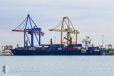
GSL ALICE
Container Ship
Current Trip
| Time Travelled | 1 day |
|---|---|
| Remaining Time | --- |
| Distance Travelled | 469.78 nm |
| Remaining Distance | --- |
| AVG Speed | 14.9 Knopen |
| MAX Speed | 17.6 Knopen |
| AVG Wind | 12.9 knots |
| MAX Wind | 28.3 knots |
| MIN Temp | 16.5°C / 61.7°F |
| MAX Temp | 20.8°C / 69.44°F |
| Diepgang | 12.4 M |
| Positie ontvangen | 56 m geleden |
Current Position
| Lengtegraad | -11.27580° |
|---|---|
| Breedtegraat | 30.60442° |
| Status | Under way using engine |
| Snelheid | 16.8 Knopen |
| Koers | 219.9° |
| Gebied | North Atlantic Ocean |
| Station | T-AIS |
| Positie ontvangen | 56 m geleden |
Info
Information
The current position of GSL ALICE is in North Atlantic Ocean with coordinates 30.60442° / -11.27580° as reported on 2024-06-03 09:09 by AIS to our vessel tracker app. The vessel's current speed is 16.8 Knopen and is heading at the port of NASSIT. The estimated time of arrival as calculated by MyShipTracking vessel tracking app is 2024-06-07 07:00 LT
The vessel GSL ALICE (IMO: 9509164, MMSI: 636017907) is a Container Ship that was built in 2014 ( 10 Jaar oud ). It's sailing under the flag of [LR] Liberia.
In this page you can find informations about the vessels current position, last detected port calls, and current voyage information. If the vessels is not in coverage by AIS you will find the latest position.
The current position of GSL ALICE is detected by our AIS receivers and we are not responsible for the reliability of the data. The last position was recorded while the vessel was in Coverage by the Ais receivers of our vessel tracking app.
The current draught of GSL ALICE as reported by AIS is 12.4 meters
Weather
| Temperature | 19°C / 66.2°F |
|---|---|
| Wind Speed | 13 knots |
| Direction | 348° NNW |
| Pressure | 1015.8 hPa |
| Humidity | 78.4 % |
| Cloud Coverage | 98 % |
Featured Company
Last Port Calls
| Port | Arrival | Departure | Time In Port |
|---|---|---|---|
| 2024-06-01 16:26 | 2024-06-02 07:25 | 14 h | |
| 2024-05-30 00:03 | 2024-05-31 04:10 | 1 d | |
| 2024-05-27 01:39 | 2024-05-28 17:20 | 1 d | |
| 2024-05-12 18:20 | 2024-05-13 20:32 | 1 d | |
| 2024-05-11 09:32 | 2024-05-12 09:47 | 1 d | |
| 2024-05-08 17:24 | 2024-05-09 08:04 | 14 h | |
| 2024-05-03 08:28 | 2024-05-06 01:16 | 2 d | |
| 2024-04-26 00:36 | 2024-04-26 19:14 | 18 h | |
| 2024-04-22 12:29 | 2024-04-23 13:47 | 1 d | |
| 2024-04-21 00:56 | 2024-04-21 22:27 | 21 h |
Last Trips
| Origin | Departure | Destination | Arrival | Distance | |
|---|---|---|---|---|---|
| 2024-05-31 04:10 | 2024-06-01 16:26 | 27.43 nm | |||
| 2024-05-28 17:20 | 2024-05-30 00:03 | 417.54 nm | |||
| 2024-05-13 20:32 | 2024-05-27 01:39 | 4066.04 nm | |||
| 2024-05-12 09:47 | 2024-05-12 18:20 | 138.15 nm | |||
| 2024-05-09 08:04 | 2024-05-11 09:32 | 671.00 nm | |||
| 2024-05-06 01:16 | 2024-05-08 17:24 | 302.66 nm | |||
| 2024-04-26 19:14 | 2024-05-03 08:28 | 2374.94 nm | |||
| 2024-04-23 13:47 | 2024-04-26 00:36 | 723.18 nm | |||
| 2024-04-21 22:27 | 2024-04-22 12:29 | 59.95 nm | |||
| 2024-04-18 13:13 | 2024-04-21 00:56 | 420.37 nm |
Events
| Tijd | Evenement | Details | Positie / Bestemming | Info |
|---|---|---|---|---|
| 2024-06-03 09:24 | Status Changed | Default Under way using engine |
30.54948 / -11.32696
SLFNA
|
Snelheid: 16.8 kn Koers: 219.9° |
| 2024-06-03 09:09 | Status Changed | Under way using engine Default |
30.60442 / -11.27580
SLFNA
|
Snelheid: 16.9 kn Koers: 219° |
| 2024-06-03 08:38 | Status Changed | Default Under way using engine |
30.71506 / -11.17250
SLFNA
|
Snelheid: 17 kn Koers: 218.6° |
| 2024-06-03 08:19 | Status Changed | Under way using engine Default |
30.78584 / -11.10641
SLFNA
|
Snelheid: 16.9 kn Koers: 219° |
| 2024-06-03 08:11 | Binnenbereik |
30.78584 / -11.10641
North Atlantic Ocean
SLFNA
|
Snelheid: 17 kn Koers: 219.1° |
|
| 2024-06-03 07:19 | Status Changed | Default Under way using engine |
31.00623 / -10.90022
SLFNA
|
Snelheid: 16.9 kn Koers: 219.3° |
| 2024-06-03 07:09 | Status Changed | Under way using engine Default |
31.04278 / -10.86604
SLFNA
|
Snelheid: 17 kn Koers: 220° |
| 2024-06-03 02:42 | Status Changed | Default Under way using engine |
32.05176 / -9.99447
SLFNA
|
Snelheid: 16.4 kn Koers: 210.3° |
| 2024-06-03 02:34 | Status Changed | Under way using engine Default |
32.08377 / -9.97353
SLFNA
|
Snelheid: 16.8 kn Koers: 209° |
| 2024-06-03 02:34 | Buitenbereik |
32.08377 / -9.97353
North Atlantic Ocean
SLFNA
|
Snelheid: 16.4 kn Koers: 210.3° |