
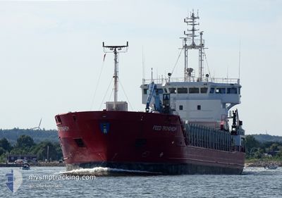
FEED TRONDHEIM
General Cargo
Current Trip
| Time Travelled | 1 day |
|---|---|
| Remaining Time | 1 day |
| Distance Travelled | 333.47 nm |
| Remaining Distance | 357.65 nm |
| AVG Speed | 11 Knopen |
| MAX Speed | 11.8 Knopen |
| AVG Wind | 8.2 knots |
| MAX Wind | 14 knots |
| MIN Temp | 11.1°C / 51.98°F |
| MAX Temp | 17.5°C / 63.5°F |
| Diepgang | 4.9 M |
| Positie ontvangen | Nu |
Current Position
| Lengtegraad | 12.72567° |
|---|---|
| Breedtegraat | 55.94517° |
| Status | Under way using engine |
| Snelheid | 9.7 Knopen |
| Koers | 338° |
| Gebied | Kattegat |
| Station | T-AIS |
| Positie ontvangen | Nu |
Info
Information
The current position of FEED TRONDHEIM is in Kattegat with coordinates 55.94517° / 12.72567° as reported on 2024-06-03 02:31 by AIS to our vessel tracker app. The vessel's current speed is 9.7 Knopen and is heading at the port of FISKA. The estimated time of arrival as calculated by MyShipTracking vessel tracking app is 2024-06-04 17:33 LT
The vessel FEED TRONDHEIM (IMO: 9226798, MMSI: 305371000) is a General Cargo that was built in 2002 ( 22 Jaar oud ). It's sailing under the flag of [AG] Antigua Barbuda.
In this page you can find informations about the vessels current position, last detected port calls, and current voyage information. If the vessels is not in coverage by AIS you will find the latest position.
The current position of FEED TRONDHEIM is detected by our AIS receivers and we are not responsible for the reliability of the data. The last position was recorded while the vessel was in Coverage by the Ais receivers of our vessel tracking app.
The current draught of FEED TRONDHEIM as reported by AIS is 4.9 meters
Weather
| Temperature | 13.2°C / 55.76°F |
|---|---|
| Wind Speed | 8 knots |
| Direction | 276° W |
| Pressure | 1012.1 hPa |
| Humidity | 95.3 % |
| Cloud Coverage | 23 % |
Featured Company
Last Port Calls
| Port | Arrival | Departure | Time In Port |
|---|---|---|---|
| 2024-05-31 20:35 | 2024-06-01 23:36 | 1 d | |
| 2024-05-28 20:08 | 2024-05-30 10:13 | 1 d | |
| 2024-05-22 15:51 | 2024-05-24 13:35 | 1 d | |
| 2024-05-19 20:05 | 2024-05-19 23:35 | 3 h | |
| 2024-05-14 16:25 | 2024-05-15 12:52 | 20 h | |
| 2024-05-07 20:44 | 2024-05-10 05:00 | 2 d | |
| 2024-05-05 11:11 | 2024-05-06 08:20 | 21 h | |
| 2024-05-03 05:21 | 2024-05-03 13:54 | 8 h | |
| 2024-04-30 14:04 | 2024-05-02 21:54 | 2 d | |
| 2024-04-27 04:22 | 2024-04-27 17:23 | 13 h |
Last Trips
| Origin | Departure | Destination | Arrival | Distance | |
|---|---|---|---|---|---|
| 2024-05-30 10:13 | 2024-05-31 20:35 | 371.55 nm | |||
| 2024-05-24 13:35 | 2024-05-28 20:08 | 735.47 nm | |||
| 2024-05-19 23:35 | 2024-05-22 15:51 | 531.79 nm | |||
| 2024-05-15 12:52 | 2024-05-19 20:05 | 562.56 nm | |||
| 2024-05-10 05:00 | 2024-05-14 16:25 | 1021.36 nm | |||
| 2024-05-06 08:20 | 2024-05-07 20:44 | 269.63 nm | |||
| 2024-05-03 13:54 | 2024-05-05 11:11 | 401.01 nm | |||
| 2024-05-02 21:54 | 2024-05-03 05:21 | 11.97 nm | |||
| 2024-04-27 17:23 | 2024-04-30 14:04 | 698.02 nm | |||
| 2024-04-26 01:46 | 2024-04-27 04:22 | 267.73 nm |
Events
| Tijd | Evenement | Details | Positie / Bestemming | Info |
|---|---|---|---|---|
| 2024-06-03 01:43 | Wijzig zee gebeid | Swedish part of the Kattegat Danish part of the Kattegat |
55.81767 / 12.72000
Kattegat
FISKAA
|
Snelheid: 9.6 kn Koers: 13° |
| 2024-06-02 23:47 | Wijzig zee gebeid | Danish part of the Kattegat Swedish part of the Kattegat |
55.49216 / 12.70767
Kattegat
FISKAA
|
Snelheid: 10.5 kn Koers: 8° |
| 2024-06-02 22:56 | Wijzig zee gebeid | Swedish part of the Kattegat Swedish part of the Baltic Sea |
55.34084 / 12.66483
Kattegat
FISKAA
|
Snelheid: 10.6 kn Koers: 6° |
| 2024-06-02 16:07 | Wijzig zee gebeid | Swedish part of the Baltic Sea Danish part of the Kattegat |
55.44467 / 14.65200
Baltic Sea
FISKAA
|
Snelheid: 10.6 kn Koers: 267° |
| 2024-06-02 12:37 | Wijzig zee gebeid | Danish part of the Kattegat Swedish part of the Baltic Sea |
55.51433 / 15.79517
Kattegat
FISKAA
|
Snelheid: 11.6 kn Koers: 264° |
| 2024-06-02 10:50 | Status Changed | Under way using engine Default |
55.55050 / 16.39100
FISKAA
|
Snelheid: 11.3 kn Koers: 264° |
| 2024-06-02 10:26 | Status Changed | Default Under way using engine |
55.55883 / 16.52233
FISKAA
|
Snelheid: 11.2 kn Koers: 263° |
| 2024-06-02 10:15 | Status Changed | Under way using engine Default |
55.56266 / 16.58433
FISKAA
|
Snelheid: 11.1 kn Koers: 264° |
| 2024-06-02 09:42 | Status Changed | Default Under way using engine |
55.57350 / 16.76050
FISKAA
|
Snelheid: 11.1 kn Koers: 264° |
| 2024-06-02 09:38 | Status Changed | Under way using engine Default |
55.57500 / 16.78383
FISKAA
|
Snelheid: 11 kn Koers: 263° |