
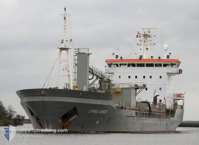
CYPRUS CEMENT
Cement Carrier
Current Trip
| Time Travelled | 7 days |
|---|---|
| Remaining Time | 1 day |
| Distance Travelled | 1855.14 nm |
| Remaining Distance | 468.44 nm |
| AVG Speed | 11.1 Knopen |
| MAX Speed | 13.1 Knopen |
| AVG Wind | 10.4 knots |
| MAX Wind | 23 knots |
| MIN Temp | -0.4°C / 31.28°F |
| MAX Temp | 13.2°C / 55.76°F |
| Diepgang | 4.8 M |
| Positie ontvangen | 11 h, 45 m geleden |
Current Position
| Lengtegraad | -2.73082° |
|---|---|
| Breedtegraat | 58.69911° |
| Status | Under way using engine |
| Snelheid | 10.8 Knopen |
| Koers | 93.9° |
| Gebied | North Sea |
| Station | T-AIS |
| Positie ontvangen | 11 h, 45 m geleden |
Info
Information
The current position of CYPRUS CEMENT is in North Sea with coordinates 58.69911° / -2.73082° as reported on 2024-05-25 20:07 by AIS to our vessel tracker app. The vessel's current speed is 10.8 Knopen and is heading at the port of AALBORG. The estimated time of arrival as calculated by MyShipTracking vessel tracking app is 2024-05-28 01:09 LT
The vessel CYPRUS CEMENT (IMO: 9037173, MMSI: 255805390) is a Cement Carrier that was built in 2002 ( 22 Jaar oud ). It's sailing under the flag of [PT] Portugal.
In this page you can find informations about the vessels current position, last detected port calls, and current voyage information. If the vessels is not in coverage by AIS you will find the latest position.
The current position of CYPRUS CEMENT is detected by our AIS receivers and we are not responsible for the reliability of the data. The last position was recorded while the vessel was in Coverage by the Ais receivers of our vessel tracking app.
The current draught of CYPRUS CEMENT as reported by AIS is 4.8 meters
Weather
| Temperature | 11.2°C / 52.16°F |
|---|---|
| Wind Speed | 10 knots |
| Direction | 101° E |
| Pressure | 1016 hPa |
| Humidity | 94.7 % |
| Cloud Coverage | 100 % |
Featured Company
Last Port Calls
| Port | Arrival | Departure | Time In Port |
|---|---|---|---|
| 2024-05-15 20:34 | 2024-05-19 01:06 | 3 d | |
| 2024-05-10 00:49 | 2024-05-10 10:39 | 9 h | |
| 2024-05-04 08:05 | 2024-05-05 03:34 | 19 h | |
| 2024-04-28 05:08 | 2024-04-29 02:17 | 21 h | |
| 2024-04-19 19:44 | 2024-04-23 19:17 | 3 d | |
| 2024-04-13 12:21 | 2024-04-14 07:10 | 18 h | |
| 2024-04-08 01:18 | 2024-04-08 22:16 | 20 h | |
| 2024-03-28 10:01 | 2024-03-28 22:57 | 12 h | |
| 2024-03-23 07:07 | 2024-03-23 21:04 | 13 h | |
| 2024-03-18 01:27 | 2024-03-18 19:33 | 18 h |
Last Trips
| Origin | Departure | Destination | Arrival | Distance | |
|---|---|---|---|---|---|
| 2024-05-10 10:39 | 2024-05-15 20:34 | 1206.63 nm | |||
| 2024-05-05 03:34 | 2024-05-10 00:49 | 1199.35 nm | |||
| 2024-04-29 02:17 | 2024-05-04 08:05 | 1266.63 nm | |||
| 2024-04-23 19:17 | 2024-04-28 05:08 | 1202.62 nm | |||
| 2024-04-14 07:10 | 2024-04-19 19:44 | 1269.03 nm | |||
| 2024-04-08 22:16 | 2024-04-13 12:21 | 1210.51 nm | |||
| 2024-03-28 22:57 | 2024-04-08 01:18 | 1457.76 nm | |||
| 2024-03-23 21:04 | 2024-03-28 10:01 | 1211.98 nm | |||
| 2024-03-18 19:33 | 2024-03-23 07:07 | 1202.17 nm | |||
| 2024-03-11 23:41 | 2024-03-18 01:27 | 1230.41 nm |
Events
| Tijd | Evenement | Details | Positie / Bestemming | Info |
|---|---|---|---|---|
| 2024-05-25 20:15 | Status Changed | Default Under way using engine |
58.69713 / -2.69018
DKROR
|
Snelheid: 10.8 kn Koers: 93.9° |
| 2024-05-25 20:07 | Buitenbereik |
58.69911 / -2.73082
North Sea
DKROR
|
Snelheid: 10.8 kn Koers: 93.9° |
|
| 2024-05-25 18:14 | Gevonden in zee | United Kingdom part of the North Sea |
58.71349 / -3.40849
North Sea
DKROR
|
Snelheid: 9.1 kn Koers: 96.9° |
| 2024-05-25 15:56 | ETA Changed | 2024/05/28 04:00 2024/05/28 20:00 |
58.76281 / -4.07398
DKROR
|
Snelheid: 8.5 kn Koers: 100.5° |
| 2024-05-25 15:20 | Draught Changed | 4.8 7.2 |
58.77891 / -4.24066
DKROR
|
Snelheid: 8.6 kn Koers: 98.6° |
| 2024-05-25 15:20 | Destination Changed | DKROR ISHEL |
58.77891 / -4.24066
DKROR
|
Snelheid: 8.6 kn Koers: 98.6° |
| 2024-05-25 15:20 | ETA Changed | 2024/05/28 20:00 2024/05/09 22:00 |
58.77891 / -4.24066
DKROR
|
Snelheid: 8.6 kn Koers: 98.6° |
| 2024-05-25 14:36 | Gevonden in zee | United Kingdom part of the North Atlantic Ocean |
58.79564 / -4.44378
North Atlantic Ocean
|
Snelheid: 9.1 kn Koers: 94.9° |
| 2024-05-25 14:36 | Status Changed | Under way using engine Default |
58.79564 / -4.44378
ISHEL
|
Snelheid: 9 kn Koers: 104° |
| 2024-05-25 14:34 | Binnenbereik |
58.79564 / -4.44378
North Atlantic Ocean
|
Snelheid: 9.1 kn Koers: 94.9° |