
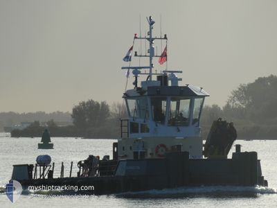
CT BARNSTON
Towing
Current Trip
| Time Travelled | 2 days |
|---|---|
| Remaining Time | 1 day |
| Distance Travelled | 248.97 nm |
| Remaining Distance | 173.60 nm |
| AVG Speed | 4.6 Knopen |
| MAX Speed | 9.7 Knopen |
| AVG Wind | 11.1 knots |
| MAX Wind | 18 knots |
| MIN Temp | 9.8°C / 49.64°F |
| MAX Temp | 12.9°C / 55.22°F |
| Diepgang | 0 M |
| Positie ontvangen | 1 m geleden |
Current Position
| Lengtegraad | -5.31842° |
|---|---|
| Breedtegraat | 54.41923° |
| Status | Towing Astern |
| Snelheid | 6.4 Knopen |
| Koers | 172.2° |
| Gebied | Inner Seas off the West Coast of Scotland |
| Station | T-AIS |
| Positie ontvangen | 1 m geleden |
Info
Information
The current position of CT BARNSTON is in Inner Seas off the West Coast of Scotland with coordinates 54.41923° / -5.31842° as reported on 2024-05-19 17:57 by AIS to our vessel tracker app. The vessel's current speed is 6.4 Knopen and is heading at the port of PEMBROKE. The estimated time of arrival as calculated by MyShipTracking vessel tracking app is 2024-05-20 22:36 LT
The vessel CT BARNSTON (IMO: 99678938, MMSI: 232043206) is a Towing It's sailing under the flag of [GB] United Kingdom.
In this page you can find informations about the vessels current position, last detected port calls, and current voyage information. If the vessels is not in coverage by AIS you will find the latest position.
The current position of CT BARNSTON is detected by our AIS receivers and we are not responsible for the reliability of the data. The last position was recorded while the vessel was in Coverage by the Ais receivers of our vessel tracking app.
Weather
| Temperature | 11.3°C / 52.34°F |
|---|---|
| Wind Speed | 16 knots |
| Direction | 348° NNW |
| Pressure | 1017.2 hPa |
| Humidity | 91.2 % |
| Cloud Coverage | 87 % |
Featured Company
Last Port Calls
| Port | Arrival | Departure | Time In Port |
|---|---|---|---|
| 2024-05-10 10:34 | 2024-05-17 17:30 | 7 d | |
| 2024-05-07 15:27 | 2024-05-08 14:17 | 22 h | |
| 2024-05-07 14:50 | 2024-05-07 15:05 | 14 m | |
| 2024-05-07 14:06 | 2024-05-07 14:11 | 5 m | |
| 2024-04-25 09:26 | 2024-04-25 09:50 | 23 m | |
| 2024-04-25 08:34 | 2024-04-25 08:48 | 13 m | |
| 2024-04-24 12:04 | 2024-04-25 08:20 | 20 h | |
| 2024-04-24 10:49 | 2024-04-24 11:36 | 47 m | |
| 2024-04-21 11:43 | 2024-04-24 09:44 | 2 d | |
| 2024-04-20 15:46 | 2024-04-21 04:58 | 13 h |
Last Trips
| Origin | Departure | Destination | Arrival | Distance | |
|---|---|---|---|---|---|
| 2024-05-08 14:17 | 2024-05-10 10:34 | 351.58 nm | |||
| 2024-05-07 15:05 | 2024-05-07 15:27 | 1.84 nm | |||
| 2024-05-07 14:11 | 2024-05-07 14:50 | 4.56 nm | |||
| 2024-04-25 09:50 | 2024-05-07 14:06 | 106.61 nm | |||
| 2024-04-25 08:48 | 2024-04-25 09:26 | 4.11 nm | |||
| 2024-04-25 08:20 | 2024-04-25 08:34 | 1.92 nm | |||
| 2024-04-24 11:36 | 2024-04-24 12:04 | 5.08 nm | |||
| 2024-04-24 09:44 | 2024-04-24 10:49 | 5.42 nm | |||
| 2024-04-21 04:58 | 2024-04-21 11:43 | 52.74 nm | |||
| 2024-04-20 07:36 | 2024-04-20 15:46 | 54.25 nm |
Events
| Tijd | Evenement | Details | Positie / Bestemming | Info |
|---|---|---|---|---|
| 2024-05-19 17:47 | Wijzig zee gebeid | United Kingdom part of the Irish Sea and St. George's Channel United Kingdom part of the Inner Seas off the West Coast of Scotland |
54.43801 / -5.32252
Irish Sea and St. George's Channel
PEMBROKE
|
Snelheid: 6.8 kn Koers: 173.6° |
| 2024-05-19 13:02 | Status Changed | Towing Astern Default |
54.84996 / -5.54317
PEMBROKE
|
Snelheid: 3.9 kn Koers: 137° |
| 2024-05-19 12:47 | Binnenbereik |
54.84996 / -5.54317
Inner Seas off the West Coast of Scotland
PEMBROKE
|
Snelheid: 3.8 kn Koers: 144.2° |
|
| 2024-05-19 11:19 | Status Changed | Default Towing Astern |
54.94101 / -5.63351
PEMBROKE
|
Snelheid: 3.7 kn Koers: 142° |
| 2024-05-19 11:18 | Status Changed | Towing Astern Default |
54.94120 / -5.63373
PEMBROKE
|
Snelheid: 3.9 kn Koers: 141° |
| 2024-05-19 11:18 | Buitenbereik |
54.94120 / -5.63373
Inner Seas off the West Coast of Scotland
PEMBROKE
|
Snelheid: 3.7 kn Koers: 148.3° |
|
| 2024-05-19 10:55 | Status Changed | Default Towing Astern |
54.96264 / -5.65984
PEMBROKE
|
Snelheid: 3.7 kn Koers: 137° |
| 2024-05-19 10:47 | Status Changed | Towing Astern Default |
54.96919 / -5.66719
PEMBROKE
|
Snelheid: 3.9 kn Koers: 136° |
| 2024-05-19 10:35 | Status Changed | Default Towing Astern |
54.97998 / -5.68002
PEMBROKE
|
Snelheid: 4.1 kn Koers: 135° |
| 2024-05-19 10:32 | Status Changed | Towing Astern Default |
54.98277 / -5.68381
PEMBROKE
|
Snelheid: 4.1 kn Koers: 136° |