
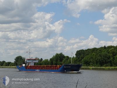
CELTICA HAV
General Cargo
Current Trip
| Time Travelled | 2 days |
|---|---|
| Remaining Time | 1 day |
| Distance Travelled | 369.83 nm |
| Remaining Distance | 356.19 nm |
| AVG Speed | 5.9 Knopen |
| MAX Speed | 9.8 Knopen |
| AVG Wind | 14.5 knots |
| MAX Wind | 24.8 knots |
| MIN Temp | 9.6°C / 49.28°F |
| MAX Temp | 19.4°C / 66.92°F |
| Diepgang | 4.3 M |
| Positie ontvangen | 12 h, 13 m geleden |
Current Position
| Lengtegraad | -4.48421° |
|---|---|
| Breedtegraat | 49.37869° |
| Status | Under way using engine |
| Snelheid | 8.5 Knopen |
| Koers | 239.8° |
| Gebied | English Channel |
| Station | T-AIS |
| Positie ontvangen | 12 h, 13 m geleden |
Info
Information
The current position of CELTICA HAV is in English Channel with coordinates 49.37869° / -4.48421° as reported on 2024-05-04 20:11 by AIS to our vessel tracker app. The vessel's current speed is 8.5 Knopen and is heading at the port of AVILES. The estimated time of arrival as calculated by MyShipTracking vessel tracking app is 2024-05-06 20:02 LT
The vessel CELTICA HAV (IMO: 8422022, MMSI: 311945000) is a General Cargo that was built in 1984 ( 40 Jaar oud ). It's sailing under the flag of [BS] Bahamas.
In this page you can find informations about the vessels current position, last detected port calls, and current voyage information. If the vessels is not in coverage by AIS you will find the latest position.
The current position of CELTICA HAV is detected by our AIS receivers and we are not responsible for the reliability of the data. The last position was recorded while the vessel was in Coverage by the Ais receivers of our vessel tracking app.
The current draught of CELTICA HAV as reported by AIS is 4.3 meters
Weather
| Temperature | 11.9°C / 53.42°F |
|---|---|
| Wind Speed | 20 knots |
| Direction | 195° SSW |
| Pressure | 1003.9 hPa |
| Humidity | 83.5 % |
| Cloud Coverage | --- |
Featured Company
Last Port Calls
| Port | Arrival | Departure | Time In Port |
|---|---|---|---|
| 2024-05-01 15:33 | 2024-05-02 13:40 | 22 h | |
| 2024-05-01 13:56 | 2024-05-01 14:08 | 11 m | |
| 2024-04-29 01:34 | 2024-04-30 14:02 | 1 d | |
| 2024-04-25 00:43 | 2024-04-26 17:08 | 1 d | |
| 2024-04-19 12:08 | 2024-04-23 12:33 | 4 d | |
| 2024-04-08 21:47 | 2024-04-11 17:42 | 2 d | |
| 2024-03-27 04:29 | 2024-03-28 18:07 | 1 d | |
| 2024-03-25 20:54 | |||
| 2024-03-19 20:10 | 2024-03-22 09:14 | 2 d | |
| 2024-03-17 13:46 | 2024-03-18 18:06 | 1 d |
Most Visited Ports (Last year)
| Port | Arrivals | |
|---|---|---|
| 6 | ||
| 5 | ||
| 4 | ||
| 3 | ||
| 3 | ||
| 3 |
Last Trips
| Origin | Departure | Destination | Arrival | Distance | |
|---|---|---|---|---|---|
| 2024-05-01 16:08 | 2024-05-01 17:33 | 7.74 nm | |||
| 2024-04-30 15:02 | 2024-05-01 15:56 | 164.18 nm | |||
| 2024-04-26 19:08 | 2024-04-29 02:34 | 399.86 nm | |||
| 2024-04-23 14:33 | 2024-04-25 02:43 | 267.90 nm | |||
| 2024-04-11 18:42 | 2024-04-19 14:08 | 1335.17 nm | |||
| 2024-03-28 19:07 | 2024-04-08 22:47 | 1524.52 nm | |||
| 2024-03-25 21:54 | 2024-03-27 05:29 | 270.09 nm | |||
| 2024-03-18 19:06 | 2024-03-19 21:10 | 184.48 nm | |||
| 2024-03-13 16:33 | 2024-03-17 14:46 | 560.94 nm | |||
| 2024-03-12 01:16 | 2024-03-13 05:04 | 220.02 nm |
Events
| Tijd | Evenement | Details | Positie / Bestemming | Info |
|---|---|---|---|---|
| 2024-05-04 20:13 | Status Changed | Default Under way using engine |
49.37571 / -4.49221
AVILES
|
Snelheid: 8.5 kn Koers: 239.8° |
| 2024-05-04 20:11 | Buitenbereik |
49.37869 / -4.48421
English Channel
AVILES
|
Snelheid: 8.5 kn Koers: 239.8° |
|
| 2024-05-04 19:25 | Status Changed | Under way using engine Default |
49.43268 / -4.33498
AVILES
|
Snelheid: 8.4 kn Koers: 242° |
| 2024-05-04 18:41 | Status Changed | Default Under way using engine |
49.48263 / -4.19831
AVILES
|
Snelheid: 8.2 kn Koers: 239.1° |
| 2024-05-04 18:37 | Gevonden in zee | French part of the English Channel |
49.48743 / -4.18544
English Channel
AVILES
|
Snelheid: 8.2 kn Koers: 239.1° |
| 2024-05-04 18:36 | Status Changed | Under way using engine Default |
49.48857 / -4.18239
AVILES
|
Snelheid: 8.1 kn Koers: 240° |
| 2024-05-04 18:34 | Binnenbereik |
49.48743 / -4.18544
English Channel
AVILES
|
Snelheid: 8.2 kn Koers: 239.1° |
|
| 2024-05-04 00:31 | Status Changed | Default Under way using engine |
50.32821 / -1.01132
AVILES
|
Snelheid: 9.4 kn Koers: 254.6° |
| 2024-05-04 00:22 | Buitenbereik |
50.33411 / -.97854
English Channel
AVILES
|
Snelheid: 9.4 kn Koers: 254.6° |
|
| 2024-05-04 00:07 | Status Changed | Under way using engine Default |
50.34580 / -.91623
AVILES
|
Snelheid: 9.6 kn Koers: 253° |