
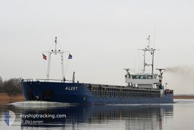
ALERT
General Cargo
Current Trip
| Time Travelled | 3 days |
|---|---|
| Remaining Time | --- |
| Distance Travelled | 564.38 nm |
| Remaining Distance | --- |
| AVG Speed | 7.3 Knopen |
| MAX Speed | 9.5 Knopen |
| AVG Wind | 17.1 knots |
| MAX Wind | 22.4 knots |
| MIN Temp | 11.8°C / 53.24°F |
| MAX Temp | 19.6°C / 67.28°F |
| Diepgang | 3.2 M |
| Positie ontvangen | 1 d geleden |
Current Position
| Lengtegraad | -4.90629° |
|---|---|
| Breedtegraat | 47.94365° |
| Status | Under way using engine |
| Snelheid | 7.7 Knopen |
| Koers | 303° |
| Gebied | Celtic Sea |
| Station | T-AIS |
| Positie ontvangen | 1 d geleden |
Info
Information
The current position of ALERT is in Celtic Sea with coordinates 47.94365° / -4.90629° as reported on 2024-05-15 07:22 by AIS to our vessel tracker app. The vessel's current speed is 7.7 Knopen and is heading at the port of PALDISKI. The estimated time of arrival as calculated by MyShipTracking vessel tracking app is 2024-05-22 15:00 LT
The vessel ALERT (IMO: 9213715, MMSI: 245921000) is a General Cargo that was built in 2000 ( 24 Jaar oud ). It's sailing under the flag of [NL] Netherlands.
In this page you can find informations about the vessels current position, last detected port calls, and current voyage information. If the vessels is not in coverage by AIS you will find the latest position.
The current position of ALERT is detected by our AIS receivers and we are not responsible for the reliability of the data. The last position was recorded while the vessel was in Coverage by the Ais receivers of our vessel tracking app.
The current draught of ALERT as reported by AIS is 3.2 meters
Weather
| Temperature | 12.3°C / 54.14°F |
|---|---|
| Wind Speed | 5 knots |
| Direction | 87° E |
| Pressure | 1005.2 hPa |
| Humidity | 84.6 % |
| Cloud Coverage | 100 % |
Featured Company
Last Port Calls
| Port | Arrival | Departure | Time In Port |
|---|---|---|---|
| 2024-05-12 21:21 | 2024-05-13 11:07 | 13 h | |
| 2024-05-08 10:09 | 2024-05-09 06:47 | 20 h | |
| 2024-05-06 09:58 | 2024-05-07 10:42 | 1 d | |
| 2024-04-30 06:37 | 2024-04-30 17:01 | 10 h | |
| 2024-04-25 08:08 | 2024-04-25 19:56 | 11 h | |
| 2024-04-12 21:38 | 2024-04-16 07:37 | 3 d | |
| 2024-04-10 20:07 | 2024-04-11 19:03 | 22 h | |
| 2024-04-08 18:10 | 2024-04-09 17:51 | 23 h | |
| 2024-03-27 02:39 | 2024-03-27 14:23 | 11 h | |
| 2024-03-21 12:23 | 2024-03-21 21:16 | 8 h |
Most Visited Ports (Last year)
| Port | Arrivals | |
|---|---|---|
| 4 | ||
| 4 | ||
| 3 | ||
| 3 | ||
| 2 | ||
| 2 |
Last Trips
| Origin | Departure | Destination | Arrival | Distance | |
|---|---|---|---|---|---|
| 2024-05-09 08:47 | 2024-05-12 23:21 | 841.68 nm | |||
| 2024-05-07 11:42 | 2024-05-08 12:09 | 146.43 nm | |||
| 2024-04-30 18:01 | 2024-05-06 10:58 | 1001.20 nm | |||
| 2024-04-25 21:56 | 2024-04-30 07:37 | 815.62 nm | |||
| 2024-04-16 09:37 | 2024-04-25 10:08 | 1875.67 nm | |||
| 2024-04-11 20:03 | 2024-04-12 23:38 | 233.87 nm | |||
| 2024-04-09 18:51 | 2024-04-10 21:07 | 59.98 nm | |||
| 2024-03-27 14:23 | 2024-04-08 19:10 | 1581.14 nm | |||
| 2024-03-21 22:16 | 2024-03-27 02:39 | 986.70 nm | |||
| 2024-03-20 08:59 | 2024-03-21 13:23 | 110.79 nm |
Events
| Tijd | Evenement | Details | Positie / Bestemming | Info |
|---|---|---|---|---|
| 2024-05-15 07:41 | Status Changed | Default Under way using engine |
47.96500 / -4.95500
EE PLS
|
Snelheid: 7.7 kn Koers: 303° |
| 2024-05-15 07:22 | Buitenbereik |
47.94365 / -4.90629
Celtic Sea
EE PLS
|
Snelheid: 7.7 kn Koers: 303° |
|
| 2024-05-15 06:12 | Status Changed | Under way using engine Default |
47.86690 / -4.71829
EE PLS
|
Snelheid: 8 kn Koers: 0° |
| 2024-05-15 06:08 | Status Changed | Default Under way using engine |
47.86167 / -4.70667
EE PLS
|
Snelheid: 7.2 kn Koers: 291.4° |
| 2024-05-15 06:00 | Gevonden in zee | French part of the Celtic Sea |
47.85514 / -4.68507
Celtic Sea
EE PLS
|
Snelheid: 7.9 kn Koers: 301.4° |
| 2024-05-15 06:00 | Status Changed | Under way using engine Default |
47.85497 / -4.68460
EE PLS
|
Snelheid: 7 kn Koers: 0° |
| 2024-05-15 06:00 | Binnenbereik |
47.85514 / -4.68507
Celtic Sea
EE PLS
|
Snelheid: 7.9 kn Koers: 301.4° |
|
| 2024-05-15 01:20 | Status Changed | Default Under way using engine |
47.52500 / -3.93500
EE PLS
|
Snelheid: 7.3 kn Koers: 310.3° |
| 2024-05-15 01:03 | Buitenbereik |
47.50281 / -3.89780
Bay of Biscay
EE PLS
|
Snelheid: 7.3 kn Koers: 310.3° |
|
| 2024-05-15 00:19 | Status Changed | Under way using engine Default |
47.45408 / -3.79038
EE PLS
|
Snelheid: 6 kn Koers: 0° |