
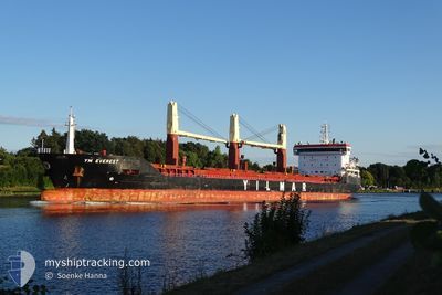
YM EVEREST
General Cargo
Current Trip
| Trip Time | 20 days |
|---|---|
| Trip Distance | 4793.28 nm |
| AVG Speed | 10.3 Noeuds |
| MAX Speed | 14 Noeuds |
| Tirant d eau | 8.2 m |
| AVG Wind | 14.8 knots |
| MAX Wind | 27 knots |
| MIN Temp | 7.1°C / 44.78°F |
| MAX Temp | 29.2°C / 84.56°F |
| Position reçue | 3 d depuis |
Current Position
| Longitude | 20.81717° |
|---|---|
| Latitude | 63.54734° |
| Etat | Under way using engine |
| Vitesse | 8.7 Noeuds |
| Parcours | 72.2° |
| Zone | Gulf of Bothnia |
| Station | T-AIS |
| Position reçue | 3 d depuis |
Info
Information
The current position of YM EVEREST is in Gulf of Bothnia with coordinates 63.54734° / 20.81717° as reported on 2024-06-06 12:11 by AIS to our vessel tracker app. The vessel's current speed is 8.7 Noeuds and is currently inside the port of LULEA.
The vessel YM EVEREST (IMO: 9653812, MMSI: 229941000) is a General Cargo that was built in 2014 ( 10 Age ). It's sailing under the flag of [MT] Malta.
In this page you can find informations about the vessels current position, last detected port calls, and current voyage information. If the vessels is not in coverage by AIS you will find the latest position.
The current position of YM EVEREST is detected by our AIS receivers and we are not responsible for the reliability of the data. The last position was recorded while the vessel was in Coverage by the Ais receivers of our vessel tracking app.
The current draught of YM EVEREST as reported by AIS is 8.2 meters
Weather
| Temperature | 11.6°C / 52.88°F |
|---|---|
| Wind Speed | 14 knots |
| Direction | 70° ENE |
| Pressure | 993.9 hPa |
| Humidity | 72.2 % |
| Cloud Coverage | 96 % |
Featured Company
Most Visited Ports (Last year)
| Port | Arrivals | |
|---|---|---|
| 5 | ||
| 3 | ||
| 2 | ||
| 2 | ||
| 2 | ||
| 2 |
Events
| Heure | Evenement | Détails | Position/ Destination | Info |
|---|---|---|---|---|
| 2024-06-07 04:09 | Arret |
65.54747 / 22.24735
[SE] LULEA
|
Vitesse: 0.3 kn Parcours: 291° |
|
| 2024-06-07 03:45 | Port d'arrivée |
|
65.54324 / 22.28443
[SE] LULEA
|
Vitesse: 7.5 kn Parcours: 305° |
| 2024-06-06 12:11 | Hors de la zone couverte |
63.54734 / 20.81717
Gulf of Bothnia
SELLA
|
Vitesse: 8.7 kn Parcours: 72.2° |
|
| 2024-06-06 11:32 | Changement de zone | Swedish part of the Gulf of Bothnia Finnish part of the Gulf of Bothnia |
63.48358 / 20.67236
Gulf of Bothnia
SELLA
|
Vitesse: 8.9 kn Parcours: 28.6° |
| 2024-06-06 07:39 | Dans la zone couverte |
62.95781 / 20.22253
Gulf of Bothnia
SELLA
|
Vitesse: 8.9 kn Parcours: 11.3° |
|
| 2024-06-06 06:20 | Hors de la zone couverte |
62.76635 / 20.12650
Gulf of Bothnia
SELLA
|
Vitesse: 9.6 kn Parcours: 12.7° |
|
| 2024-06-06 05:18 | Dans la zone couverte |
62.60454 / 20.05232
Gulf of Bothnia
SELLA
|
Vitesse: 9.6 kn Parcours: 12.5° |
|
| 2024-06-06 02:51 | Hors de la zone couverte |
62.21832 / 19.85801
Gulf of Bothnia
SELLA
|
Vitesse: 10 kn Parcours: 13.9° |
|
| 2024-06-06 02:51 | Detecté en mer | Finnish part of the Gulf of Bothnia |
62.21832 / 19.85801
Gulf of Bothnia
SELLA
|
Vitesse: 10 kn Parcours: 13.9° |
| 2024-06-06 02:51 | Dans la zone couverte |
62.21832 / 19.85801
Gulf of Bothnia
SELLA
|
Vitesse: 10 kn Parcours: 13.9° |