
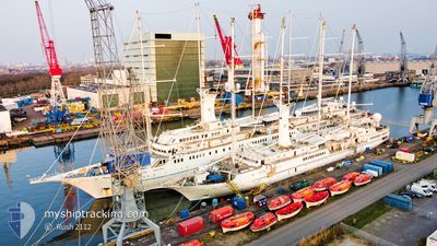
WIND STAR
Passengers Ship
Current Trip
| Time Travelled | 1 day |
|---|---|
| Remaining Time | 5 h, 56 mins |
| Distance Travelled | 150.27 nm |
| Remaining Distance | 58.87 nm |
| AVG Speed | 8 Noeuds |
| MAX Speed | 12 Noeuds |
| AVG Wind | 14.3 knots |
| MAX Wind | 23.1 knots |
| MIN Temp | 22.4°C / 72.32°F |
| MAX Temp | 31.4°C / 88.52°F |
| Tirant d eau | 4.4 m |
| Position reçue | 10 m depuis |
Current Position
| Longitude | 26.25066° |
|---|---|
| Latitude | 37.50298° |
| Etat | Under way using engine |
| Vitesse | 9 Noeuds |
| Parcours | 74.2° |
| Zone | Aegean Sea |
| Station | T-AIS |
| Position reçue | 10 m depuis |
Info
Information
The current position of WIND STAR is in Aegean Sea with coordinates 37.50298° / 26.25066° as reported on 2024-06-09 21:14 by AIS to our vessel tracker app. The vessel's current speed is 9 Noeuds and is heading at the port of KUSADASI. The estimated time of arrival as calculated by MyShipTracking vessel tracking app is 2024-06-10 06:20 LT
The vessel WIND STAR (IMO: 8420878, MMSI: 309163000) is a Passengers Ship that was built in 1986 ( 38 Age ). It's sailing under the flag of [BS] Bahamas.
In this page you can find informations about the vessels current position, last detected port calls, and current voyage information. If the vessels is not in coverage by AIS you will find the latest position.
The current position of WIND STAR is detected by our AIS receivers and we are not responsible for the reliability of the data. The last position was recorded while the vessel was in Coverage by the Ais receivers of our vessel tracking app.
The current draught of WIND STAR as reported by AIS is 4.4 meters
Weather
| Temperature | 23.8°C / 74.84°F |
|---|---|
| Wind Speed | 15 knots |
| Direction | 326° NW |
| Pressure | 1008.3 hPa |
| Humidity | 66.8 % |
| Cloud Coverage | 2 % |
Featured Company
Last Port Calls
| Port | Arrival | Departure | Time In Port |
|---|---|---|---|
| 2024-06-08 06:24 | 2024-06-08 17:29 | 11 h | |
| 2024-06-05 07:42 | 2024-06-05 21:06 | 13 h | |
| 2024-06-03 06:55 | 2024-06-03 23:17 | 16 h | |
| 2024-06-01 04:46 | 2024-06-01 17:37 | 12 h | |
| 2024-05-29 07:00 | 2024-05-29 21:00 | 14 h | |
| 2024-05-27 06:55 | 2024-05-27 23:10 | 16 h | |
| 2024-05-25 06:20 | 2024-05-25 17:32 | 11 h | |
| 2024-05-22 07:15 | 2024-05-22 21:02 | 13 h | |
| 2024-05-20 06:52 | 2024-05-20 23:14 | 16 h | |
| 2024-05-18 06:16 | 2024-05-18 17:02 | 10 h |
Last Trips
| Origin | Departure | Destination | Arrival | Distance | |
|---|---|---|---|---|---|
| 2024-06-05 21:06 | 2024-06-08 06:24 | 267.27 nm | |||
| 2024-06-03 23:17 | 2024-06-05 07:42 | 136.60 nm | |||
| 2024-06-01 17:37 | 2024-06-03 06:55 | 202.18 nm | |||
| 2024-05-29 21:00 | 2024-06-01 04:46 | 265.26 nm | |||
| 2024-05-27 23:10 | 2024-05-29 07:00 | 137.92 nm | |||
| 2024-05-25 17:32 | 2024-05-27 06:55 | 211.30 nm | |||
| 2024-05-22 21:02 | 2024-05-25 06:20 | 267.25 nm | |||
| 2024-05-20 23:14 | 2024-05-22 07:15 | 154.71 nm | |||
| 2024-05-18 17:02 | 2024-05-20 06:52 | 208.13 nm | |||
| 2024-05-15 20:27 | 2024-05-18 06:16 | 263.95 nm |
Events
| Heure | Evenement | Détails | Position/ Destination | Info |
|---|---|---|---|---|
| 2024-06-09 21:19 | Etat Changé | Default Under way using engine |
37.50500 / 26.26500
KUSADASI
|
Vitesse: 9 kn Parcours: 74.2° |
| 2024-06-09 20:44 | Etat Changé | Under way using engine Default |
37.48357 / 26.15579
KUSADASI
|
Vitesse: 9.1 kn Parcours: 79° |
| 2024-06-09 20:25 | Etat Changé | Default Under way using engine |
37.47167 / 26.09333
KUSADASI
|
Vitesse: 9.3 kn Parcours: 79.2° |
| 2024-06-09 18:59 | Dans la zone couverte |
37.41789 / 25.81104
Aegean Sea
KUSADASI
|
Vitesse: 9.2 kn Parcours: 75.2° |
|
| 2024-06-09 18:57 | Etat Changé | Under way using engine Default |
37.41670 / 25.80527
KUSADASI
|
Vitesse: 9 kn Parcours: 75° |
| 2024-06-09 17:33 | Etat Changé | Default Under way sailing |
37.37707 / 25.58317
KUSADASI
|
Vitesse: 8.5 kn Parcours: 85.3° |
| 2024-06-09 17:24 | Hors de la zone couverte |
37.37565 / 25.55938
Aegean Sea
KUSADASI
|
Vitesse: 8.5 kn Parcours: 85.3° |
|
| 2024-06-09 16:52 | Etat Changé | Under way sailing Under way using engine |
37.37082 / 25.46555
KUSADASI
|
Vitesse: 7.5 kn Parcours: 86.7° |
| 2024-06-09 15:17 | Démarrage | 0.24 nm, South of MYKONOS |
37.45892 / 25.32040
KUSADASI
|
Vitesse: 4.4 kn Parcours: 271° |
| 2024-06-09 14:46 | Etat Changé | Under way using engine At anchor |
37.45893 / 25.32326
KUSADASI
|
Vitesse: 0.2 kn Parcours: 331° |