
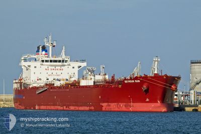
SEYMOUR SUN
Tanker
Current Trip
BRARB
| Time Travelled | 5 days |
|---|---|
| Remaining Time | --- |
| Distance Travelled | 1128.46 nm |
| Remaining Distance | --- |
| AVG Speed | 10.8 Noeuds |
| MAX Speed | 13.2 Noeuds |
| AVG Wind | 12.3 knots |
| MAX Wind | 22.9 knots |
| MIN Temp | 16.8°C / 62.24°F |
| MAX Temp | 27.4°C / 81.32°F |
| Tirant d eau | 12.1 m |
| Position reçue | 17 d depuis |
Current Position
| Longitude | -59.25344° |
|---|---|
| Latitude | 11.14804° |
| Etat | Under way using engine |
| Vitesse | 11.7 Noeuds |
| Parcours | 111.7° |
| Zone | North Atlantic Ocean |
| Station | T-AIS |
| Position reçue | 17 d depuis |
Info
Information
The current position of SEYMOUR SUN is in North Atlantic Ocean with coordinates 11.14804° / -59.25344° as reported on 2024-05-15 11:12 by AIS to our vessel tracker app. The vessel's current speed is 11.7 Noeuds
The vessel SEYMOUR SUN (IMO: 9911501, MMSI: 563145200) is a Tanker It's sailing under the flag of [SG] Singapore.
In this page you can find informations about the vessels current position, last detected port calls, and current voyage information. If the vessels is not in coverage by AIS you will find the latest position.
The current position of SEYMOUR SUN is detected by our AIS receivers and we are not responsible for the reliability of the data. The last position was recorded while the vessel was in Coverage by the Ais receivers of our vessel tracking app.
The current draught of SEYMOUR SUN as reported by AIS is 12.1 meters
Weather
| Temperature | 21°C / 69.8°F |
|---|---|
| Wind Speed | 14 knots |
| Direction | 38° NE |
| Pressure | 1022.5 hPa |
| Humidity | 85.2 % |
| Cloud Coverage | 81 % |
Featured Company
Last Port Calls
| Port | Arrival | Departure | Time In Port |
|---|---|---|---|
| 2024-05-25 20:46 | 2024-05-27 07:54 | 1 d | |
| 2024-05-04 17:47 | 2024-05-04 23:06 | 5 h | |
| 2024-04-21 00:23 | 2024-04-22 23:25 | 1 d | |
| 2024-04-05 17:37 | 2024-04-08 20:40 | 3 d |
Last Trips
| Origin | Departure | Destination | Arrival | Distance | |
|---|---|---|---|---|---|
| 2024-05-04 18:06 | 2024-05-25 17:46 | 4782.48 nm | |||
| 2024-04-22 19:25 | 2024-05-04 12:47 | 3514.44 nm | |||
| 2024-04-08 22:40 | 2024-04-20 20:23 | 3407.00 nm | |||
| 2024-03-29 08:15 | 2024-04-05 19:37 | 533.06 nm |
Events
| Heure | Evenement | Détails | Position/ Destination | Info |
|---|---|---|---|---|
| 2024-05-31 13:10 | Arret | 12.28 nm, South East of ILHA DO MEL |
-25.72833 / -48.20833
BRARB
|
Vitesse: Parcours: -1° |
| 2024-05-27 07:58 | Démarrage | 1.96 nm, West of ARATU |
-12.78761 / -38.50567
BRARB
|
Vitesse: 5.2 kn Parcours: 220° |
| 2024-05-27 07:54 | PORT DE DEPART |
|
-12.78384 / -38.50267
BRARB
|
Vitesse: 0.8 kn Parcours: 159° |
| 2024-05-25 20:46 | Arret |
-12.78268 / -38.50081
[BR] ARATU
|
Vitesse: 0.1 kn Parcours: 31° |
|
| 2024-05-25 20:46 | Port d'arrivée |
|
-12.78268 / -38.50081
[BR] ARATU
|
Vitesse: 1.2 kn Parcours: 49° |
| 2024-05-25 18:26 | Démarrage | 7.8 nm, South West of SALVADOR |
-13.05222 / -38.61579
BRARB
|
Vitesse: 4.3 kn Parcours: 86° |
| 2024-05-24 04:16 | Arret | 8 nm, South West of SALVADOR |
-13.05057 / -38.62151
BRARB
|
Vitesse: 0.1 kn Parcours: 154° |