
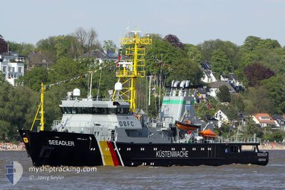
SEEADLER
Fishery Patrol Vessel
Current Trip
| Time Travelled | 6 days |
|---|---|
| Remaining Time | --- |
| Distance Travelled | 656.70 nm |
| Remaining Distance | --- |
| AVG Speed | 11.8 Noeuds |
| MAX Speed | 14 Noeuds |
| AVG Wind | 16.3 knots |
| MAX Wind | 21 knots |
| MIN Temp | 10.1°C / 50.18°F |
| MAX Temp | 22.7°C / 72.86°F |
| Tirant d eau | 5.1 m |
| Position reçue | 4 d depuis |
Current Position
| Longitude | -8.19383° |
|---|---|
| Latitude | 58.25285° |
| Etat | Under way using engine |
| Vitesse | 12.3 Noeuds |
| Parcours | 239.9° |
| Zone | North Atlantic Ocean |
| Station | T-AIS |
| Position reçue | 4 d depuis |
Info
Information
The current position of SEEADLER is in North Atlantic Ocean with coordinates 58.25285° / -8.19383° as reported on 2024-05-16 21:36 by AIS to our vessel tracker app. The vessel's current speed is 12.3 Noeuds and is heading at the port of ST JOHNS. The estimated time of arrival as calculated by MyShipTracking vessel tracking app is 2024-06-02 12:00 LT
The vessel SEEADLER (IMO: 9191541, MMSI: 211316340) is a Fishery Patrol Vessel that was built in 2000 ( 24 Age ). It's sailing under the flag of [DE] Germany.
In this page you can find informations about the vessels current position, last detected port calls, and current voyage information. If the vessels is not in coverage by AIS you will find the latest position.
The current position of SEEADLER is detected by our AIS receivers and we are not responsible for the reliability of the data. The last position was recorded while the vessel was in Coverage by the Ais receivers of our vessel tracking app.
The current draught of SEEADLER as reported by AIS is 5.1 meters
Weather
| Temperature | 11.3°C / 52.34°F |
|---|---|
| Wind Speed | 17 knots |
| Direction | 356° N |
| Pressure | 1013.2 hPa |
| Humidity | 93.7 % |
| Cloud Coverage | 98 % |
Featured Company
Last Port Calls
| Port | Arrival | Departure | Time In Port |
|---|---|---|---|
| 2024-05-13 04:49 | 2024-05-14 12:34 | 1 d | |
| 2024-05-09 13:50 | 2024-05-12 16:41 | 3 d | |
| 2024-05-08 08:06 | 2024-05-09 08:12 | 1 d | |
| 2024-05-06 04:31 | 2024-05-06 14:07 | 9 h | |
| 2024-04-25 08:58 | 2024-04-29 15:45 | 4 d | |
| 2024-04-12 04:28 | 2024-04-15 13:54 | 3 d | |
| 2024-03-21 05:26 | 2024-04-09 11:02 | 19 d | |
| 2024-03-15 05:22 | 2024-03-18 13:31 | 3 d | |
| 2024-03-14 05:33 | 2024-03-14 09:12 | 3 h | |
| 2024-03-01 05:45 | 2024-03-04 14:56 | 3 d |
Last Trips
| Origin | Departure | Destination | Arrival | Distance | |
|---|---|---|---|---|---|
| 2024-05-12 18:41 | 2024-05-13 06:49 | 49.75 nm | |||
| 2024-05-09 10:12 | 2024-05-09 15:50 | 52.10 nm | |||
| 2024-05-06 16:07 | 2024-05-08 10:06 | 156.31 nm | |||
| 2024-04-29 17:45 | 2024-05-06 06:31 | 709.69 nm | |||
| 2024-04-15 15:54 | 2024-04-25 10:58 | 784.47 nm | |||
| 2024-04-09 13:02 | 2024-04-12 06:28 | 255.53 nm | |||
| 2024-03-18 14:31 | 2024-03-21 06:26 | 220.61 nm | |||
| 2024-03-14 10:12 | 2024-03-15 06:22 | 37.83 nm | |||
| 2024-03-04 15:56 | 2024-03-14 06:33 | 845.98 nm | |||
| 2024-02-19 16:37 | 2024-03-01 06:45 | 677.84 nm |
Events
| Heure | Evenement | Détails | Position/ Destination | Info |
|---|---|---|---|---|
| 2024-05-16 21:36 | Hors de la zone couverte |
58.25285 / -8.19383
North Atlantic Ocean
CASJF
|
Vitesse: 12.3 kn Parcours: 239.9° |
|
| 2024-05-16 21:25 | Dans la zone couverte |
58.27160 / -8.13505
North Atlantic Ocean
CASJF
|
Vitesse: 11.7 kn Parcours: 237.7° |
|
| 2024-05-16 10:12 | Hors de la zone couverte |
58.74983 / -4.24080
North Atlantic Ocean
CASJF
|
Vitesse: 12 kn Parcours: 275.1° |
|
| 2024-05-16 08:07 | Detecté en mer | United Kingdom part of the North Atlantic Ocean |
58.72798 / -3.41718
North Atlantic Ocean
CASJF
|
Vitesse: 12.6 kn Parcours: 275.2° |
| 2024-05-16 06:22 | Dans la zone couverte |
58.57790 / -2.86607
North Sea
CASJF
|
Vitesse: 11.1 kn Parcours: 320.1° |
|
| 2024-05-16 01:58 | Hors de la zone couverte |
58.01638 / -1.74777
North Sea
CASJF
|
Vitesse: 10.8 kn Parcours: 300.3° |
|
| 2024-05-15 22:57 | Dans la zone couverte |
57.67585 / -.85792
North Sea
CASJF
|
Vitesse: 11.4 kn Parcours: 302.5° |
|
| 2024-05-15 12:19 | Hors de la zone couverte |
56.36210 / 1.97945
North Sea
CASJF
|
Vitesse: 11.6 kn Parcours: 306.1° |
|
| 2024-05-15 07:20 | Changement de zone | United Kingdom part of the North Sea German part of the North Sea |
55.79828 / 3.38192
North Sea
CASJF
|
Vitesse: 12 kn Parcours: 309.3° |
| 2024-05-14 20:29 | Dans la zone couverte |
54.69323 / 6.53597
North Sea
CASJF
|
Vitesse: 12.5 kn Parcours: 302° |