
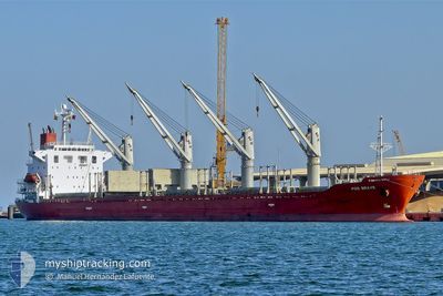
SEA BRAVE
Bulk Carrier
Current Trip
| Time Travelled | 25 days |
|---|---|
| Remaining Time | --- |
| Distance Travelled | 7151.28 nm |
| Remaining Distance | --- |
| AVG Speed | 11.9 Noeuds |
| MAX Speed | 18.3 Noeuds |
| AVG Wind | 11.8 knots |
| MAX Wind | 23.4 knots |
| MIN Temp | 12.6°C / 54.68°F |
| MAX Temp | 28.5°C / 83.3°F |
| Tirant d eau | 9.8 m |
| Position reçue | 1 m depuis |
Current Position
| Longitude | -54.95185° |
|---|---|
| Latitude | -35.05715° |
| Etat | Under way using engine |
| Vitesse | 12.1 Noeuds |
| Parcours | 266.7° |
| Zone | South Atlantic Ocean |
| Station | T-AIS |
| Position reçue | 1 m depuis |
Info
Information
The current position of SEA BRAVE is in South Atlantic Ocean with coordinates -35.05715° / -54.95185° as reported on 2024-06-17 05:41 by AIS to our vessel tracker app. The vessel's current speed is 12.1 Noeuds and is heading at the port of SAN LORENZO. The estimated time of arrival as calculated by MyShipTracking vessel tracking app is 2024-06-16 07:00 LT
The vessel SEA BRAVE (IMO: 9279551, MMSI: 538003930) is a Bulk Carrier that was built in 2004 ( 20 Age ). It's sailing under the flag of [MH] Marshall Is.
In this page you can find informations about the vessels current position, last detected port calls, and current voyage information. If the vessels is not in coverage by AIS you will find the latest position.
The current position of SEA BRAVE is detected by our AIS receivers and we are not responsible for the reliability of the data. The last position was recorded while the vessel was in Coverage by the Ais receivers of our vessel tracking app.
The current draught of SEA BRAVE as reported by AIS is 9.8 meters
Weather
| Temperature | 12.7°C / 54.86°F |
|---|---|
| Wind Speed | 9 knots |
| Direction | 58° ENE |
| Pressure | 1018.8 hPa |
| Humidity | 80.2 % |
| Cloud Coverage | 49 % |
Featured Company
Last Port Calls
Last Trips
| Origin | Departure | Destination | Arrival | Distance | |
|---|---|---|---|---|---|
| 2024-05-19 06:44 | 2024-05-20 21:54 | 358.33 nm | |||
| 2024-05-11 02:51 | 2024-05-16 00:36 | 22.12 nm | |||
| 2024-05-03 19:12 | 2024-05-09 17:53 | 1036.75 nm | |||
| 2024-04-24 22:43 | 2024-04-26 22:36 | 166.82 nm | |||
| 2024-04-22 08:24 | 2024-04-24 21:25 | 362.19 nm |
Events
| Heure | Evenement | Détails | Position/ Destination | Info |
|---|---|---|---|---|
| 2024-06-17 05:23 | Tirant d'eau modifié | 9.8 9.6 |
-35.05582 / -54.87763
AR SLO
|
Vitesse: 12.4 kn Parcours: 266.1° |
| 2024-06-17 05:23 | Changement d'ETA | 2024/06/17 06:00 2024/06/16 10:00 |
-35.05582 / -54.87763
AR SLO
|
Vitesse: 12.4 kn Parcours: 266.1° |
| 2024-06-17 05:19 | Changement de zone | Uruguayan part of the South Atlantic Ocean Brazilian part of the South Atlantic Ocean |
-35.05514 / -54.85947
South Atlantic Ocean
|
Vitesse: 12.4 kn Parcours: 265.5° |
| 2024-06-17 05:19 | Dans la zone couverte |
-35.05514 / -54.85947
South Atlantic Ocean
|
Vitesse: 12.4 kn Parcours: 265.5° |
|
| 2024-06-17 05:17 | Etat Changé | Under way using engine Default |
-35.05471 / -54.84967
AR SLO
|
Vitesse: 12.4 kn Parcours: 266° |
| 2024-06-14 01:05 | Etat Changé | Default Under way using engine |
-24.04817 / -42.77426
AR SLO
|
Vitesse: 12 kn Parcours: 220.9° |
| 2024-06-14 00:59 | Etat Changé | Under way using engine Default |
-24.03382 / -42.75955
AR SLO
|
Vitesse: 12 kn Parcours: 223° |
| 2024-06-14 00:59 | Hors de la zone couverte |
-24.03382 / -42.75955
South Atlantic Ocean
AR SLO
|
Vitesse: 12 kn Parcours: 220.9° |
|
| 2024-06-14 00:45 | Dans la zone couverte |
-24.03382 / -42.75955
South Atlantic Ocean
AR SLO
|
Vitesse: 12 kn Parcours: 220.9° |
|
| 2024-06-13 22:45 | Hors de la zone couverte |
-23.69498 / -42.43465
South Atlantic Ocean
AR SLO
|
Vitesse: 12.2 kn Parcours: 222.8° |